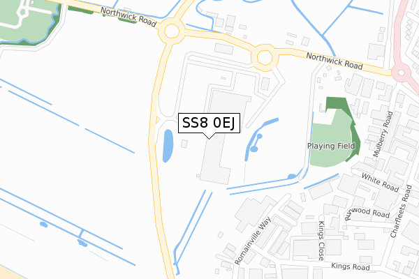
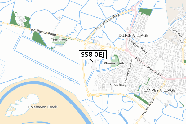
SS8 0EJ is located in the Canvey Island West electoral ward, within the local authority district of Castle Point and the English Parliamentary constituency of Castle Point. The Sub Integrated Care Board (ICB) Location is NHS Mid and South Essex ICB - 99F and the police force is Essex. This postcode has been in use since January 2019.


GetTheData
Source: OS Open Zoomstack (Ordnance Survey)
Licence: Open Government Licence (requires attribution)
Attribution: Contains OS data © Crown copyright and database right 2025
Source: Open Postcode Geo
Licence: Open Government Licence (requires attribution)
Attribution: Contains OS data © Crown copyright and database right 2025; Contains Royal Mail data © Royal Mail copyright and database right 2025; Source: Office for National Statistics licensed under the Open Government Licence v.3.0
| Easting | 577024 |
| Northing | 183442 |
| Latitude | 51.522153 |
| Longitude | 0.550297 |
GetTheData
Source: Open Postcode Geo
Licence: Open Government Licence
| Country | England |
| Postcode District | SS8 |
➜ See where SS8 is on a map | |
GetTheData
Source: Land Registry Price Paid Data
Licence: Open Government Licence
| Ward | Canvey Island West |
| Constituency | Castle Point |
GetTheData
Source: ONS Postcode Database
Licence: Open Government Licence
| Morrisons (Northwick Road) | Canvey Village | 296m |
| Charfleets (Canvey Road) | Canvey Village | 526m |
| Charfleets (Canvey Road) | Canvey Village | 535m |
| Dyke Crescent (Canvey Way) | Canvey Village | 583m |
| Dyke Crescent (Canvey Way) | Canvey Village | 602m |
| Benfleet Station | 2.6km |
| Pitsea Station | 5.2km |
GetTheData
Source: NaPTAN
Licence: Open Government Licence
GetTheData
Source: ONS Postcode Database
Licence: Open Government Licence


➜ Get more ratings from the Food Standards Agency
GetTheData
Source: Food Standards Agency
Licence: FSA terms & conditions
| Last Collection | |||
|---|---|---|---|
| Location | Mon-Fri | Sat | Distance |
| Dutch Village | 16:45 | 11:45 | 645m |
| St Michaels | 17:00 | 11:45 | 729m |
| Canvey Village Post Office | 17:15 | 12:00 | 1,202m |
GetTheData
Source: Dracos
Licence: Creative Commons Attribution-ShareAlike
| Risk of SS8 0EJ flooding from rivers and sea | Very Low |
| ➜ SS8 0EJ flood map | |
GetTheData
Source: Open Flood Risk by Postcode
Licence: Open Government Licence
The below table lists the International Territorial Level (ITL) codes (formerly Nomenclature of Territorial Units for Statistics (NUTS) codes) and Local Administrative Units (LAU) codes for SS8 0EJ:
| ITL 1 Code | Name |
|---|---|
| TLH | East |
| ITL 2 Code | Name |
| TLH3 | Essex |
| ITL 3 Code | Name |
| TLH37 | Essex Thames Gateway |
| LAU 1 Code | Name |
| E07000069 | Castle Point |
GetTheData
Source: ONS Postcode Directory
Licence: Open Government Licence
The below table lists the Census Output Area (OA), Lower Layer Super Output Area (LSOA), and Middle Layer Super Output Area (MSOA) for SS8 0EJ:
| Code | Name | |
|---|---|---|
| OA | E00109246 | |
| LSOA | E01021503 | Castle Point 010D |
| MSOA | E02004482 | Castle Point 010 |
GetTheData
Source: ONS Postcode Directory
Licence: Open Government Licence
| SS8 0SD | Arjan Way | 269m |
| SS8 0SE | West Point Place | 297m |
| SS8 0QZ | Charfleet Industrial Estate | 352m |
| SS8 0PL | Runwood Road | 394m |
| SS8 0SA | Sandhurst | 406m |
| SS8 0PR | Mulberry Road | 430m |
| SS8 0PQ | Charfleets Road | 475m |
| SS8 0QY | Kings Road | 493m |
| SS8 9NT | The Picketts | 548m |
| SS8 9NR | St Georges Walk | 566m |
GetTheData
Source: Open Postcode Geo; Land Registry Price Paid Data
Licence: Open Government Licence