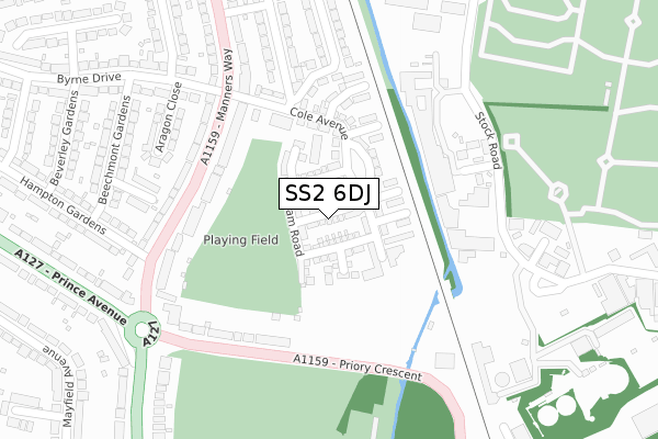
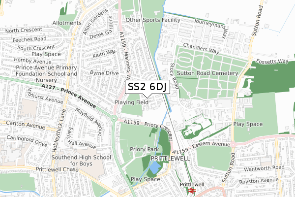
SS2 6DJ is located in the St Laurence electoral ward, within the unitary authority of Southend-on-Sea and the English Parliamentary constituency of Southend West. The Sub Integrated Care Board (ICB) Location is NHS Mid and South Essex ICB - 99G and the police force is Essex. This postcode has been in use since October 2017.


GetTheData
Source: OS Open Zoomstack (Ordnance Survey)
Licence: Open Government Licence (requires attribution)
Attribution: Contains OS data © Crown copyright and database right 2024
Source: Open Postcode Geo
Licence: Open Government Licence (requires attribution)
Attribution: Contains OS data © Crown copyright and database right 2024; Contains Royal Mail data © Royal Mail copyright and database right 2024; Source: Office for National Statistics licensed under the Open Government Licence v.3.0
| Easting | 587649 |
| Northing | 187790 |
| Latitude | 51.557778 |
| Longitude | 0.705587 |
GetTheData
Source: Open Postcode Geo
Licence: Open Government Licence
| Country | England |
| Postcode District | SS2 |
| ➜ SS2 open data dashboard ➜ See where SS2 is on a map ➜ Where is Southend-on-Sea? | |
GetTheData
Source: Land Registry Price Paid Data
Licence: Open Government Licence
| Ward | St Laurence |
| Constituency | Southend West |
GetTheData
Source: ONS Postcode Database
Licence: Open Government Licence
2019 30 SEP £320,000 |
3, CONCORDE ROAD, SOUTHEND-ON-SEA, SS2 6DJ 2018 28 MAR £349,995 |
2018 28 MAR £359,995 |
5, CONCORDE ROAD, SOUTHEND-ON-SEA, SS2 6DJ 2018 26 JAN £359,995 |
2, CONCORDE ROAD, SOUTHEND-ON-SEA, SS2 6DJ 2017 23 NOV £439,995 |
1, CONCORDE ROAD, SOUTHEND-ON-SEA, SS2 6DJ 2017 14 NOV £444,995 |
9, CONCORDE ROAD, SOUTHEND-ON-SEA, SS2 6DJ 2017 10 NOV £354,995 |
11, CONCORDE ROAD, SOUTHEND-ON-SEA, SS2 6DJ 2017 27 OCT £434,995 |
➜ Southend-on-Sea house prices
GetTheData
Source: HM Land Registry Price Paid Data
Licence: Contains HM Land Registry data © Crown copyright and database right 2024. This data is licensed under the Open Government Licence v3.0.
| December 2023 | Anti-social behaviour | On or near Stock Road | 278m |
| June 2022 | Bicycle theft | On or near Priory Crescent | 217m |
| June 2022 | Criminal damage and arson | On or near Priory Crescent | 217m |
| ➜ Get more crime data in our Crime section | |||
GetTheData
Source: data.police.uk
Licence: Open Government Licence
| Fdr House (Priory Crescent) | Prittlewell | 230m |
| Fdr House (Priory Crescent) | Prittlewell | 235m |
| Stock Close (Stock Road) | Temple Farm Ind Estate | 262m |
| Cuckoo Corner North (Manners Way) | Prittlewell | 274m |
| Thornford Gardens (Manners Way) | Prittlewell | 280m |
| Prittlewell Station | 0.9km |
| Southend Airport Station | 1.2km |
| Southend Victoria Station | 1.9km |
GetTheData
Source: NaPTAN
Licence: Open Government Licence
➜ Broadband speed and availability dashboard for SS2 6DJ
| Percentage of properties with Next Generation Access | 100.0% |
| Percentage of properties with Superfast Broadband | 100.0% |
| Percentage of properties with Ultrafast Broadband | 100.0% |
| Percentage of properties with Full Fibre Broadband | 100.0% |
Superfast Broadband is between 30Mbps and 300Mbps
Ultrafast Broadband is > 300Mbps
| Median download speed | 60.9Mbps |
| Average download speed | 57.4Mbps |
| Maximum download speed | 68.16Mbps |
| Median upload speed | 16.8Mbps |
| Average upload speed | 15.3Mbps |
| Maximum upload speed | 19.89Mbps |
| Percentage of properties unable to receive 2Mbps | 0.0% |
| Percentage of properties unable to receive 5Mbps | 0.0% |
| Percentage of properties unable to receive 10Mbps | 0.0% |
| Percentage of properties unable to receive 30Mbps | 0.0% |
➜ Broadband speed and availability dashboard for SS2 6DJ
GetTheData
Source: Ofcom
Licence: Ofcom Terms of Use (requires attribution)
GetTheData
Source: ONS Postcode Database
Licence: Open Government Licence


➜ Get more ratings from the Food Standards Agency
GetTheData
Source: Food Standards Agency
Licence: FSA terms & conditions
| Last Collection | |||
|---|---|---|---|
| Location | Mon-Fri | Sat | Distance |
| Thornford Gardens | 17:30 | 11:30 | 349m |
| Earls Hall Parade Post Office | 17:30 | 11:30 | 393m |
| Hampton Gardens | 17:30 | 11:30 | 639m |
GetTheData
Source: Dracos
Licence: Creative Commons Attribution-ShareAlike
| Facility | Distance |
|---|---|
| Ekco Social And Sports Club Association Thornford Gardens, Southend-on-sea Grass Pitches | 165m |
| Priory Park (Southend) Victoria Avenue, Southend-on-sea Grass Pitches, Outdoor Tennis Courts | 456m |
| Southend Rfc Sumpters Way, Warners Bridge Park, Southend-on-sea Health and Fitness Gym, Grass Pitches | 682m |
GetTheData
Source: Active Places
Licence: Open Government Licence
| School | Phase of Education | Distance |
|---|---|---|
| Southend High School for Boys Prittlewell Chase, Southend-on-Sea, SS0 0RG | Secondary | 835m |
| Prince Avenue Academy and Nursery Hornby Avenue, Westcliff-on-Sea, SS0 0LG | Primary | 891m |
| Southend YMCA Community School The Ticket House, 110 East Street, Prittlewell, Southend-on-Sea, SS2 6LH | Not applicable | 985m |
GetTheData
Source: Edubase
Licence: Open Government Licence
The below table lists the International Territorial Level (ITL) codes (formerly Nomenclature of Territorial Units for Statistics (NUTS) codes) and Local Administrative Units (LAU) codes for SS2 6DJ:
| ITL 1 Code | Name |
|---|---|
| TLH | East |
| ITL 2 Code | Name |
| TLH3 | Essex |
| ITL 3 Code | Name |
| TLH31 | Southend-on-Sea |
| LAU 1 Code | Name |
| E06000033 | Southend-on-Sea |
GetTheData
Source: ONS Postcode Directory
Licence: Open Government Licence
The below table lists the Census Output Area (OA), Lower Layer Super Output Area (LSOA), and Middle Layer Super Output Area (MSOA) for SS2 6DJ:
| Code | Name | |
|---|---|---|
| OA | E00080224 | |
| LSOA | E01015866 | Southend-on-Sea 002D |
| MSOA | E02003280 | Southend-on-Sea 002 |
GetTheData
Source: ONS Postcode Directory
Licence: Open Government Licence
| SS2 6PT | Manners Way | 193m |
| SS2 6PR | Priory Crescent | 226m |
| SS2 6QW | Manners Way | 238m |
| SS2 6PU | Thornford Gardens | 263m |
| SS2 6QN | Priory Crescent | 282m |
| SS2 6RR | Marina Close | 284m |
| SS2 6SE | Byrne Drive | 288m |
| SS2 6SF | Aragon Close | 298m |
| SS2 6RP | Beechmont Gardens | 361m |
| SS2 5QF | Stock Road | 363m |
GetTheData
Source: Open Postcode Geo; Land Registry Price Paid Data
Licence: Open Government Licence