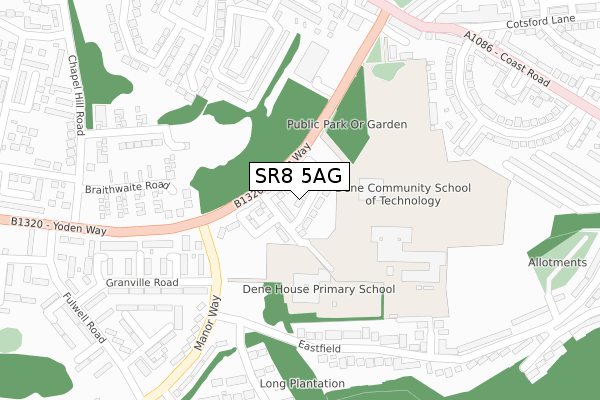
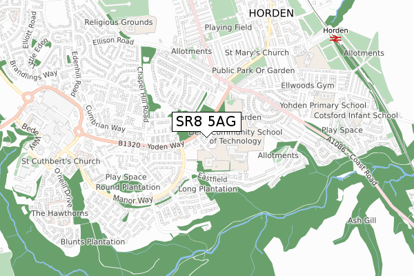
SR8 5AG is located in the Peterlee East electoral ward, within the unitary authority of County Durham and the English Parliamentary constituency of Easington. The Sub Integrated Care Board (ICB) Location is NHS North East and North Cumbria ICB - 84H and the police force is Durham. This postcode has been in use since April 2019.


GetTheData
Source: OS Open Zoomstack (Ordnance Survey)
Licence: Open Government Licence (requires attribution)
Attribution: Contains OS data © Crown copyright and database right 2024
Source: Open Postcode Geo
Licence: Open Government Licence (requires attribution)
Attribution: Contains OS data © Crown copyright and database right 2024; Contains Royal Mail data © Royal Mail copyright and database right 2024; Source: Office for National Statistics licensed under the Open Government Licence v.3.0
| Easting | 443865 |
| Northing | 540555 |
| Latitude | 54.758039 |
| Longitude | -1.319920 |
GetTheData
Source: Open Postcode Geo
Licence: Open Government Licence
| Country | England |
| Postcode District | SR8 |
| ➜ SR8 open data dashboard ➜ See where SR8 is on a map ➜ Where is Peterlee? | |
GetTheData
Source: Land Registry Price Paid Data
Licence: Open Government Licence
| Ward | Peterlee East |
| Constituency | Easington |
GetTheData
Source: ONS Postcode Database
Licence: Open Government Licence
2023 16 JUN £157,000 |
2022 22 DEC £175,000 |
19, DANESLY CLOSE, PETERLEE, SR8 5AG 2022 8 NOV £177,500 |
2022 14 OCT £177,000 |
60, DANESLY CLOSE, PETERLEE, SR8 5AG 2021 30 APR £138,557 |
6, DANESLY CLOSE, PETERLEE, SR8 5AG 2021 30 APR £138,557 |
68, DANESLY CLOSE, PETERLEE, SR8 5AG 2020 11 DEC £138,557 |
45, DANESLY CLOSE, PETERLEE, SR8 5AG 2020 30 JUL £138,557 |
78, DANESLY CLOSE, PETERLEE, SR8 5AG 2020 19 MAR £164,995 |
25, DANESLY CLOSE, PETERLEE, SR8 5AG 2019 1 OCT £164,995 |
GetTheData
Source: HM Land Registry Price Paid Data
Licence: Contains HM Land Registry data © Crown copyright and database right 2024. This data is licensed under the Open Government Licence v3.0.
| January 2024 | Anti-social behaviour | On or near Hardwick Street | 481m |
| January 2024 | Shoplifting | On or near Hardwick Street | 481m |
| January 2024 | Shoplifting | On or near Hardwick Street | 481m |
| ➜ Get more crime data in our Crime section | |||
GetTheData
Source: data.police.uk
Licence: Open Government Licence
| Dene House School (Manor Way) | Peterlee | 122m |
| Eastfield | Peterlee | 237m |
| Eastfield | Peterlee | 254m |
| Yoden Way | Horden | 279m |
| Yoden Way - Chapel Hill Road (Yodan Way) | Peterlee | 288m |
GetTheData
Source: NaPTAN
Licence: Open Government Licence
| Percentage of properties with Next Generation Access | 100.0% |
| Percentage of properties with Superfast Broadband | 100.0% |
| Percentage of properties with Ultrafast Broadband | 100.0% |
| Percentage of properties with Full Fibre Broadband | 100.0% |
Superfast Broadband is between 30Mbps and 300Mbps
Ultrafast Broadband is > 300Mbps
| Percentage of properties unable to receive 2Mbps | 0.0% |
| Percentage of properties unable to receive 5Mbps | 0.0% |
| Percentage of properties unable to receive 10Mbps | 0.0% |
| Percentage of properties unable to receive 30Mbps | 0.0% |
GetTheData
Source: Ofcom
Licence: Ofcom Terms of Use (requires attribution)
GetTheData
Source: ONS Postcode Database
Licence: Open Government Licence


➜ Get more ratings from the Food Standards Agency
GetTheData
Source: Food Standards Agency
Licence: FSA terms & conditions
| Last Collection | |||
|---|---|---|---|
| Location | Mon-Fri | Sat | Distance |
| Eden Hill Road | 16:45 | 12:00 | 1,107m |
| O'neill Drive | 17:15 | 13:15 | 1,181m |
| Peterlee Post Office | 18:30 | 12:15 | 1,529m |
GetTheData
Source: Dracos
Licence: Creative Commons Attribution-ShareAlike
| Facility | Distance |
|---|---|
| Dene House Primary School Manor Way, Peterlee Grass Pitches | 119m |
| Dene Academy Manor Way, Peterlee Grass Pitches, Sports Hall, Studio, Outdoor Tennis Courts | 190m |
| Ellwoods Gym & Fitness Centre Windsor Corner, Horden, Peterlee Health and Fitness Gym | 738m |
GetTheData
Source: Active Places
Licence: Open Government Licence
| School | Phase of Education | Distance |
|---|---|---|
| Dene House Primary School Manor Way, Peterlee, SR8 5RL | Primary | 118m |
| Dene Academy Manor Way, Peterlee, SR8 5RL | Secondary | 124m |
| Cotsford Primary School Third Street, Horden, Peterlee, SR8 4EH | Primary | 806m |
GetTheData
Source: Edubase
Licence: Open Government Licence
The below table lists the International Territorial Level (ITL) codes (formerly Nomenclature of Territorial Units for Statistics (NUTS) codes) and Local Administrative Units (LAU) codes for SR8 5AG:
| ITL 1 Code | Name |
|---|---|
| TLC | North East (England) |
| ITL 2 Code | Name |
| TLC1 | Tees Valley and Durham |
| ITL 3 Code | Name |
| TLC14 | Durham |
| LAU 1 Code | Name |
| E06000047 | County Durham |
GetTheData
Source: ONS Postcode Directory
Licence: Open Government Licence
The below table lists the Census Output Area (OA), Lower Layer Super Output Area (LSOA), and Middle Layer Super Output Area (MSOA) for SR8 5AG:
| Code | Name | |
|---|---|---|
| OA | E00105262 | |
| LSOA | E01020744 | County Durham 039E |
| MSOA | E02004330 | County Durham 039 |
GetTheData
Source: ONS Postcode Directory
Licence: Open Government Licence
| SR8 5RJ | Manor Way | 147m |
| SR8 5RH | Delavale Close | 171m |
| SR8 5SD | Elm Tree Gardens | 216m |
| SR8 5RQ | Thornes Close | 227m |
| SR8 5LE | Braithwaite Road | 232m |
| SR8 5RN | Manor Way | 236m |
| SR8 5RG | Granville Road | 247m |
| SR8 4SS | Eastfield | 256m |
| SR8 5RX | Dean Close | 262m |
| SR8 5RW | Manor Way | 272m |
GetTheData
Source: Open Postcode Geo; Land Registry Price Paid Data
Licence: Open Government Licence