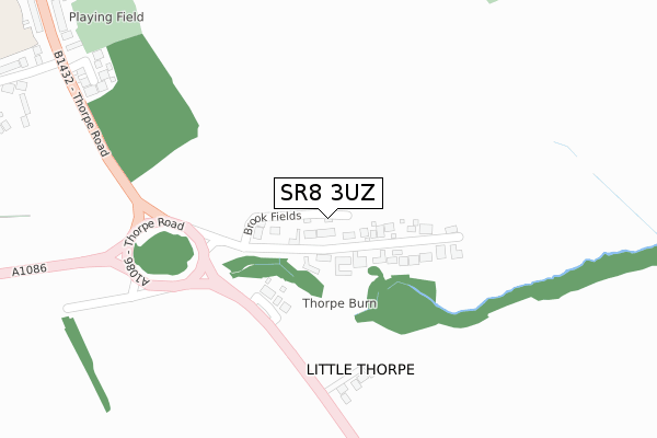
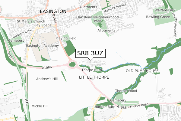
SR8 3UZ is located in the Easington electoral ward, within the unitary authority of County Durham and the English Parliamentary constituency of Easington. The Sub Integrated Care Board (ICB) Location is NHS North East and North Cumbria ICB - 84H and the police force is Durham. This postcode has been in use since November 2019.


GetTheData
Source: OS Open Zoomstack (Ordnance Survey)
Licence: Open Government Licence (requires attribution)
Attribution: Contains OS data © Crown copyright and database right 2024
Source: Open Postcode Geo
Licence: Open Government Licence (requires attribution)
Attribution: Contains OS data © Crown copyright and database right 2024; Contains Royal Mail data © Royal Mail copyright and database right 2024; Source: Office for National Statistics licensed under the Open Government Licence v.3.0
| Easting | 442237 |
| Northing | 542878 |
| Latitude | 54.779052 |
| Longitude | -1.344878 |
GetTheData
Source: Open Postcode Geo
Licence: Open Government Licence
| Country | England |
| Postcode District | SR8 |
| ➜ SR8 open data dashboard ➜ See where SR8 is on a map ➜ Where is Little Thorpe? | |
GetTheData
Source: Land Registry Price Paid Data
Licence: Open Government Licence
| Ward | Easington |
| Constituency | Easington |
GetTheData
Source: ONS Postcode Database
Licence: Open Government Licence
| May 2022 | Burglary | On or near Thorpe Road | 124m |
| May 2022 | Burglary | On or near Thorpe Road | 124m |
| April 2022 | Burglary | On or near Thorpe Road | 124m |
| ➜ Get more crime data in our Crime section | |||
GetTheData
Source: data.police.uk
Licence: Open Government Licence
| Post Box (A1086 Thorpe Road) | Little Thorpe | 136m |
| Post Box (A1086 Thorpe Road) | Little Thorpe | 159m |
| West View (Thorpe Road) | Easington Village | 577m |
| Jupiter Court (Street Not Known) | Easington Village | 625m |
| Jupiter Court (Street Not Known) | Easington Village | 638m |
GetTheData
Source: NaPTAN
Licence: Open Government Licence
GetTheData
Source: ONS Postcode Database
Licence: Open Government Licence


➜ Get more ratings from the Food Standards Agency
GetTheData
Source: Food Standards Agency
Licence: FSA terms & conditions
| Last Collection | |||
|---|---|---|---|
| Location | Mon-Fri | Sat | Distance |
| Laburnum Crescent | 16:00 | 10:30 | 748m |
| Hall Walks | 16:00 | 10:30 | 1,019m |
| Peterlee Post Office | 18:30 | 12:15 | 1,383m |
GetTheData
Source: Dracos
Licence: Creative Commons Attribution-ShareAlike
| Facility | Distance |
|---|---|
| Easington Academy Stockton Road, Easington, Peterlee Sports Hall, Grass Pitches, Artificial Grass Pitch | 648m |
| Jupiter Health & Fitness Club Seaside Lane, Easington, Peterlee Health and Fitness Gym, Studio | 817m |
| Low Hills Road Playing Fields Lowhills Road, Peterlee Grass Pitches | 899m |
GetTheData
Source: Active Places
Licence: Open Government Licence
| School | Phase of Education | Distance |
|---|---|---|
| Easington Academy Stockton Road, Easington Village, Peterlee, SR8 3AY | Secondary | 647m |
| Rosemary Lane Nursery School Rosemary Lane, Easington Village, Peterlee, SR8 3BQ | Nursery | 951m |
| Easington Colliery Primary School Whickham Street, Easington Colliery, Peterlee, SR8 3DJ | Primary | 977m |
GetTheData
Source: Edubase
Licence: Open Government Licence
The below table lists the International Territorial Level (ITL) codes (formerly Nomenclature of Territorial Units for Statistics (NUTS) codes) and Local Administrative Units (LAU) codes for SR8 3UZ:
| ITL 1 Code | Name |
|---|---|
| TLC | North East (England) |
| ITL 2 Code | Name |
| TLC1 | Tees Valley and Durham |
| ITL 3 Code | Name |
| TLC14 | Durham |
| LAU 1 Code | Name |
| E06000047 | County Durham |
GetTheData
Source: ONS Postcode Directory
Licence: Open Government Licence
The below table lists the Census Output Area (OA), Lower Layer Super Output Area (LSOA), and Middle Layer Super Output Area (MSOA) for SR8 3UZ:
| Code | Name | |
|---|---|---|
| OA | E00105312 | |
| LSOA | E01020756 | County Durham 025D |
| MSOA | E02004324 | County Durham 025 |
GetTheData
Source: ONS Postcode Directory
Licence: Open Government Licence
| SR8 3UD | 111m | |
| SR8 3UE | Thorpe Road | 117m |
| SR8 3UU | Highgrove Court | 242m |
| SR8 3US | Stonelea Court | 394m |
| SR8 3HR | Oak Road | 518m |
| SR8 3UB | Thorpe Road | 522m |
| SR8 3UY | Nursery Gardens | 538m |
| SR8 3AJ | Craig Terrace | 555m |
| SR8 3AL | Carlton Terrace | 568m |
| SR8 3AH | Washington Square | 568m |
GetTheData
Source: Open Postcode Geo; Land Registry Price Paid Data
Licence: Open Government Licence