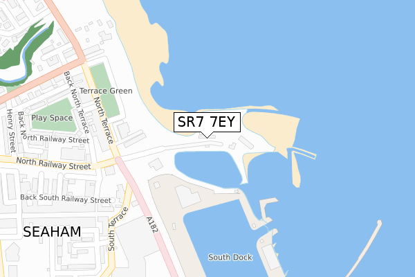
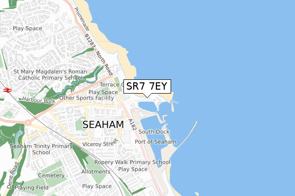
SR7 7EY is located in the Dawdon electoral ward, within the unitary authority of County Durham and the English Parliamentary constituency of Easington. The Sub Integrated Care Board (ICB) Location is NHS North East and North Cumbria ICB - 84H and the police force is Durham. This postcode has been in use since April 2019.


GetTheData
Source: OS Open Zoomstack (Ordnance Survey)
Licence: Open Government Licence (requires attribution)
Attribution: Contains OS data © Crown copyright and database right 2024
Source: Open Postcode Geo
Licence: Open Government Licence (requires attribution)
Attribution: Contains OS data © Crown copyright and database right 2024; Contains Royal Mail data © Royal Mail copyright and database right 2024; Source: Office for National Statistics licensed under the Open Government Licence v.3.0
| Easting | 443251 |
| Northing | 549522 |
| Latitude | 54.838666 |
| Longitude | -1.328125 |
GetTheData
Source: Open Postcode Geo
Licence: Open Government Licence
| Country | England |
| Postcode District | SR7 |
| ➜ SR7 open data dashboard ➜ See where SR7 is on a map ➜ Where is Seaham? | |
GetTheData
Source: Land Registry Price Paid Data
Licence: Open Government Licence
| Ward | Dawdon |
| Constituency | Easington |
GetTheData
Source: ONS Postcode Database
Licence: Open Government Licence
| June 2022 | Burglary | On or near North Terrace | 268m |
| June 2022 | Burglary | On or near North Terrace | 268m |
| June 2022 | Anti-social behaviour | On or near North Terrace | 268m |
| ➜ Get more crime data in our Crime section | |||
GetTheData
Source: data.police.uk
Licence: Open Government Licence
| North Railway Street | Seaham | 303m |
| Coastguard Cottages (North Road) | Seaham | 400m |
| Adolphus Place (Street Not Known) | Seaham | 430m |
| Tempest Road | Seaham | 442m |
| Adolphus Place (Street Not Known) | Seaham | 443m |
| Seaham Station | 1.2km |
GetTheData
Source: NaPTAN
Licence: Open Government Licence
GetTheData
Source: ONS Postcode Database
Licence: Open Government Licence


➜ Get more ratings from the Food Standards Agency
GetTheData
Source: Food Standards Agency
Licence: FSA terms & conditions
| Last Collection | |||
|---|---|---|---|
| Location | Mon-Fri | Sat | Distance |
| Station Road North | 16:45 | 11:30 | 637m |
| Ryhope Post Office | 17:15 | 11:45 | 3,991m |
| Tunstall Vale | 17:00 | 11:30 | 5,794m |
GetTheData
Source: Dracos
Licence: Creative Commons Attribution-ShareAlike
| Facility | Distance |
|---|---|
| Bruces Gym Vane Terrace, Seaham Health and Fitness Gym, Studio | 516m |
| Ropery Walk Primary School Ropery Walk, Seaham Sports Hall, Artificial Grass Pitch | 542m |
| The Chemical Works Field Bottle Works Road, Seaham Grass Pitches | 664m |
GetTheData
Source: Active Places
Licence: Open Government Licence
| School | Phase of Education | Distance |
|---|---|---|
| Ropery Walk Primary School Ropery Walk, Seaham, SR7 7JZ | Primary | 541m |
| Seaham Harbour Nursery School Bottleworks Road, Seaham Harbour, Seaham, SR7 7NN | Nursery | 710m |
| St Mary Magdalen's Catholic Primary School Dene House Road, St. Mary Magdalene Rc Primary School, Dene House Road, SEAHAM, SR7 7BJ | Primary | 849m |
GetTheData
Source: Edubase
Licence: Open Government Licence
The below table lists the International Territorial Level (ITL) codes (formerly Nomenclature of Territorial Units for Statistics (NUTS) codes) and Local Administrative Units (LAU) codes for SR7 7EY:
| ITL 1 Code | Name |
|---|---|
| TLC | North East (England) |
| ITL 2 Code | Name |
| TLC1 | Tees Valley and Durham |
| ITL 3 Code | Name |
| TLC14 | Durham |
| LAU 1 Code | Name |
| E06000047 | County Durham |
GetTheData
Source: ONS Postcode Directory
Licence: Open Government Licence
The below table lists the Census Output Area (OA), Lower Layer Super Output Area (LSOA), and Middle Layer Super Output Area (MSOA) for SR7 7EY:
| Code | Name | |
|---|---|---|
| OA | E00105459 | |
| LSOA | E01020784 | County Durham 017F |
| MSOA | E02004321 | County Durham 017 |
GetTheData
Source: ONS Postcode Directory
Licence: Open Government Licence
| SR7 7EA | Marquess Point | 191m |
| SR7 7HD | South Crescent | 262m |
| SR7 7EU | North Terrace | 266m |
| SR7 7HL | Green Street | 331m |
| SR7 7HN | South Terrace | 331m |
| SR7 7EZ | Bath Terrace | 353m |
| SR7 7ER | Wear Street | 364m |
| SR7 7HF | Church Street | 374m |
| SR7 7DB | North Railway Street Back | 387m |
| SR7 7DD | Hawthorn Square | 393m |
GetTheData
Source: Open Postcode Geo; Land Registry Price Paid Data
Licence: Open Government Licence