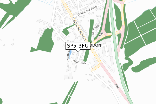
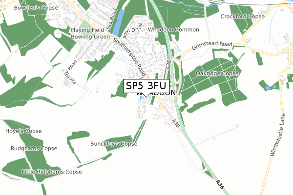
SP5 3FU is located in the Alderbury & Whiteparish electoral ward, within the unitary authority of Wiltshire and the English Parliamentary constituency of Salisbury. The Sub Integrated Care Board (ICB) Location is NHS Bath and North East Somerset, Swindon and Wiltshire ICB - 92 and the police force is Wiltshire. This postcode has been in use since March 2019.


GetTheData
Source: OS Open Zoomstack (Ordnance Survey)
Licence: Open Government Licence (requires attribution)
Attribution: Contains OS data © Crown copyright and database right 2024
Source: Open Postcode Geo
Licence: Open Government Licence (requires attribution)
Attribution: Contains OS data © Crown copyright and database right 2024; Contains Royal Mail data © Royal Mail copyright and database right 2024; Source: Office for National Statistics licensed under the Open Government Licence v.3.0
| Easting | 419610 |
| Northing | 126198 |
| Latitude | 51.034806 |
| Longitude | -1.721698 |
GetTheData
Source: Open Postcode Geo
Licence: Open Government Licence
| Country | England |
| Postcode District | SP5 |
| ➜ SP5 open data dashboard ➜ See where SP5 is on a map ➜ Where is Whaddon? | |
GetTheData
Source: Land Registry Price Paid Data
Licence: Open Government Licence
| Ward | Alderbury & Whiteparish |
| Constituency | Salisbury |
GetTheData
Source: ONS Postcode Database
Licence: Open Government Licence
5, SPARKES DRIVE, WHADDON, SALISBURY, SP5 3FU 2020 18 AUG £475,000 |
21, SPARKES DRIVE, WHADDON, SALISBURY, SP5 3FU 2020 30 JAN £485,000 |
7, SPARKES DRIVE, WHADDON, SALISBURY, SP5 3FU 2019 3 OCT £470,000 |
GetTheData
Source: HM Land Registry Price Paid Data
Licence: Contains HM Land Registry data © Crown copyright and database right 2024. This data is licensed under the Open Government Licence v3.0.
| June 2022 | Violence and sexual offences | On or near Park/Open Space | 263m |
| June 2022 | Public order | On or near Park/Open Space | 263m |
| June 2022 | Violence and sexual offences | On or near Park/Open Space | 263m |
| ➜ Get more crime data in our Crime section | |||
GetTheData
Source: data.police.uk
Licence: Open Government Licence
| Post Office | Whaddon | 93m |
| Post Office | Whaddon | 95m |
| Grimstead Road | Alderbury | 189m |
| Grimstead Road | Alderbury | 283m |
| Old Police Station (Southampton Road) | Alderbury | 428m |
GetTheData
Source: NaPTAN
Licence: Open Government Licence
| Percentage of properties with Next Generation Access | 100.0% |
| Percentage of properties with Superfast Broadband | 100.0% |
| Percentage of properties with Ultrafast Broadband | 0.0% |
| Percentage of properties with Full Fibre Broadband | 0.0% |
Superfast Broadband is between 30Mbps and 300Mbps
Ultrafast Broadband is > 300Mbps
| Percentage of properties unable to receive 2Mbps | 0.0% |
| Percentage of properties unable to receive 5Mbps | 0.0% |
| Percentage of properties unable to receive 10Mbps | 0.0% |
| Percentage of properties unable to receive 30Mbps | 0.0% |
GetTheData
Source: Ofcom
Licence: Ofcom Terms of Use (requires attribution)
GetTheData
Source: ONS Postcode Database
Licence: Open Government Licence


➜ Get more ratings from the Food Standards Agency
GetTheData
Source: Food Standards Agency
Licence: FSA terms & conditions
| Last Collection | |||
|---|---|---|---|
| Location | Mon-Fri | Sat | Distance |
| Alderbury Post Office | 17:30 | 10:15 | 102m |
| Junction Road | 17:30 | 10:30 | 1,139m |
| Tunnel Hill | 17:30 | 10:30 | 1,452m |
GetTheData
Source: Dracos
Licence: Creative Commons Attribution-ShareAlike
| Facility | Distance |
|---|---|
| Alderbury Football Club Firs Road, Alderbury, Salisbury Grass Pitches | 958m |
| Junction Road Recreation Ground Junction Road, Alderbury, Salisbury Grass Pitches | 1.1km |
| Nunton Recreation Ground (Closed) Nunton, Salisbury Grass Pitches | 3.9km |
GetTheData
Source: Active Places
Licence: Open Government Licence
| School | Phase of Education | Distance |
|---|---|---|
| Alderbury and West Grimstead Church of England Primary School Firs Road, Alderbury, Salisbury, SP5 3BD | Primary | 897m |
| Longford Church of England Primary School High Road, Britford, Salisbury, SP5 4DS | Primary | 4.4km |
| Downton CofE VA Primary School Gravel Close, Downton, Salisbury, SP5 3LZ | Primary | 5.1km |
GetTheData
Source: Edubase
Licence: Open Government Licence
The below table lists the International Territorial Level (ITL) codes (formerly Nomenclature of Territorial Units for Statistics (NUTS) codes) and Local Administrative Units (LAU) codes for SP5 3FU:
| ITL 1 Code | Name |
|---|---|
| TLK | South West (England) |
| ITL 2 Code | Name |
| TLK1 | Gloucestershire, Wiltshire and Bath/Bristol area |
| ITL 3 Code | Name |
| TLK15 | Wiltshire |
| LAU 1 Code | Name |
| E06000054 | Wiltshire |
GetTheData
Source: ONS Postcode Directory
Licence: Open Government Licence
The below table lists the Census Output Area (OA), Lower Layer Super Output Area (LSOA), and Middle Layer Super Output Area (MSOA) for SP5 3FU:
| Code | Name | |
|---|---|---|
| OA | E00163045 | |
| LSOA | E01031970 | Wiltshire 060A |
| MSOA | E02006675 | Wiltshire 060 |
GetTheData
Source: ONS Postcode Directory
Licence: Open Government Licence
| SP5 3EQ | Castle Lane | 125m |
| SP5 3EB | Southampton Road | 165m |
| SP5 3HF | Whaddon Business Park | 169m |
| SP5 3HB | Southampton Road | 201m |
| SP5 3HE | Kiln Close | 216m |
| SP5 3EG | Castle Lane | 230m |
| SP5 3SP | The Sandringhams | 230m |
| SP5 3EX | Grimstead Road | 251m |
| SP5 3SN | Matrons Cottages | 277m |
| SP5 3HD | Three Crown Cottages | 307m |
GetTheData
Source: Open Postcode Geo; Land Registry Price Paid Data
Licence: Open Government Licence