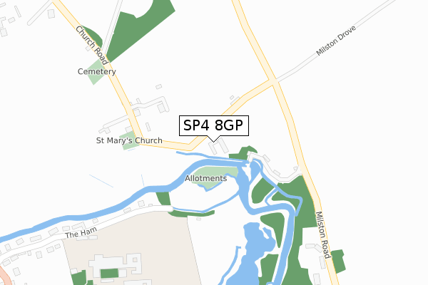
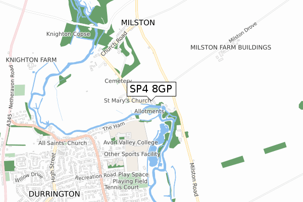
SP4 8GP is located in the Avon Valley electoral ward, within the unitary authority of Wiltshire and the English Parliamentary constituency of Devizes. The Sub Integrated Care Board (ICB) Location is NHS Bath and North East Somerset, Swindon and Wiltshire ICB - 92 and the police force is Wiltshire. This postcode has been in use since September 2019.


GetTheData
Source: OS Open Zoomstack (Ordnance Survey)
Licence: Open Government Licence (requires attribution)
Attribution: Contains OS data © Crown copyright and database right 2024
Source: Open Postcode Geo
Licence: Open Government Licence (requires attribution)
Attribution: Contains OS data © Crown copyright and database right 2024; Contains Royal Mail data © Royal Mail copyright and database right 2024; Source: Office for National Statistics licensed under the Open Government Licence v.3.0
| Easting | 416421 |
| Northing | 145202 |
| Latitude | 51.205790 |
| Longitude | -1.766317 |
GetTheData
Source: Open Postcode Geo
Licence: Open Government Licence
| Country | England |
| Postcode District | SP4 |
| ➜ SP4 open data dashboard ➜ See where SP4 is on a map ➜ Where is Milston? | |
GetTheData
Source: Land Registry Price Paid Data
Licence: Open Government Licence
| Ward | Avon Valley |
| Constituency | Devizes |
GetTheData
Source: ONS Postcode Database
Licence: Open Government Licence
| June 2022 | Other theft | On or near Park/Open Space | 451m |
| June 2022 | Public order | On or near Park/Open Space | 451m |
| May 2022 | Criminal damage and arson | On or near Milston View | 488m |
| ➜ Get more crime data in our Crime section | |||
GetTheData
Source: data.police.uk
Licence: Open Government Licence
| Avon Valley College (Recreation Road) | Durrington | 515m |
| Telephone Box (Church Road) | Milston | 607m |
| Telephone Box (The Croft) | Milston | 621m |
| School Road (Bulford Road) | Durrington | 644m |
| School Road (Bulford Road) | Durrington | 683m |
GetTheData
Source: NaPTAN
Licence: Open Government Licence
GetTheData
Source: ONS Postcode Database
Licence: Open Government Licence


➜ Get more ratings from the Food Standards Agency
GetTheData
Source: Food Standards Agency
Licence: FSA terms & conditions
| Last Collection | |||
|---|---|---|---|
| Location | Mon-Fri | Sat | Distance |
| Milston House | 16:45 | 07:30 | 190m |
| Brigmerston Corner | 16:45 | 08:00 | 643m |
| Bulford Road | 16:45 | 07:30 | 656m |
GetTheData
Source: Dracos
Licence: Creative Commons Attribution-ShareAlike
| Facility | Distance |
|---|---|
| Avon Valley College Recreation Road, Durrington, Salisbury Sports Hall, Grass Pitches, Health and Fitness Gym, Outdoor Tennis Courts | 383m |
| Durrington Swimming & Fitness Centre Recreation Road, Durrington, Salisbury Swimming Pool, Health and Fitness Gym, Studio | 462m |
| Durrington Recreation Ground Recreation Road, Durrington Grass Pitches, Outdoor Tennis Courts | 646m |
GetTheData
Source: Active Places
Licence: Open Government Licence
| School | Phase of Education | Distance |
|---|---|---|
| Durrington All Saints Church of England Voluntary Controlled Infants' School School Road, Durrington, Salisbury, SP4 8HJ | Primary | 561m |
| Avon Valley Academy Recreation Road, Durrington, Salisbury, SP4 8HH | Secondary | 649m |
| Durrington Church of England Controlled Junior School Bulford Road, Durrington, Salisbury, SP4 8DL | Primary | 1.1km |
GetTheData
Source: Edubase
Licence: Open Government Licence
The below table lists the International Territorial Level (ITL) codes (formerly Nomenclature of Territorial Units for Statistics (NUTS) codes) and Local Administrative Units (LAU) codes for SP4 8GP:
| ITL 1 Code | Name |
|---|---|
| TLK | South West (England) |
| ITL 2 Code | Name |
| TLK1 | Gloucestershire, Wiltshire and Bath/Bristol area |
| ITL 3 Code | Name |
| TLK15 | Wiltshire |
| LAU 1 Code | Name |
| E06000054 | Wiltshire |
GetTheData
Source: ONS Postcode Directory
Licence: Open Government Licence
The below table lists the Census Output Area (OA), Lower Layer Super Output Area (LSOA), and Middle Layer Super Output Area (MSOA) for SP4 8GP:
| Code | Name | |
|---|---|---|
| OA | E00163142 | |
| LSOA | E01032696 | Wiltshire 045F |
| MSOA | E02006661 | Wiltshire 045 |
GetTheData
Source: ONS Postcode Directory
Licence: Open Government Licence
| SP4 8HS | 128m | |
| SP4 8HT | 143m | |
| SP4 8HW | The Ham | 455m |
| SP4 8HX | Brigmerston | 483m |
| SP4 8HN | Milston View | 496m |
| SP4 8HJ | School Road | 556m |
| SP4 8JA | Brigmerston | 571m |
| SP4 8HB | Bulford Road | 589m |
| SP4 8HZ | The Croft | 625m |
| SP4 8HH | Recreation Road | 643m |
GetTheData
Source: Open Postcode Geo; Land Registry Price Paid Data
Licence: Open Government Licence