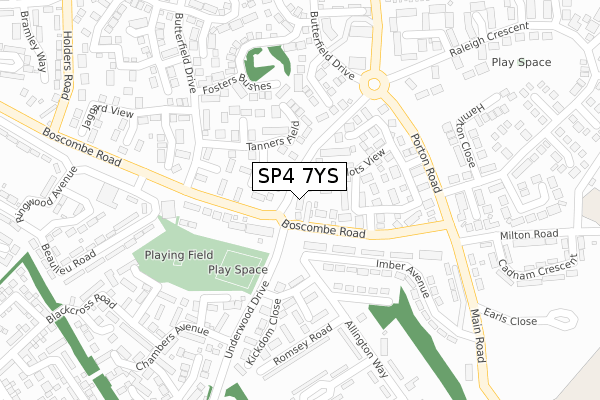
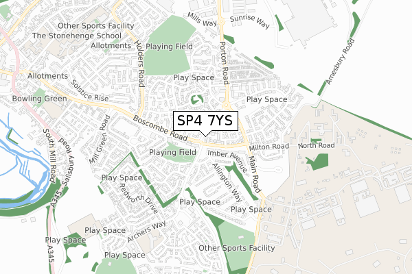
SP4 7YS is located in the Amesbury East & Bulford electoral ward, within the unitary authority of Wiltshire and the English Parliamentary constituency of Salisbury. The Sub Integrated Care Board (ICB) Location is NHS Bath and North East Somerset, Swindon and Wiltshire ICB - 92 and the police force is Wiltshire. This postcode has been in use since July 2018.


GetTheData
Source: OS Open Zoomstack (Ordnance Survey)
Licence: Open Government Licence (requires attribution)
Attribution: Contains OS data © Crown copyright and database right 2024
Source: Open Postcode Geo
Licence: Open Government Licence (requires attribution)
Attribution: Contains OS data © Crown copyright and database right 2024; Contains Royal Mail data © Royal Mail copyright and database right 2024; Source: Office for National Statistics licensed under the Open Government Licence v.3.0
| Easting | 416709 |
| Northing | 141006 |
| Latitude | 51.168052 |
| Longitude | -1.762388 |
GetTheData
Source: Open Postcode Geo
Licence: Open Government Licence
| Country | England |
| Postcode District | SP4 |
| ➜ SP4 open data dashboard ➜ See where SP4 is on a map ➜ Where is Amesbury? | |
GetTheData
Source: Land Registry Price Paid Data
Licence: Open Government Licence
| Ward | Amesbury East & Bulford |
| Constituency | Salisbury |
GetTheData
Source: ONS Postcode Database
Licence: Open Government Licence
6, HUNTER CLOSE, AMESBURY, SALISBURY, SP4 7YS 2019 18 OCT £325,000 |
HUNTER HOUSE, 1, HUNTER CLOSE, AMESBURY, SALISBURY, SP4 7YS 2019 28 FEB £425,000 |
GetTheData
Source: HM Land Registry Price Paid Data
Licence: Contains HM Land Registry data © Crown copyright and database right 2024. This data is licensed under the Open Government Licence v3.0.
| October 2023 | Criminal damage and arson | On or near Harvard Way | 260m |
| October 2023 | Anti-social behaviour | On or near Harvard Way | 260m |
| October 2023 | Anti-social behaviour | On or near Harvard Way | 260m |
| ➜ Get more crime data in our Crime section | |||
GetTheData
Source: data.police.uk
Licence: Open Government Licence
| Larkspur (Underwood Drive) | Boscombe Down | 68m |
| Larkspur (Underwood Drive) | Boscombe Down | 70m |
| Lightning Road (Boscombe Road) | Boscombe Down | 154m |
| Lightning Road (Boscombe Road) | Boscombe Down | 163m |
| Chambers Avenue (Underwood Drive) | Boscombe Down | 221m |
GetTheData
Source: NaPTAN
Licence: Open Government Licence
| Percentage of properties with Next Generation Access | 100.0% |
| Percentage of properties with Superfast Broadband | 100.0% |
| Percentage of properties with Ultrafast Broadband | 50.0% |
| Percentage of properties with Full Fibre Broadband | 0.0% |
Superfast Broadband is between 30Mbps and 300Mbps
Ultrafast Broadband is > 300Mbps
| Percentage of properties unable to receive 2Mbps | 0.0% |
| Percentage of properties unable to receive 5Mbps | 0.0% |
| Percentage of properties unable to receive 10Mbps | 0.0% |
| Percentage of properties unable to receive 30Mbps | 0.0% |
GetTheData
Source: Ofcom
Licence: Ofcom Terms of Use (requires attribution)
GetTheData
Source: ONS Postcode Database
Licence: Open Government Licence


➜ Get more ratings from the Food Standards Agency
GetTheData
Source: Food Standards Agency
Licence: FSA terms & conditions
| Last Collection | |||
|---|---|---|---|
| Location | Mon-Fri | Sat | Distance |
| Boscombe Down Road | 16:00 | 08:00 | 54m |
| Butterfield Down | 16:00 | 09:00 | 200m |
| Porton Road | 16:15 | 09:00 | 446m |
GetTheData
Source: Dracos
Licence: Creative Commons Attribution-ShareAlike
| Facility | Distance |
|---|---|
| Amesbury Sports Centre Playing Fields Holders Road, Amesbury, Salisbury Grass Pitches | 529m |
| Boscombe Down Sports Field Stockport Road, Amesbury, Salisbury Grass Pitches | 637m |
| Amesbury Archer Primary School Shears Drive, Amesbury, Salisbury Grass Pitches | 683m |
GetTheData
Source: Active Places
Licence: Open Government Licence
| School | Phase of Education | Distance |
|---|---|---|
| Amesbury Archer Primary School Shears Drive, Archers Gate, Amesbury, SP4 7XX | Primary | 682m |
| King's Gate Primary School Great Amber Way, Amesbury, Salisbury, SP4 7GD | Primary | 872m |
| Christ The King Catholic School, Amesbury Earls Court Road, Amesbury, Salisbury, SP4 7LX | Primary | 929m |
GetTheData
Source: Edubase
Licence: Open Government Licence
The below table lists the International Territorial Level (ITL) codes (formerly Nomenclature of Territorial Units for Statistics (NUTS) codes) and Local Administrative Units (LAU) codes for SP4 7YS:
| ITL 1 Code | Name |
|---|---|
| TLK | South West (England) |
| ITL 2 Code | Name |
| TLK1 | Gloucestershire, Wiltshire and Bath/Bristol area |
| ITL 3 Code | Name |
| TLK15 | Wiltshire |
| LAU 1 Code | Name |
| E06000054 | Wiltshire |
GetTheData
Source: ONS Postcode Directory
Licence: Open Government Licence
The below table lists the Census Output Area (OA), Lower Layer Super Output Area (LSOA), and Middle Layer Super Output Area (MSOA) for SP4 7YS:
| Code | Name | |
|---|---|---|
| OA | E00163084 | |
| LSOA | E01031977 | Wiltshire 048D |
| MSOA | E02006663 | Wiltshire 048 |
GetTheData
Source: ONS Postcode Directory
Licence: Open Government Licence
| SP4 7JQ | Boscombe Down Road | 60m |
| SP4 7UB | Pilots View | 92m |
| SP4 7JH | Boscombe Down Road | 99m |
| SP4 7SB | Lumley Walk | 101m |
| SP4 7SF | Tanners Field | 123m |
| SP4 7SA | Moyne Gardens | 129m |
| SP4 7XD | Mckie Road | 129m |
| SP4 7UF | Lightning Road | 140m |
| SP4 7SE | Tanners Field | 150m |
| SP4 7UA | Beamont Way | 158m |
GetTheData
Source: Open Postcode Geo; Land Registry Price Paid Data
Licence: Open Government Licence