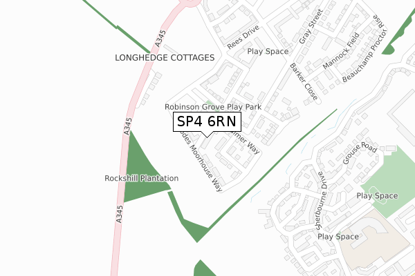
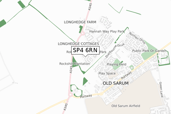
SP4 6RN is located in the Old Sarum & Lower Bourne Valley electoral ward, within the unitary authority of Wiltshire and the English Parliamentary constituency of Salisbury. The Sub Integrated Care Board (ICB) Location is NHS Bath and North East Somerset, Swindon and Wiltshire ICB - 92 and the police force is Wiltshire. This postcode has been in use since May 2018.


GetTheData
Source: OS Open Zoomstack (Ordnance Survey)
Licence: Open Government Licence (requires attribution)
Attribution: Contains OS data © Crown copyright and database right 2024
Source: Open Postcode Geo
Licence: Open Government Licence (requires attribution)
Attribution: Contains OS data © Crown copyright and database right 2024; Contains Royal Mail data © Royal Mail copyright and database right 2024; Source: Office for National Statistics licensed under the Open Government Licence v.3.0
| Easting | 414582 |
| Northing | 133871 |
| Latitude | 51.103951 |
| Longitude | -1.793097 |
GetTheData
Source: Open Postcode Geo
Licence: Open Government Licence
| Country | England |
| Postcode District | SP4 |
| ➜ SP4 open data dashboard ➜ See where SP4 is on a map ➜ Where is Old Sarum? | |
GetTheData
Source: Land Registry Price Paid Data
Licence: Open Government Licence
| Ward | Old Sarum & Lower Bourne Valley |
| Constituency | Salisbury |
GetTheData
Source: ONS Postcode Database
Licence: Open Government Licence
| June 2022 | Vehicle crime | On or near Castle Well Drive | 315m |
| June 2022 | Other theft | On or near Castle Well Drive | 315m |
| June 2022 | Violence and sexual offences | On or near Castle Well Drive | 315m |
| ➜ Get more crime data in our Crime section | |||
GetTheData
Source: data.police.uk
Licence: Open Government Licence
| Castle Well Drive | Salisbury | 262m |
| Longhedge (A345 Amesbury Road) | Winterbourne | 299m |
| Longhedge (A345 Amesbury Road) | Winterbourne | 311m |
| Dinnis Way | Salisbury | 319m |
| Old Sarum Primary School | Salisbury | 405m |
| Salisbury Station | 3.8km |
GetTheData
Source: NaPTAN
Licence: Open Government Licence
➜ Broadband speed and availability dashboard for SP4 6RN
| Percentage of properties with Next Generation Access | 100.0% |
| Percentage of properties with Superfast Broadband | 100.0% |
| Percentage of properties with Ultrafast Broadband | 100.0% |
| Percentage of properties with Full Fibre Broadband | 100.0% |
Superfast Broadband is between 30Mbps and 300Mbps
Ultrafast Broadband is > 300Mbps
| Median download speed | 360.0Mbps |
| Average download speed | 360.0Mbps |
| Maximum download speed | 360.00Mbps |
| Median upload speed | 360.0Mbps |
| Average upload speed | 360.0Mbps |
| Maximum upload speed | 360.00Mbps |
| Percentage of properties unable to receive 2Mbps | 0.0% |
| Percentage of properties unable to receive 5Mbps | 0.0% |
| Percentage of properties unable to receive 10Mbps | 0.0% |
| Percentage of properties unable to receive 30Mbps | 0.0% |
➜ Broadband speed and availability dashboard for SP4 6RN
GetTheData
Source: Ofcom
Licence: Ofcom Terms of Use (requires attribution)
GetTheData
Source: ONS Postcode Database
Licence: Open Government Licence


➜ Get more ratings from the Food Standards Agency
GetTheData
Source: Food Standards Agency
Licence: FSA terms & conditions
| Last Collection | |||
|---|---|---|---|
| Location | Mon-Fri | Sat | Distance |
| Old Sarum | 17:30 | 07:00 | 672m |
| Old Castle Road | 16:15 | 12:00 | 1,442m |
| Sycamore Drive | 16:45 | 12:00 | 1,846m |
GetTheData
Source: Dracos
Licence: Creative Commons Attribution-ShareAlike
| Facility | Distance |
|---|---|
| Salisbury Fc Partridge Way, Old Sarum, Salisbury Grass Pitches | 480m |
| Greentrees Primary School (Junior Site) Saunders Avenue, Bishopdown, Salisbury Grass Pitches | 1.4km |
| Hampton Park Pavilion Ash Crescent, Bishopdown, Salisbury Grass Pitches, Sports Hall | 1.8km |
GetTheData
Source: Active Places
Licence: Open Government Licence
| School | Phase of Education | Distance |
|---|---|---|
| Old Sarum Primary School Pheasant Drive, Old Sarum, Salisbury, SP4 6GH | Primary | 494m |
| Greentrees Primary School Sycamore Drive, Bishopdown, Salisbury, SP1 3GZ | Primary | 1.8km |
| Stratford-sub-Castle Church of England Voluntary Controlled Primary School Stratford Road, Stratford-sub-Castle, Salisbury, SP1 3LL | Primary | 2.1km |
GetTheData
Source: Edubase
Licence: Open Government Licence
The below table lists the International Territorial Level (ITL) codes (formerly Nomenclature of Territorial Units for Statistics (NUTS) codes) and Local Administrative Units (LAU) codes for SP4 6RN:
| ITL 1 Code | Name |
|---|---|
| TLK | South West (England) |
| ITL 2 Code | Name |
| TLK1 | Gloucestershire, Wiltshire and Bath/Bristol area |
| ITL 3 Code | Name |
| TLK15 | Wiltshire |
| LAU 1 Code | Name |
| E06000054 | Wiltshire |
GetTheData
Source: ONS Postcode Directory
Licence: Open Government Licence
The below table lists the Census Output Area (OA), Lower Layer Super Output Area (LSOA), and Middle Layer Super Output Area (MSOA) for SP4 6RN:
| Code | Name | |
|---|---|---|
| OA | E00166384 | |
| LSOA | E01032011 | Wiltshire 057B |
| MSOA | E02006672 | Wiltshire 057 |
GetTheData
Source: ONS Postcode Directory
Licence: Open Government Licence
| SP4 6BP | Longhedge Cottages | 221m |
| SP4 6FZ | Castle Well Drive | 221m |
| SP4 6GD | Castle Well Drive | 268m |
| SP4 6FS | Sherbourne Drive | 324m |
| SP4 6GT | Dinnis Way | 351m |
| SP4 6GA | Sherbourne Drive | 367m |
| SP4 6GE | Grouse Road | 371m |
| SP4 6FY | Castle Well Mews | 376m |
| SP4 6GH | Pheasant Drive | 381m |
| SP4 6FX | Castle Well Road | 394m |
GetTheData
Source: Open Postcode Geo; Land Registry Price Paid Data
Licence: Open Government Licence