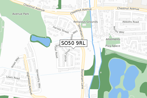
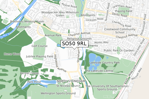
SO50 9RL is located in the Eastleigh South electoral ward, within the local authority district of Eastleigh and the English Parliamentary constituency of Eastleigh. The Sub Integrated Care Board (ICB) Location is NHS Hampshire and Isle of Wight ICB - D9Y0V and the police force is Hampshire. This postcode has been in use since March 2019.


GetTheData
Source: OS Open Zoomstack (Ordnance Survey)
Licence: Open Government Licence (requires attribution)
Attribution: Contains OS data © Crown copyright and database right 2024
Source: Open Postcode Geo
Licence: Open Government Licence (requires attribution)
Attribution: Contains OS data © Crown copyright and database right 2024; Contains Royal Mail data © Royal Mail copyright and database right 2024; Source: Office for National Statistics licensed under the Open Government Licence v.3.0
| Easting | 444130 |
| Northing | 118023 |
| Latitude | 50.959941 |
| Longitude | -1.373014 |
GetTheData
Source: Open Postcode Geo
Licence: Open Government Licence
| Country | England |
| Postcode District | SO50 |
| ➜ SO50 open data dashboard ➜ See where SO50 is on a map ➜ Where is Eastleigh? | |
GetTheData
Source: Land Registry Price Paid Data
Licence: Open Government Licence
| Ward | Eastleigh South |
| Constituency | Eastleigh |
GetTheData
Source: ONS Postcode Database
Licence: Open Government Licence
| August 2023 | Violence and sexual offences | On or near Park/Open Space | 428m |
| July 2023 | Burglary | On or near Chestnut Avenue | 162m |
| January 2023 | Criminal damage and arson | On or near Chestnut Avenue | 162m |
| ➜ Get more crime data in our Crime section | |||
GetTheData
Source: data.police.uk
Licence: Open Government Licence
| The Cricketers (Chestnut Avenue) | Eastleigh | 139m |
| The Cricketers (Chestnut Avenue) | Eastleigh | 163m |
| Monks Way (Chestnut Avenue) | Eastleigh | 298m |
| Monks Way (Chestnut Avenue) | Eastleigh | 317m |
| Cedar Road (Passfield Avenue) | Eastleigh | 334m |
| Southampton Airport Parkway Station | 1.2km |
| Eastleigh Station | 1.9km |
| Swaythling Station | 2.1km |
GetTheData
Source: NaPTAN
Licence: Open Government Licence
| Percentage of properties with Next Generation Access | 100.0% |
| Percentage of properties with Superfast Broadband | 100.0% |
| Percentage of properties with Ultrafast Broadband | 42.9% |
| Percentage of properties with Full Fibre Broadband | 42.9% |
Superfast Broadband is between 30Mbps and 300Mbps
Ultrafast Broadband is > 300Mbps
| Percentage of properties unable to receive 2Mbps | 0.0% |
| Percentage of properties unable to receive 5Mbps | 0.0% |
| Percentage of properties unable to receive 10Mbps | 0.0% |
| Percentage of properties unable to receive 30Mbps | 0.0% |
GetTheData
Source: Ofcom
Licence: Ofcom Terms of Use (requires attribution)
GetTheData
Source: ONS Postcode Database
Licence: Open Government Licence


➜ Get more ratings from the Food Standards Agency
GetTheData
Source: Food Standards Agency
Licence: FSA terms & conditions
| Last Collection | |||
|---|---|---|---|
| Location | Mon-Fri | Sat | Distance |
| Chestnut Avenue | 16:15 | 11:45 | 286m |
| Heron Square | 17:30 | 11:45 | 414m |
| Tennyson Road | 16:15 | 11:45 | 760m |
GetTheData
Source: Dracos
Licence: Creative Commons Attribution-ShareAlike
| Facility | Distance |
|---|---|
| Monksbrook (Closed) Stoneham Lane, Eastleigh Grass Pitches | 79m |
| Doncaster Farm (Closed) Monks Brook Close, Eastleigh Grass Pitches | 143m |
| The Concorde Club (Closed) Stoneham Lane, Eastleigh Grass Pitches | 196m |
GetTheData
Source: Active Places
Licence: Open Government Licence
| School | Phase of Education | Distance |
|---|---|---|
| Stoneham Park Primary Academy 21 Whieldon Way, North Stoneham Park, Eastleigh, SO50 9SB | Primary | 417m |
| Barton Peveril Sixth Form College Chestnut Avenue, Eastleigh, SO50 5ZA | 16 plus | 566m |
| Nightingale Primary School Blackbird Road, Eastleigh, SO50 9JW | Primary | 685m |
GetTheData
Source: Edubase
Licence: Open Government Licence
The below table lists the International Territorial Level (ITL) codes (formerly Nomenclature of Territorial Units for Statistics (NUTS) codes) and Local Administrative Units (LAU) codes for SO50 9RL:
| ITL 1 Code | Name |
|---|---|
| TLJ | South East (England) |
| ITL 2 Code | Name |
| TLJ3 | Hampshire and Isle of Wight |
| ITL 3 Code | Name |
| TLJ35 | South Hampshire |
| LAU 1 Code | Name |
| E07000086 | Eastleigh |
GetTheData
Source: ONS Postcode Directory
Licence: Open Government Licence
The below table lists the Census Output Area (OA), Lower Layer Super Output Area (LSOA), and Middle Layer Super Output Area (MSOA) for SO50 9RL:
| Code | Name | |
|---|---|---|
| OA | E00168057 | |
| LSOA | E01022677 | Eastleigh 006B |
| MSOA | E02004717 | Eastleigh 006 |
GetTheData
Source: ONS Postcode Directory
Licence: Open Government Licence
| SO50 9NQ | Monksbrook Close | 185m |
| SO53 3HN | Chestnut Avenue | 222m |
| SO50 9JF | Falcon Square | 248m |
| SO53 3HL | Chestnut Rise | 282m |
| SO50 5BW | Chestnut Avenue | 282m |
| SO50 9LS | Magpie Lane | 285m |
| SO50 9LR | Magpie Lane | 293m |
| SO50 9NB | Passfield Avenue | 299m |
| SO50 5BX | Chestnut Avenue | 328m |
| SO50 5BH | Monks Way | 340m |
GetTheData
Source: Open Postcode Geo; Land Registry Price Paid Data
Licence: Open Government Licence