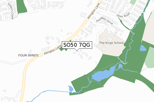
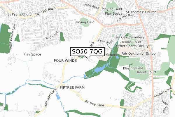
SO50 7QG is located in the Fair Oak & Horton Heath electoral ward, within the local authority district of Eastleigh and the English Parliamentary constituency of Eastleigh. The Sub Integrated Care Board (ICB) Location is NHS Hampshire and Isle of Wight ICB - D9Y0V and the police force is Hampshire. This postcode has been in use since February 2020.


GetTheData
Source: OS Open Zoomstack (Ordnance Survey)
Licence: Open Government Licence (requires attribution)
Attribution: Contains OS data © Crown copyright and database right 2024
Source: Open Postcode Geo
Licence: Open Government Licence (requires attribution)
Attribution: Contains OS data © Crown copyright and database right 2024; Contains Royal Mail data © Royal Mail copyright and database right 2024; Source: Office for National Statistics licensed under the Open Government Licence v.3.0
| Easting | 448722 |
| Northing | 117944 |
| Latitude | 50.958862 |
| Longitude | -1.307645 |
GetTheData
Source: Open Postcode Geo
Licence: Open Government Licence
| Country | England |
| Postcode District | SO50 |
| ➜ SO50 open data dashboard ➜ See where SO50 is on a map ➜ Where is Eastleigh? | |
GetTheData
Source: Land Registry Price Paid Data
Licence: Open Government Licence
| Ward | Fair Oak & Horton Heath |
| Constituency | Eastleigh |
GetTheData
Source: ONS Postcode Database
Licence: Open Government Licence
20, CLEMENTINE WAY, FAIR OAK, EASTLEIGH, SO50 7QG 2021 9 APR £624,950 |
23, CLEMENTINE WAY, FAIR OAK, EASTLEIGH, SO50 7QG 2021 7 APR £584,950 |
28, CLEMENTINE WAY, FAIR OAK, EASTLEIGH, SO50 7QG 2021 1 APR £399,950 |
38, CLEMENTINE WAY, FAIR OAK, EASTLEIGH, SO50 7QG 2021 1 APR £454,950 |
21, CLEMENTINE WAY, FAIR OAK, EASTLEIGH, SO50 7QG 2021 1 APR £410,000 |
22, CLEMENTINE WAY, FAIR OAK, EASTLEIGH, SO50 7QG 2021 31 MAR £594,950 |
29, CLEMENTINE WAY, FAIR OAK, EASTLEIGH, SO50 7QG 2021 5 MAR £405,000 |
39, CLEMENTINE WAY, FAIR OAK, EASTLEIGH, SO50 7QG 2021 26 FEB £559,950 |
37, CLEMENTINE WAY, FAIR OAK, EASTLEIGH, SO50 7QG 2021 29 JAN £464,950 |
49, CLEMENTINE WAY, FAIR OAK, EASTLEIGH, SO50 7QG 2020 22 DEC £454,950 |
GetTheData
Source: HM Land Registry Price Paid Data
Licence: Contains HM Land Registry data © Crown copyright and database right 2024. This data is licensed under the Open Government Licence v3.0.
| June 2022 | Violence and sexual offences | On or near Dean Road | 342m |
| June 2022 | Violence and sexual offences | On or near Dean Road | 342m |
| June 2022 | Criminal damage and arson | On or near Dean Road | 342m |
| ➜ Get more crime data in our Crime section | |||
GetTheData
Source: data.police.uk
Licence: Open Government Licence
| Dean Road (Fairoak Road) | Fair Oak | 559m |
| New Clock Inn (Fair Oak Road) | Fair Oak | 579m |
| New Clock Inn (Fair Oak Road) | Fair Oak | 617m |
| New Clock Inn (Sandy Lane) | Fair Oak | 647m |
| Recreation Ground (Shorts Road) | Fair Oak | 698m |
| Hedge End Station | 3.1km |
| Eastleigh Station | 3.2km |
| Southampton Airport Parkway Station | 4km |
GetTheData
Source: NaPTAN
Licence: Open Government Licence
GetTheData
Source: ONS Postcode Database
Licence: Open Government Licence


➜ Get more ratings from the Food Standards Agency
GetTheData
Source: Food Standards Agency
Licence: FSA terms & conditions
| Last Collection | |||
|---|---|---|---|
| Location | Mon-Fri | Sat | Distance |
| Allington Lane | 16:45 | 09:30 | 385m |
| Fair Oak Post Office | 17:00 | 11:30 | 883m |
| Olympic Way | 16:45 | 09:15 | 998m |
GetTheData
Source: Dracos
Licence: Creative Commons Attribution-ShareAlike
| Facility | Distance |
|---|---|
| The Kings School Fair Oak Allington Lane, Fair Oak, Eastleigh Grass Pitches | 200m |
| Lapstone Playing Fields Pavilion Close, Fair Oak Grass Pitches, Outdoor Tennis Courts | 686m |
| Wyvern College Sport And Fitness Botley Road, Fair Oak, Eastleigh Sports Hall, Health and Fitness Gym, Athletics, Grass Pitches, Studio, Artificial Grass Pitch, Outdoor Tennis Courts | 714m |
GetTheData
Source: Active Places
Licence: Open Government Licence
| School | Phase of Education | Distance |
|---|---|---|
| The King's School Lakesmere House, Allington Lane, Fair Oak, Hampshire, SO50 7DB | Not applicable | 200m |
| Fair Oak Junior School Botley Road, Fair Oak, Eastleigh, SO50 7AN | Primary | 676m |
| Wyvern College Botley Road, Fair Oak, Eastleigh, SO50 7AN | Secondary | 741m |
GetTheData
Source: Edubase
Licence: Open Government Licence
The below table lists the International Territorial Level (ITL) codes (formerly Nomenclature of Territorial Units for Statistics (NUTS) codes) and Local Administrative Units (LAU) codes for SO50 7QG:
| ITL 1 Code | Name |
|---|---|
| TLJ | South East (England) |
| ITL 2 Code | Name |
| TLJ3 | Hampshire and Isle of Wight |
| ITL 3 Code | Name |
| TLJ35 | South Hampshire |
| LAU 1 Code | Name |
| E07000086 | Eastleigh |
GetTheData
Source: ONS Postcode Directory
Licence: Open Government Licence
The below table lists the Census Output Area (OA), Lower Layer Super Output Area (LSOA), and Middle Layer Super Output Area (MSOA) for SO50 7QG:
| Code | Name | |
|---|---|---|
| OA | E00115318 | |
| LSOA | E01022686 | Eastleigh 008F |
| MSOA | E02004719 | Eastleigh 008 |
GetTheData
Source: ONS Postcode Directory
Licence: Open Government Licence
| SO50 7DB | Allington Lane | 153m |
| SO50 7LE | Goodison Close | 367m |
| SO50 7LF | Anfield Close | 375m |
| SO50 7LA | Anfield Close | 411m |
| SO50 7LD | Roker Way | 422m |
| SO50 8RG | Strawberry Mead | 429m |
| SO50 8RQ | Strawberry Mead | 442m |
| SO50 8RE | Damson Crescent | 458m |
| SO50 7JE | Dean Road | 465m |
| SO50 7LB | Trafford Road | 467m |
GetTheData
Source: Open Postcode Geo; Land Registry Price Paid Data
Licence: Open Government Licence