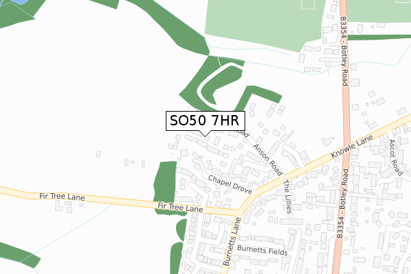
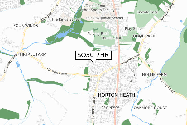
SO50 7HR is located in the Fair Oak & Horton Heath electoral ward, within the local authority district of Eastleigh and the English Parliamentary constituency of Eastleigh. The Sub Integrated Care Board (ICB) Location is NHS Hampshire and Isle of Wight ICB - D9Y0V and the police force is Hampshire. This postcode has been in use since September 2019.


GetTheData
Source: OS Open Zoomstack (Ordnance Survey)
Licence: Open Government Licence (requires attribution)
Attribution: Contains OS data © Crown copyright and database right 2024
Source: Open Postcode Geo
Licence: Open Government Licence (requires attribution)
Attribution: Contains OS data © Crown copyright and database right 2024; Contains Royal Mail data © Royal Mail copyright and database right 2024; Source: Office for National Statistics licensed under the Open Government Licence v.3.0
| Easting | 449294 |
| Northing | 117447 |
| Latitude | 50.954345 |
| Longitude | -1.299569 |
GetTheData
Source: Open Postcode Geo
Licence: Open Government Licence
| Country | England |
| Postcode District | SO50 |
| ➜ SO50 open data dashboard ➜ See where SO50 is on a map ➜ Where is Horton Heath? | |
GetTheData
Source: Land Registry Price Paid Data
Licence: Open Government Licence
| Ward | Fair Oak & Horton Heath |
| Constituency | Eastleigh |
GetTheData
Source: ONS Postcode Database
Licence: Open Government Licence
12, FARM ROAD, HORTON HEATH, EASTLEIGH, SO50 7HR 2020 18 SEP £405,000 |
5, FARM ROAD, HORTON HEATH, EASTLEIGH, SO50 7HR 2020 31 MAR £500,000 |
4, FARM ROAD, HORTON HEATH, EASTLEIGH, SO50 7HR 2020 27 MAR £475,000 |
14, FARM ROAD, HORTON HEATH, EASTLEIGH, SO50 7HR 2020 19 MAR £415,000 |
20, FARM ROAD, HORTON HEATH, EASTLEIGH, SO50 7HR 2020 21 FEB £575,000 |
2, FARM ROAD, HORTON HEATH, EASTLEIGH, SO50 7HR 2020 20 JAN £400,000 |
10, FARM ROAD, HORTON HEATH, EASTLEIGH, SO50 7HR 2019 28 NOV £490,000 |
22, FARM ROAD, HORTON HEATH, EASTLEIGH, SO50 7HR 2019 22 NOV £410,000 |
18, FARM ROAD, HORTON HEATH, EASTLEIGH, SO50 7HR 2019 15 NOV £585,000 |
GetTheData
Source: HM Land Registry Price Paid Data
Licence: Contains HM Land Registry data © Crown copyright and database right 2024. This data is licensed under the Open Government Licence v3.0.
| June 2022 | Drugs | On or near Burnetts Fields | 304m |
| June 2022 | Violence and sexual offences | On or near Petrol Station | 459m |
| June 2022 | Violence and sexual offences | On or near Burnetts Lane | 461m |
| ➜ Get more crime data in our Crime section | |||
GetTheData
Source: data.police.uk
Licence: Open Government Licence
| Chapel Drove (Knowle Lane) | Horton Heath | 224m |
| Chapel Drove (Knowle Lane) | Horton Heath | 268m |
| Burnetts Field (Burnetts Lane) | Horton Heath | 305m |
| Horton Heath Cross Roads (Botley Road) | Horton Heath | 336m |
| Horton Heath Cross Roads (Botley Road) | Horton Heath | 350m |
| Hedge End Station | 2.5km |
| Eastleigh Station | 3.9km |
| Southampton Airport Parkway Station | 4.5km |
GetTheData
Source: NaPTAN
Licence: Open Government Licence
GetTheData
Source: ONS Postcode Database
Licence: Open Government Licence


➜ Get more ratings from the Food Standards Agency
GetTheData
Source: Food Standards Agency
Licence: FSA terms & conditions
| Last Collection | |||
|---|---|---|---|
| Location | Mon-Fri | Sat | Distance |
| Horton Heath Post Office | 16:30 | 09:00 | 455m |
| Ascot Close | 16:15 | 09:30 | 507m |
| Allington Lane | 16:45 | 09:30 | 961m |
GetTheData
Source: Dracos
Licence: Creative Commons Attribution-ShareAlike
| Facility | Distance |
|---|---|
| Lapstone Playing Fields Pavilion Close, Fair Oak Grass Pitches, Outdoor Tennis Courts | 510m |
| The Kings School Fair Oak Allington Lane, Fair Oak, Eastleigh Grass Pitches | 699m |
| Wyvern College Sport And Fitness Botley Road, Fair Oak, Eastleigh Sports Hall, Health and Fitness Gym, Athletics, Grass Pitches, Studio, Artificial Grass Pitch, Outdoor Tennis Courts | 733m |
GetTheData
Source: Active Places
Licence: Open Government Licence
| School | Phase of Education | Distance |
|---|---|---|
| Fair Oak Junior School Botley Road, Fair Oak, Eastleigh, SO50 7AN | Primary | 605m |
| Fair Oak Infant School Botley Road, Fair Oak, Eastleigh, SO50 7AN | Primary | 651m |
| The King's School Lakesmere House, Allington Lane, Fair Oak, Hampshire, SO50 7DB | Not applicable | 699m |
GetTheData
Source: Edubase
Licence: Open Government Licence
The below table lists the International Territorial Level (ITL) codes (formerly Nomenclature of Territorial Units for Statistics (NUTS) codes) and Local Administrative Units (LAU) codes for SO50 7HR:
| ITL 1 Code | Name |
|---|---|
| TLJ | South East (England) |
| ITL 2 Code | Name |
| TLJ3 | Hampshire and Isle of Wight |
| ITL 3 Code | Name |
| TLJ35 | South Hampshire |
| LAU 1 Code | Name |
| E07000086 | Eastleigh |
GetTheData
Source: ONS Postcode Directory
Licence: Open Government Licence
The below table lists the Census Output Area (OA), Lower Layer Super Output Area (LSOA), and Middle Layer Super Output Area (MSOA) for SO50 7HR:
| Code | Name | |
|---|---|---|
| OA | E00115318 | |
| LSOA | E01022686 | Eastleigh 008F |
| MSOA | E02004719 | Eastleigh 008 |
GetTheData
Source: ONS Postcode Directory
Licence: Open Government Licence
| SO50 7DL | Chapel Drove | 85m |
| SO50 7LL | Exmouth Gardens | 123m |
| SO50 7BZ | Fir Tree Close | 142m |
| SO50 7DJ | Burnetts Lane | 217m |
| SO50 7FG | Saxon Court | 217m |
| SO50 7PB | Angelica Gardens | 242m |
| SO50 7QH | The Lillies | 252m |
| SO50 7DH | Burnetts Fields | 281m |
| SO50 7EU | Botley Road | 304m |
| SO50 7PA | Angelica Gardens | 332m |
GetTheData
Source: Open Postcode Geo; Land Registry Price Paid Data
Licence: Open Government Licence