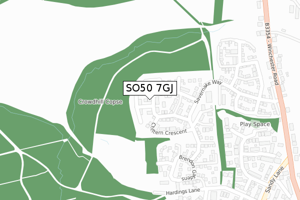
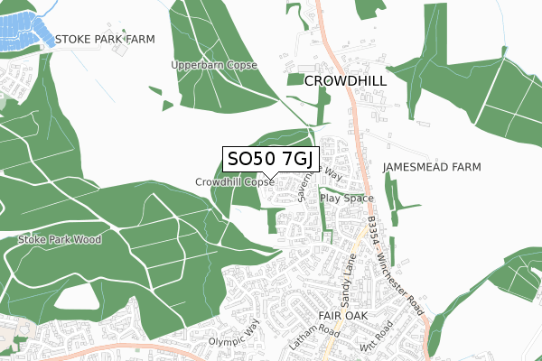
SO50 7GJ is located in the Fair Oak & Horton Heath electoral ward, within the local authority district of Eastleigh and the English Parliamentary constituency of Eastleigh. The Sub Integrated Care Board (ICB) Location is NHS Hampshire and Isle of Wight ICB - D9Y0V and the police force is Hampshire. This postcode has been in use since February 2018.


GetTheData
Source: OS Open Zoomstack (Ordnance Survey)
Licence: Open Government Licence (requires attribution)
Attribution: Contains OS data © Crown copyright and database right 2024
Source: Open Postcode Geo
Licence: Open Government Licence (requires attribution)
Attribution: Contains OS data © Crown copyright and database right 2024; Contains Royal Mail data © Royal Mail copyright and database right 2024; Source: Office for National Statistics licensed under the Open Government Licence v.3.0
| Easting | 448704 |
| Northing | 119658 |
| Latitude | 50.974276 |
| Longitude | -1.307672 |
GetTheData
Source: Open Postcode Geo
Licence: Open Government Licence
| Country | England |
| Postcode District | SO50 |
| ➜ SO50 open data dashboard ➜ See where SO50 is on a map ➜ Where is Eastleigh? | |
GetTheData
Source: Land Registry Price Paid Data
Licence: Open Government Licence
| Ward | Fair Oak & Horton Heath |
| Constituency | Eastleigh |
GetTheData
Source: ONS Postcode Database
Licence: Open Government Licence
2021 30 APR £405,000 |
2019 28 JUN £370,000 |
20, CHILTERN CRESCENT, FAIR OAK, EASTLEIGH, SO50 7GJ 2019 28 JUN £510,000 |
30, CHILTERN CRESCENT, FAIR OAK, EASTLEIGH, SO50 7GJ 2019 31 MAY £490,000 |
28, CHILTERN CRESCENT, FAIR OAK, EASTLEIGH, SO50 7GJ 2019 29 APR £530,000 |
36, CHILTERN CRESCENT, FAIR OAK, EASTLEIGH, SO50 7GJ 2019 25 JAN £530,000 |
38, CHILTERN CRESCENT, FAIR OAK, EASTLEIGH, SO50 7GJ 2019 25 JAN £480,000 |
42, CHILTERN CRESCENT, FAIR OAK, EASTLEIGH, SO50 7GJ 2018 20 DEC £495,000 |
40, CHILTERN CRESCENT, FAIR OAK, EASTLEIGH, SO50 7GJ 2018 19 DEC £510,000 |
54, CHILTERN CRESCENT, FAIR OAK, EASTLEIGH, SO50 7GJ 2018 7 DEC £460,000 |
GetTheData
Source: HM Land Registry Price Paid Data
Licence: Contains HM Land Registry data © Crown copyright and database right 2024. This data is licensed under the Open Government Licence v3.0.
| June 2022 | Anti-social behaviour | On or near Upper Barn Copse | 361m |
| June 2022 | Vehicle crime | On or near Winchester Road | 394m |
| June 2022 | Violence and sexual offences | On or near Denham Fields | 405m |
| ➜ Get more crime data in our Crime section | |||
GetTheData
Source: data.police.uk
Licence: Open Government Licence
| Fox And Hounds (Winchester Road) | Crowdhill | 399m |
| Fox And Hounds (Winchester Road) | Crowdhill | 403m |
| Pyle Hill (Winchester Road) | Pylehill | 441m |
| Winchester Road (Sandy Lane) | Pylehill | 461m |
| Pyle Hill (Winchester Road) | Pylehill | 467m |
| Eastleigh Station | 3km |
| Southampton Airport Parkway Station | 4.7km |
| Hedge End Station | 4.8km |
GetTheData
Source: NaPTAN
Licence: Open Government Licence
➜ Broadband speed and availability dashboard for SO50 7GJ
| Percentage of properties with Next Generation Access | 100.0% |
| Percentage of properties with Superfast Broadband | 100.0% |
| Percentage of properties with Ultrafast Broadband | 0.0% |
| Percentage of properties with Full Fibre Broadband | 0.0% |
Superfast Broadband is between 30Mbps and 300Mbps
Ultrafast Broadband is > 300Mbps
| Median download speed | 40.0Mbps |
| Average download speed | 44.2Mbps |
| Maximum download speed | 80.00Mbps |
| Median upload speed | 10.0Mbps |
| Average upload speed | 11.0Mbps |
| Maximum upload speed | 20.00Mbps |
| Percentage of properties unable to receive 2Mbps | 0.0% |
| Percentage of properties unable to receive 5Mbps | 0.0% |
| Percentage of properties unable to receive 10Mbps | 0.0% |
| Percentage of properties unable to receive 30Mbps | 0.0% |
➜ Broadband speed and availability dashboard for SO50 7GJ
GetTheData
Source: Ofcom
Licence: Ofcom Terms of Use (requires attribution)
GetTheData
Source: ONS Postcode Database
Licence: Open Government Licence


➜ Get more ratings from the Food Standards Agency
GetTheData
Source: Food Standards Agency
Licence: FSA terms & conditions
| Last Collection | |||
|---|---|---|---|
| Location | Mon-Fri | Sat | Distance |
| Hardings Lane | 16:45 | 11:30 | 453m |
| Hill Close | 16:00 | 09:00 | 531m |
| Sandy Lane | 16:45 | 11:30 | 761m |
GetTheData
Source: Dracos
Licence: Creative Commons Attribution-ShareAlike
| Facility | Distance |
|---|---|
| Fair Oak Squash And Racketball Club Campbell Way, Fair Oak, Eastleigh Health and Fitness Gym, Squash Courts | 1.1km |
| Wyvern College Sport And Fitness Botley Road, Fair Oak, Eastleigh Sports Hall, Health and Fitness Gym, Athletics, Grass Pitches, Studio, Artificial Grass Pitch, Outdoor Tennis Courts | 1.6km |
| The Kings School Fair Oak Allington Lane, Fair Oak, Eastleigh Grass Pitches | 1.6km |
GetTheData
Source: Active Places
Licence: Open Government Licence
| School | Phase of Education | Distance |
|---|---|---|
| Stoke Park Infant School Abbotsbury Road, Bishopstoke, Eastleigh, SO50 8NZ | Primary | 1.4km |
| Stoke Park Junior School Underwood Road, Bishopstoke, Eastleigh, SO50 6GR | Primary | 1.5km |
| Wyvern College Botley Road, Fair Oak, Eastleigh, SO50 7AN | Secondary | 1.6km |
GetTheData
Source: Edubase
Licence: Open Government Licence
The below table lists the International Territorial Level (ITL) codes (formerly Nomenclature of Territorial Units for Statistics (NUTS) codes) and Local Administrative Units (LAU) codes for SO50 7GJ:
| ITL 1 Code | Name |
|---|---|
| TLJ | South East (England) |
| ITL 2 Code | Name |
| TLJ3 | Hampshire and Isle of Wight |
| ITL 3 Code | Name |
| TLJ35 | South Hampshire |
| LAU 1 Code | Name |
| E07000086 | Eastleigh |
GetTheData
Source: ONS Postcode Directory
Licence: Open Government Licence
The below table lists the Census Output Area (OA), Lower Layer Super Output Area (LSOA), and Middle Layer Super Output Area (MSOA) for SO50 7GJ:
| Code | Name | |
|---|---|---|
| OA | E00115320 | |
| LSOA | E01022683 | Eastleigh 008C |
| MSOA | E02004719 | Eastleigh 008 |
GetTheData
Source: ONS Postcode Directory
Licence: Open Government Licence
| SO50 8DB | Upper Barn Copse | 344m |
| SO50 8DD | Upper Barn Copse | 392m |
| SO50 7HA | Winchester Road | 398m |
| SO50 8GL | Hardings Lane | 405m |
| SO50 8DH | Denham Fields | 406m |
| SO50 7HB | Winchester Road | 418m |
| SO50 8AJ | Stoke Heights | 432m |
| SO50 8AH | Stoke Heights | 450m |
| SO50 7GX | Pyle Hill | 456m |
| SO50 8GN | Roselands Close | 457m |
GetTheData
Source: Open Postcode Geo; Land Registry Price Paid Data
Licence: Open Government Licence