Property/Postcode Data Search:
SO41 8QW open data databoard
SO41 8QW is located in the Forest & Solent electoral ward, within the local authority district of New Forest and the English Parliamentary constituency of New Forest East. The Sub Integrated Care Board (ICB) Location is NHS Hampshire and Isle of Wight ICB - D9Y0V and the police force is Hampshire. This postcode has been in use since October 2019.
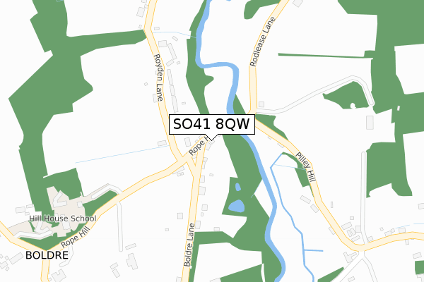
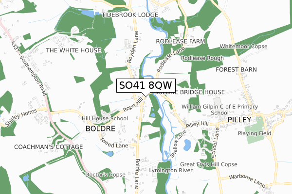
SO41 8QW maps


Source: OS Open Zoomstack (Ordnance Survey)
Licence: Open Government Licence (requires attribution)
Attribution: Contains OS data © Crown copyright and database right 2025
Source: Open Postcode Geo
Licence: Open Government Licence (requires attribution)
Attribution: Contains OS data © Crown copyright and database right 2025; Contains Royal Mail data © Royal Mail copyright and database right 2025; Source: Office for National Statistics licensed under the Open Government Licence v.3.0
Licence: Open Government Licence (requires attribution)
Attribution: Contains OS data © Crown copyright and database right 2025
Source: Open Postcode Geo
Licence: Open Government Licence (requires attribution)
Attribution: Contains OS data © Crown copyright and database right 2025; Contains Royal Mail data © Royal Mail copyright and database right 2025; Source: Office for National Statistics licensed under the Open Government Licence v.3.0
SO41 8QW geodata
| Easting | 431936 |
| Northing | 98402 |
| Latitude | 50.784308 |
| Longitude | -1.548342 |
Where is SO41 8QW?
| Country | England |
| Postcode District | SO41 |
Politics
| Ward | Forest & Solent |
|---|---|
| Constituency | New Forest East |
Transport
Nearest bus stops to SO41 8QW
| Boldre Bridge (Pilley Hill) | Boldre | 118m |
| Boldre Bridge (Pilley Hill) | Boldre | 122m |
| The Red Lion (Boldre Lane) | Boldre | 138m |
| The Red Lion (Boldre Lane) | Boldre | 140m |
| Shallow Lane (Pilley Hill) | Boldre | 337m |
Nearest railway stations to SO41 8QW
| Lymington Town Station | 2.7km |
| Lymington Pier Station | 3.2km |
| Brockenhurst Station | 4km |
Deprivation
25.2% of English postcodes are less deprived than SO41 8QW:Food Standards Agency
Three nearest food hygiene ratings to SO41 8QW (metres)
HILL HOUSE SCHOOL

ROPE HILL
481m
THE RED LION BOLDRE

ROPE HILL
481m
LAUNCHPAD: BOLDRE

WILLIAM GILPIN CHURCH OF ENGLAND PRIMARY SCHOOL
639m
➜ Get more ratings from the Food Standards Agency
Nearest post box to SO41 8QW
| Last Collection | |||
|---|---|---|---|
| Location | Mon-Fri | Sat | Distance |
| Boldre | 17:15 | 10:45 | 86m |
| Pilleys Hill | 16:15 | 08:30 | 730m |
| Battramsley Cross Road | 16:45 | 07:45 | 740m |
Environment
| Risk of SO41 8QW flooding from rivers and sea | Low |
SO41 8QW ITL and SO41 8QW LAU
The below table lists the International Territorial Level (ITL) codes (formerly Nomenclature of Territorial Units for Statistics (NUTS) codes) and Local Administrative Units (LAU) codes for SO41 8QW:
| ITL 1 Code | Name |
|---|---|
| TLJ | South East (England) |
| ITL 2 Code | Name |
| TLJ3 | Hampshire and Isle of Wight |
| ITL 3 Code | Name |
| TLJ36 | Central Hampshire |
| LAU 1 Code | Name |
| E07000091 | New Forest |
SO41 8QW census areas
The below table lists the Census Output Area (OA), Lower Layer Super Output Area (LSOA), and Middle Layer Super Output Area (MSOA) for SO41 8QW:
| Code | Name | |
|---|---|---|
| OA | E00116807 | |
| LSOA | E01022990 | New Forest 017A |
| MSOA | E02004795 | New Forest 017 |
Nearest postcodes to SO41 8QW
| SO41 8PD | Boldre Lane | 121m |
| SO41 8PF | Royden Lane | 162m |
| SO41 8PE | Royden Lane | 260m |
| SO41 8NF | Tweed Lane | 410m |
| SO41 8NE | Rope Hill | 480m |
| SO41 8PB | Shallows Lane | 547m |
| SO41 5QF | Pilley Hill | 589m |
| SO41 5QE | School Lane | 654m |
| SO41 5RY | Gilpin Close | 736m |
| SO41 5QG | Pilley Street | 876m |