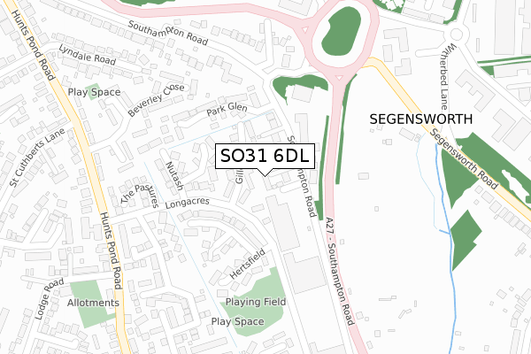
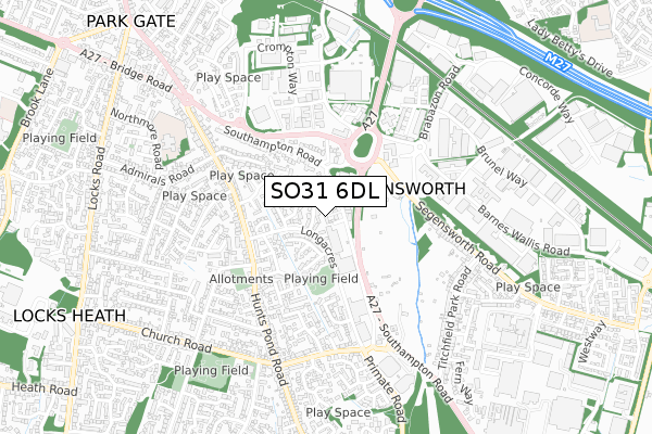
SO31 6DL is located in the Titchfield Common electoral ward, within the local authority district of Fareham and the English Parliamentary constituency of Fareham. The Sub Integrated Care Board (ICB) Location is NHS Hampshire and Isle of Wight ICB - D9Y0V and the police force is Hampshire. This postcode has been in use since October 2017.


GetTheData
Source: OS Open Zoomstack (Ordnance Survey)
Licence: Open Government Licence (requires attribution)
Attribution: Contains OS data © Crown copyright and database right 2024
Source: Open Postcode Geo
Licence: Open Government Licence (requires attribution)
Attribution: Contains OS data © Crown copyright and database right 2024; Contains Royal Mail data © Royal Mail copyright and database right 2024; Source: Office for National Statistics licensed under the Open Government Licence v.3.0
| Easting | 452370 |
| Northing | 107708 |
| Latitude | 50.866503 |
| Longitude | -1.257174 |
GetTheData
Source: Open Postcode Geo
Licence: Open Government Licence
| Country | England |
| Postcode District | SO31 |
| ➜ SO31 open data dashboard ➜ See where SO31 is on a map ➜ Where is Locks Heath? | |
GetTheData
Source: Land Registry Price Paid Data
Licence: Open Government Licence
| Ward | Titchfield Common |
| Constituency | Fareham |
GetTheData
Source: ONS Postcode Database
Licence: Open Government Licence
| March 2023 | Criminal damage and arson | On or near Lichfield Road | 438m |
| June 2022 | Criminal damage and arson | On or near Hertsfield | 172m |
| June 2022 | Bicycle theft | On or near Hertsfield | 172m |
| ➜ Get more crime data in our Crime section | |||
GetTheData
Source: data.police.uk
Licence: Open Government Licence
| Witherbed Lane (Segensworth Road) | Segensworth | 343m |
| Long Acres (Hunts Pond Road) | Locks Heath | 343m |
| Little Park Farm Road | Segensworth | 369m |
| St Cuthberts Lane (Hunts Pond Road) | Locks Heath | 379m |
| Witherbed Lane (Segensworth Road) | Segensworth | 383m |
| Swanwick Station | 1.2km |
| Bursledon Station | 3.9km |
| Fareham Station | 4.8km |
GetTheData
Source: NaPTAN
Licence: Open Government Licence
➜ Broadband speed and availability dashboard for SO31 6DL
| Percentage of properties with Next Generation Access | 100.0% |
| Percentage of properties with Superfast Broadband | 83.3% |
| Percentage of properties with Ultrafast Broadband | 0.0% |
| Percentage of properties with Full Fibre Broadband | 0.0% |
Superfast Broadband is between 30Mbps and 300Mbps
Ultrafast Broadband is > 300Mbps
| Median download speed | 29.9Mbps |
| Average download speed | 29.1Mbps |
| Maximum download speed | 41.55Mbps |
| Median upload speed | 5.8Mbps |
| Average upload speed | 5.3Mbps |
| Maximum upload speed | 7.08Mbps |
| Percentage of properties unable to receive 2Mbps | 0.0% |
| Percentage of properties unable to receive 5Mbps | 0.0% |
| Percentage of properties unable to receive 10Mbps | 0.0% |
| Percentage of properties unable to receive 30Mbps | 16.7% |
➜ Broadband speed and availability dashboard for SO31 6DL
GetTheData
Source: Ofcom
Licence: Ofcom Terms of Use (requires attribution)
GetTheData
Source: ONS Postcode Database
Licence: Open Government Licence


➜ Get more ratings from the Food Standards Agency
GetTheData
Source: Food Standards Agency
Licence: FSA terms & conditions
| Last Collection | |||
|---|---|---|---|
| Location | Mon-Fri | Sat | Distance |
| Long Acres | 17:00 | 09:00 | 199m |
| Old Southampton Road | 16:00 | 07:15 | 217m |
| Segensworth West | 17:00 | 08:15 | 370m |
GetTheData
Source: Dracos
Licence: Creative Commons Attribution-ShareAlike
| Facility | Distance |
|---|---|
| The Gym Group (Fareham Locks Heath) Southampton Road, Titchfield, Fareham Health and Fitness Gym | 481m |
| Park Gate Primary School Northmore Road, Locks Heath, Southampton Grass Pitches | 683m |
| St Anthonys Catholic Primary School Primate Road, Titchfield Common, Fareham Grass Pitches | 1.2km |
GetTheData
Source: Active Places
Licence: Open Government Licence
| School | Phase of Education | Distance |
|---|---|---|
| Park Gate Primary School Northmore Road, Park Gate, Southampton, SO31 6LX | Primary | 749m |
| St John the Baptist Church of England Primary School Abshot Road, Titchfield Common, Fareham, PO14 4NH | Primary | 1.1km |
| St Anthony's Catholic Primary School Primate Road, Titchfield Common, Fareham, PO14 4RP | Primary | 1.2km |
GetTheData
Source: Edubase
Licence: Open Government Licence
The below table lists the International Territorial Level (ITL) codes (formerly Nomenclature of Territorial Units for Statistics (NUTS) codes) and Local Administrative Units (LAU) codes for SO31 6DL:
| ITL 1 Code | Name |
|---|---|
| TLJ | South East (England) |
| ITL 2 Code | Name |
| TLJ3 | Hampshire and Isle of Wight |
| ITL 3 Code | Name |
| TLJ35 | South Hampshire |
| LAU 1 Code | Name |
| E07000087 | Fareham |
GetTheData
Source: ONS Postcode Directory
Licence: Open Government Licence
The below table lists the Census Output Area (OA), Lower Layer Super Output Area (LSOA), and Middle Layer Super Output Area (MSOA) for SO31 6DL:
| Code | Name | |
|---|---|---|
| OA | E00115797 | |
| LSOA | E01022787 | Fareham 002E |
| MSOA | E02004728 | Fareham 002 |
GetTheData
Source: ONS Postcode Directory
Licence: Open Government Licence
| PO14 4SH | Gillcrest | 39m |
| PO14 4SD | Longacres | 59m |
| PO14 4SQ | Grassymead | 126m |
| PO14 4SF | Merryfield | 139m |
| SO31 6BZ | Park Glen | 172m |
| PO14 4SG | Nutash | 198m |
| PO14 4SE | Hertsfield | 198m |
| SO31 6QU | Beverley Close | 237m |
| SO31 6AF | Southampton Road | 246m |
| PO14 4SL | Wheatlands | 260m |
GetTheData
Source: Open Postcode Geo; Land Registry Price Paid Data
Licence: Open Government Licence