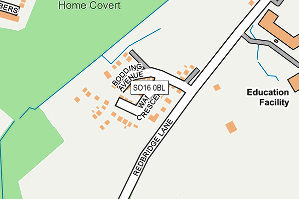
SO16 0BL is located in the Chilworth, Nursling & Rownhams electoral ward, within the local authority district of Test Valley and the English Parliamentary constituency of Romsey and Southampton North. The Sub Integrated Care Board (ICB) Location is NHS Hampshire and Isle of Wight ICB - D9Y0V and the police force is Hampshire. This postcode has been in use since April 2017.


GetTheData
Source: OS OpenMap – Local (Ordnance Survey)
Source: OS VectorMap District (Ordnance Survey)
Licence: Open Government Licence (requires attribution)
| Easting | 437761 |
| Northing | 115823 |
| Latitude | 50.940611 |
| Longitude | -1.463924 |
GetTheData
Source: Open Postcode Geo
Licence: Open Government Licence
| Country | England |
| Postcode District | SO16 |
➜ See where SO16 is on a map ➜ Where is Nursling? | |
GetTheData
Source: Land Registry Price Paid Data
Licence: Open Government Licence
| Ward | Chilworth, Nursling & Rownhams |
| Constituency | Romsey And Southampton North |
GetTheData
Source: ONS Postcode Database
Licence: Open Government Licence
2021 25 JUN £386,000 |
16, WADES CRESCENT, NURSLING, SOUTHAMPTON, SO16 0BL 2017 31 AUG £460,000 |
14, WADES CRESCENT, NURSLING, SOUTHAMPTON, SO16 0BL 2017 11 AUG £425,000 |
12, WADES CRESCENT, NURSLING, SOUTHAMPTON, SO16 0BL 2017 30 JUN £425,000 |
7, WADES CRESCENT, NURSLING, SOUTHAMPTON, SO16 0BL 2017 22 JUN £335,000 |
2, WADES CRESCENT, NURSLING, SOUTHAMPTON, SO16 0BL 2017 31 MAY £420,000 |
5, WADES CRESCENT, NURSLING, SOUTHAMPTON, SO16 0BL 2017 5 MAY £335,000 |
2017 28 APR £340,000 |
GetTheData
Source: HM Land Registry Price Paid Data
Licence: Contains HM Land Registry data © Crown copyright and database right 2025. This data is licensed under the Open Government Licence v3.0.
| Bakers Drove (Romsey Road) | Nursling | 440m |
| Bakers Drove (Romsey Road) | Nursling | 444m |
| Oasis Academy (Romsey Road) | Lord's Hill | 451m |
| Oasis Academy (Romsey Road) | Lord's Hill | 460m |
| Guernsey Close (Brownhill Way) | Maybush | 474m |
| Redbridge (Hants) Station | 2.3km |
| Totton Station | 2.8km |
| Millbrook (Hants) Station | 3.9km |
GetTheData
Source: NaPTAN
Licence: Open Government Licence
| Percentage of properties with Next Generation Access | 100.0% |
| Percentage of properties with Superfast Broadband | 100.0% |
| Percentage of properties with Ultrafast Broadband | 100.0% |
| Percentage of properties with Full Fibre Broadband | 100.0% |
Superfast Broadband is between 30Mbps and 300Mbps
Ultrafast Broadband is > 300Mbps
| Percentage of properties unable to receive 2Mbps | 0.0% |
| Percentage of properties unable to receive 5Mbps | 0.0% |
| Percentage of properties unable to receive 10Mbps | 0.0% |
| Percentage of properties unable to receive 30Mbps | 0.0% |
GetTheData
Source: Ofcom
Licence: Ofcom Terms of Use (requires attribution)
GetTheData
Source: ONS Postcode Database
Licence: Open Government Licence


➜ Get more ratings from the Food Standards Agency
GetTheData
Source: Food Standards Agency
Licence: FSA terms & conditions
| Last Collection | |||
|---|---|---|---|
| Location | Mon-Fri | Sat | Distance |
| Redbridge Lane | 16:00 | 11:00 | 286m |
| Nursling Post Office | 17:00 | 11:15 | 490m |
| Cromarty Road | 17:45 | 12:00 | 908m |
GetTheData
Source: Dracos
Licence: Creative Commons Attribution-ShareAlike
The below table lists the International Territorial Level (ITL) codes (formerly Nomenclature of Territorial Units for Statistics (NUTS) codes) and Local Administrative Units (LAU) codes for SO16 0BL:
| ITL 1 Code | Name |
|---|---|
| TLJ | South East (England) |
| ITL 2 Code | Name |
| TLJ3 | Hampshire and Isle of Wight |
| ITL 3 Code | Name |
| TLJ36 | Central Hampshire |
| LAU 1 Code | Name |
| E07000093 | Test Valley |
GetTheData
Source: ONS Postcode Directory
Licence: Open Government Licence
The below table lists the Census Output Area (OA), Lower Layer Super Output Area (LSOA), and Middle Layer Super Output Area (MSOA) for SO16 0BL:
| Code | Name | |
|---|---|---|
| OA | E00117734 | |
| LSOA | E01023170 | Test Valley 015A |
| MSOA | E02004828 | Test Valley 015 |
GetTheData
Source: ONS Postcode Directory
Licence: Open Government Licence
| SO16 0XN | Redbridge Lane | 299m |
| SO16 0YR | Jerretts Lane | 313m |
| SO16 0TB | Watley Close | 332m |
| SO16 0TA | Chambers Close | 365m |
| SO16 0XT | Triangle Gardens | 382m |
| SO16 0XP | Hillyfields | 388m |
| SO16 0XL | Toogoods Way | 398m |
| SO16 0XR | Triangle Gardens | 400m |
| SO16 0TD | Cranmer Drive | 433m |
| SO16 0TG | Tuffin Close | 465m |
GetTheData
Source: Open Postcode Geo; Land Registry Price Paid Data
Licence: Open Government Licence