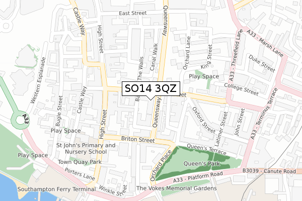
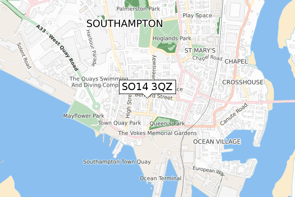
SO14 3QZ is located in the Bargate electoral ward, within the unitary authority of Southampton and the English Parliamentary constituency of Southampton, Itchen. The Sub Integrated Care Board (ICB) Location is NHS Hampshire and Isle of Wight ICB - D9Y0V and the police force is Hampshire. This postcode has been in use since January 2018.


GetTheData
Source: OS Open Zoomstack (Ordnance Survey)
Licence: Open Government Licence (requires attribution)
Attribution: Contains OS data © Crown copyright and database right 2024
Source: Open Postcode Geo
Licence: Open Government Licence (requires attribution)
Attribution: Contains OS data © Crown copyright and database right 2024; Contains Royal Mail data © Royal Mail copyright and database right 2024; Source: Office for National Statistics licensed under the Open Government Licence v.3.0
| Easting | 442175 |
| Northing | 111245 |
| Latitude | 50.899140 |
| Longitude | -1.401633 |
GetTheData
Source: Open Postcode Geo
Licence: Open Government Licence
| Country | England |
| Postcode District | SO14 |
| ➜ SO14 open data dashboard ➜ See where SO14 is on a map ➜ Where is Southampton? | |
GetTheData
Source: Land Registry Price Paid Data
Licence: Open Government Licence
| Ward | Bargate |
| Constituency | Southampton, Itchen |
GetTheData
Source: ONS Postcode Database
Licence: Open Government Licence
| January 2024 | Criminal damage and arson | On or near Castle Lane | 328m |
| January 2024 | Robbery | On or near Castle Lane | 328m |
| January 2024 | Violence and sexual offences | On or near Castle Lane | 328m |
| ➜ Get more crime data in our Crime section | |||
GetTheData
Source: data.police.uk
Licence: Open Government Licence
| National Express Stop (Queen's Way) | Queens Park | 68m |
| Oxford Street (Bernard Street) | Southampton City Centre | 87m |
| Briton Street (Queensway) | Queens Park | 95m |
| Oxford Street (Bernard Street) | Southampton City Centre | 134m |
| Friary House (Briton Street) | Queens Park | 140m |
| Southampton Town Quay | 0.5km |
| Southampton Central Station | 1.2km |
| Woolston Station | 1.7km |
GetTheData
Source: NaPTAN
Licence: Open Government Licence
| Percentage of properties with Next Generation Access | 100.0% |
| Percentage of properties with Superfast Broadband | 100.0% |
| Percentage of properties with Ultrafast Broadband | 100.0% |
| Percentage of properties with Full Fibre Broadband | 100.0% |
Superfast Broadband is between 30Mbps and 300Mbps
Ultrafast Broadband is > 300Mbps
| Percentage of properties unable to receive 2Mbps | 0.0% |
| Percentage of properties unable to receive 5Mbps | 0.0% |
| Percentage of properties unable to receive 10Mbps | 0.0% |
| Percentage of properties unable to receive 30Mbps | 0.0% |
GetTheData
Source: Ofcom
Licence: Ofcom Terms of Use (requires attribution)
GetTheData
Source: ONS Postcode Database
Licence: Open Government Licence


➜ Get more ratings from the Food Standards Agency
GetTheData
Source: Food Standards Agency
Licence: FSA terms & conditions
| Last Collection | |||
|---|---|---|---|
| Location | Mon-Fri | Sat | Distance |
| Bernard Street | 18:30 | 12:00 | 152m |
| Queensway | 18:45 | 12:15 | 210m |
| High Street (163-164) | 18:45 | 12:30 | 285m |
GetTheData
Source: Dracos
Licence: Creative Commons Attribution-ShareAlike
| Facility | Distance |
|---|---|
| Speedflex (Southampton) (Closed) Briton Street, Southampton Health and Fitness Gym, Studio | 167m |
| The Gym Group (Southampton Central) High Street, Southampton Health and Fitness Gym | 391m |
| Energie Ladies Fitness Club (Southampton) (Closed) East Bargate, Southampton Health and Fitness Gym, Studio | 406m |
GetTheData
Source: Active Places
Licence: Open Government Licence
| School | Phase of Education | Distance |
|---|---|---|
| St John's Primary and Nursery School French Street, Old Town, Southampton, SO14 2AU | Primary | 263m |
| Hope Community School Southampton Central Hall, St Mary Street, Southampton, SO14 1NF | Primary | 434m |
| St Mary's Church of England Voluntary Controlled Primary School Ascupart Street, Southampton, SO14 1LU | Primary | 838m |
GetTheData
Source: Edubase
Licence: Open Government Licence
The below table lists the International Territorial Level (ITL) codes (formerly Nomenclature of Territorial Units for Statistics (NUTS) codes) and Local Administrative Units (LAU) codes for SO14 3QZ:
| ITL 1 Code | Name |
|---|---|
| TLJ | South East (England) |
| ITL 2 Code | Name |
| TLJ3 | Hampshire and Isle of Wight |
| ITL 3 Code | Name |
| TLJ32 | Southampton |
| LAU 1 Code | Name |
| E06000045 | Southampton |
GetTheData
Source: ONS Postcode Directory
Licence: Open Government Licence
The below table lists the Census Output Area (OA), Lower Layer Super Output Area (LSOA), and Middle Layer Super Output Area (MSOA) for SO14 3QZ:
| Code | Name | |
|---|---|---|
| OA | E00166984 | |
| LSOA | E01032751 | Southampton 029H |
| MSOA | E02003577 | Southampton 029 |
GetTheData
Source: ONS Postcode Directory
Licence: Open Government Licence
| SO14 3AU | Bernard Street | 13m |
| SO14 3AZ | Queens Way | 50m |
| SO14 3AY | Bernard Street | 51m |
| SO14 3BB | Orchard Lane | 93m |
| SO14 3EZ | Briton Street | 99m |
| SO14 3AQ | Queens Way | 104m |
| SO14 3ES | Briton Street | 121m |
| SO14 3EY | Briton Street | 123m |
| SO14 2NS | High Street | 134m |
| SO14 3RS | Bernard Street | 138m |
GetTheData
Source: Open Postcode Geo; Land Registry Price Paid Data
Licence: Open Government Licence