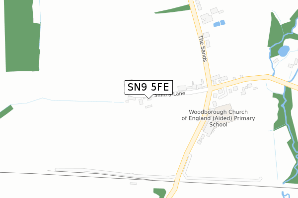
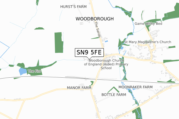
SN9 5FE is located in the Pewsey Vale West electoral ward, within the unitary authority of Wiltshire and the English Parliamentary constituency of Devizes. The Sub Integrated Care Board (ICB) Location is NHS Bath and North East Somerset, Swindon and Wiltshire ICB - 92 and the police force is Wiltshire. This postcode has been in use since November 2019.


GetTheData
Source: OS Open Zoomstack (Ordnance Survey)
Licence: Open Government Licence (requires attribution)
Attribution: Contains OS data © Crown copyright and database right 2024
Source: Open Postcode Geo
Licence: Open Government Licence (requires attribution)
Attribution: Contains OS data © Crown copyright and database right 2024; Contains Royal Mail data © Royal Mail copyright and database right 2024; Source: Office for National Statistics licensed under the Open Government Licence v.3.0
| Easting | 410546 |
| Northing | 159838 |
| Latitude | 51.337533 |
| Longitude | -1.849988 |
GetTheData
Source: Open Postcode Geo
Licence: Open Government Licence
| Country | England |
| Postcode District | SN9 |
| ➜ SN9 open data dashboard ➜ See where SN9 is on a map ➜ Where is Woodborough? | |
GetTheData
Source: Land Registry Price Paid Data
Licence: Open Government Licence
| Ward | Pewsey Vale West |
| Constituency | Devizes |
GetTheData
Source: ONS Postcode Database
Licence: Open Government Licence
| November 2021 | Other theft | On or near Smithy Lane | 72m |
| November 2021 | Vehicle crime | On or near Smithy Lane | 72m |
| ➜ Get more crime data in our Crime section | |||
GetTheData
Source: data.police.uk
Licence: Open Government Licence
| Crossroads (Broad Street) | Woodborough | 201m |
| Crossroads (Broad Street) | Woodborough | 210m |
| Broad Street (Woodborough Road) | Woodborough | 405m |
| Broad Street (Woodborough Road) | Woodborough | 413m |
| Church Road (Main Street) | Woodborough | 827m |
GetTheData
Source: NaPTAN
Licence: Open Government Licence
GetTheData
Source: ONS Postcode Database
Licence: Open Government Licence


➜ Get more ratings from the Food Standards Agency
GetTheData
Source: Food Standards Agency
Licence: FSA terms & conditions
| Last Collection | |||
|---|---|---|---|
| Location | Mon-Fri | Sat | Distance |
| Alton Priors | 16:15 | 08:30 | 2,548m |
| Marden | 16:15 | 08:30 | 2,874m |
| Little Abbotts | 16:15 | 07:00 | 3,608m |
GetTheData
Source: Dracos
Licence: Creative Commons Attribution-ShareAlike
| Facility | Distance |
|---|---|
| All Cannings Cricket Club (Closed) All Cannings, Devizes Grass Pitches | 3.7km |
| All Cannings Church Of England Primary School Chandlers Lane, All Cannings, Devizes Grass Pitches | 3.7km |
| All Cannings Village Green School Lane, All Cannings, Devizes Grass Pitches | 3.9km |
GetTheData
Source: Active Places
Licence: Open Government Licence
| School | Phase of Education | Distance |
|---|---|---|
| Woodborough Church of England Primary School Broad Street, Pewsey, SN9 5PL | Primary | 117m |
| All Cannings Church of England Primary School Chandlers Lane, All Cannings, Devizes, SN10 3PG | Primary | 3.9km |
| Chirton Church of England Primary School The Street, Chirton, Devizes, SN10 3QS | Primary | 4km |
GetTheData
Source: Edubase
Licence: Open Government Licence
The below table lists the International Territorial Level (ITL) codes (formerly Nomenclature of Territorial Units for Statistics (NUTS) codes) and Local Administrative Units (LAU) codes for SN9 5FE:
| ITL 1 Code | Name |
|---|---|
| TLK | South West (England) |
| ITL 2 Code | Name |
| TLK1 | Gloucestershire, Wiltshire and Bath/Bristol area |
| ITL 3 Code | Name |
| TLK15 | Wiltshire |
| LAU 1 Code | Name |
| E06000054 | Wiltshire |
GetTheData
Source: ONS Postcode Directory
Licence: Open Government Licence
The below table lists the Census Output Area (OA), Lower Layer Super Output Area (LSOA), and Middle Layer Super Output Area (MSOA) for SN9 5FE:
| Code | Name | |
|---|---|---|
| OA | E00162558 | |
| LSOA | E01031871 | Wiltshire 024D |
| MSOA | E02006636 | Wiltshire 024 |
GetTheData
Source: ONS Postcode Directory
Licence: Open Government Licence
| SN9 6HP | Broad Street | 221m |
| SN9 5PW | West End Cottages | 318m |
| SN9 6HN | 421m | |
| SN9 5PL | 508m | |
| SN9 5PR | The Sands | 591m |
| SN9 6HW | Broad Street | 679m |
| SN9 5PH | Church Road | 786m |
| SN9 5PQ | Bondfield | 836m |
| SN9 6LP | Martins Close | 878m |
| SN9 6LW | 878m |
GetTheData
Source: Open Postcode Geo; Land Registry Price Paid Data
Licence: Open Government Licence