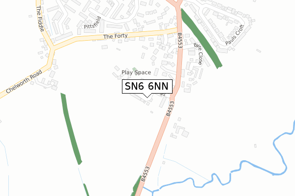
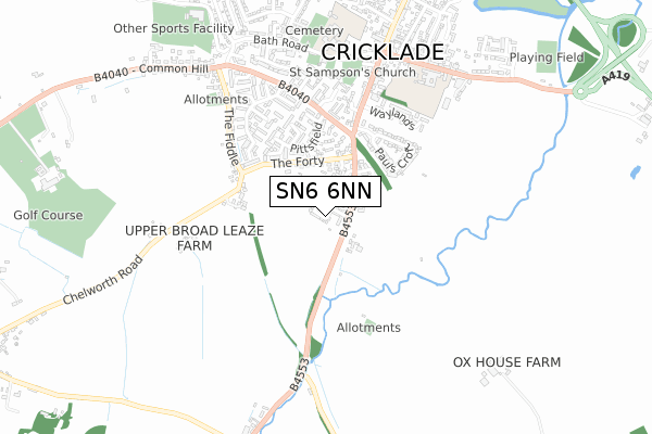
SN6 6NN is located in the Cricklade & Latton electoral ward, within the unitary authority of Wiltshire and the English Parliamentary constituency of North Wiltshire. The Sub Integrated Care Board (ICB) Location is NHS Bath and North East Somerset, Swindon and Wiltshire ICB - 92 and the police force is Wiltshire. This postcode has been in use since November 2019.


GetTheData
Source: OS Open Zoomstack (Ordnance Survey)
Licence: Open Government Licence (requires attribution)
Attribution: Contains OS data © Crown copyright and database right 2024
Source: Open Postcode Geo
Licence: Open Government Licence (requires attribution)
Attribution: Contains OS data © Crown copyright and database right 2024; Contains Royal Mail data © Royal Mail copyright and database right 2024; Source: Office for National Statistics licensed under the Open Government Licence v.3.0
| Easting | 409808 |
| Northing | 192966 |
| Latitude | 51.635421 |
| Longitude | -1.859670 |
GetTheData
Source: Open Postcode Geo
Licence: Open Government Licence
| Country | England |
| Postcode District | SN6 |
| ➜ SN6 open data dashboard ➜ See where SN6 is on a map ➜ Where is Cricklade? | |
GetTheData
Source: Land Registry Price Paid Data
Licence: Open Government Licence
| Ward | Cricklade & Latton |
| Constituency | North Wiltshire |
GetTheData
Source: ONS Postcode Database
Licence: Open Government Licence
18, MATILDAS PIECE, CRICKLADE, SWINDON, SN6 6NN 2020 7 OCT £420,000 |
16, MATILDAS PIECE, CRICKLADE, SWINDON, SN6 6NN 2020 26 JUN £649,950 |
14, MATILDAS PIECE, CRICKLADE, SWINDON, SN6 6NN 2020 10 JUN £479,950 |
5, MATILDAS PIECE, CRICKLADE, SWINDON, SN6 6NN 2020 8 APR £381,000 |
12, MATILDAS PIECE, CRICKLADE, SWINDON, SN6 6NN 2020 5 MAR £375,000 |
10, MATILDAS PIECE, CRICKLADE, SWINDON, SN6 6NN 2020 7 FEB £295,000 |
6, MATILDAS PIECE, CRICKLADE, SWINDON, SN6 6NN 2020 20 JAN £380,000 |
GetTheData
Source: HM Land Registry Price Paid Data
Licence: Contains HM Land Registry data © Crown copyright and database right 2024. This data is licensed under the Open Government Licence v3.0.
| June 2022 | Public order | On or near The Forty | 243m |
| June 2022 | Anti-social behaviour | On or near Parsonage Farm | 461m |
| May 2022 | Criminal damage and arson | On or near Portwell | 442m |
| ➜ Get more crime data in our Crime section | |||
GetTheData
Source: data.police.uk
Licence: Open Government Licence
| Turning Circle (B4040) | Cricklade | 344m |
| Pauls Croft (High Street) | Cricklade | 417m |
| Pauls Croft (High Street) | Cricklade | 419m |
| Town Hall (High Street) | Cricklade | 512m |
| Town Hall (High Street) | Cricklade | 529m |
GetTheData
Source: NaPTAN
Licence: Open Government Licence
GetTheData
Source: ONS Postcode Database
Licence: Open Government Licence

➜ Get more ratings from the Food Standards Agency
GetTheData
Source: Food Standards Agency
Licence: FSA terms & conditions
| Last Collection | |||
|---|---|---|---|
| Location | Mon-Fri | Sat | Distance |
| The Forty | 17:00 | 10:00 | 273m |
| Cricklade Post Office | 17:30 | 12:30 | 748m |
| Cerney Wick | 17:00 | 08:30 | 3,809m |
GetTheData
Source: Dracos
Licence: Creative Commons Attribution-ShareAlike
| Facility | Distance |
|---|---|
| Cricklade Manor Prep School Calcutt Street, Cricklade, Swindon Swimming Pool, Artificial Grass Pitch, Grass Pitches, Sports Hall | 694m |
| St Sampsons Ce Primary School Bath Road, Cricklade Grass Pitches | 729m |
| Cricklade Leisure Centre Stones Lane, Cricklade, Swindon Sports Hall, Swimming Pool, Health and Fitness Gym, Grass Pitches, Squash Courts, Outdoor Tennis Courts | 919m |
GetTheData
Source: Active Places
Licence: Open Government Licence
| School | Phase of Education | Distance |
|---|---|---|
| St Sampson's Church of England Primary School Bath Road, Cricklade, Swindon, SN6 6AX | Primary | 647m |
| Cricklade Manor Prep Manor House, Calcutt Street, Calcutt Street, Swindon, SN6 6BB | Not applicable | 697m |
| Meadow Bridge School The Old School House, High Street, Cricklade, Wiltshire, SN6 6DD | Not applicable | 1.1km |
GetTheData
Source: Edubase
Licence: Open Government Licence
The below table lists the International Territorial Level (ITL) codes (formerly Nomenclature of Territorial Units for Statistics (NUTS) codes) and Local Administrative Units (LAU) codes for SN6 6NN:
| ITL 1 Code | Name |
|---|---|
| TLK | South West (England) |
| ITL 2 Code | Name |
| TLK1 | Gloucestershire, Wiltshire and Bath/Bristol area |
| ITL 3 Code | Name |
| TLK15 | Wiltshire |
| LAU 1 Code | Name |
| E06000054 | Wiltshire |
GetTheData
Source: ONS Postcode Directory
Licence: Open Government Licence
The below table lists the Census Output Area (OA), Lower Layer Super Output Area (LSOA), and Middle Layer Super Output Area (MSOA) for SN6 6NN:
| Code | Name | |
|---|---|---|
| OA | E00162880 | |
| LSOA | E01031934 | Wiltshire 001B |
| MSOA | E02006644 | Wiltshire 001 |
GetTheData
Source: ONS Postcode Directory
Licence: Open Government Licence
| SN6 6HS | Giles Avenue | 113m |
| SN6 6HF | Dance Court | 164m |
| SN6 6JA | Purton Road | 179m |
| SN6 6HR | The Forty | 202m |
| SN6 6HW | The Forty | 212m |
| SN6 6FG | Carpenters | 213m |
| SN6 6HH | Byre Close | 232m |
| SN6 6FD | Lypiatt View | 302m |
| SN6 6ED | Ockwells | 306m |
| SN6 6AJ | Pauls Croft | 320m |
GetTheData
Source: Open Postcode Geo; Land Registry Price Paid Data
Licence: Open Government Licence