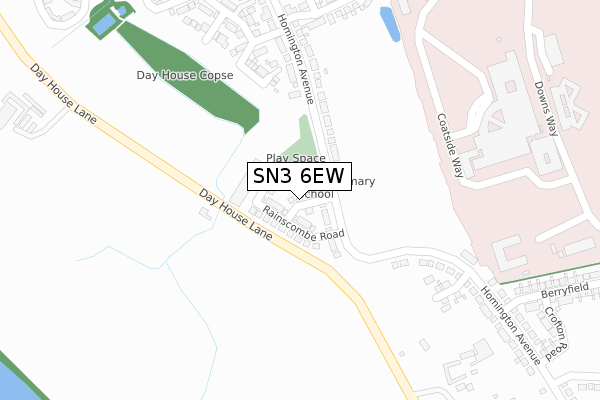
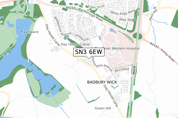
SN3 6EW is located in the Chiseldon and Lawn electoral ward, within the unitary authority of Swindon and the English Parliamentary constituency of South Swindon. The Sub Integrated Care Board (ICB) Location is NHS Bath and North East Somerset, Swindon and Wiltshire ICB - 92 and the police force is Wiltshire. This postcode has been in use since October 2017.


GetTheData
Source: OS Open Zoomstack (Ordnance Survey)
Licence: Open Government Licence (requires attribution)
Attribution: Contains OS data © Crown copyright and database right 2024
Source: Open Postcode Geo
Licence: Open Government Licence (requires attribution)
Attribution: Contains OS data © Crown copyright and database right 2024; Contains Royal Mail data © Royal Mail copyright and database right 2024; Source: Office for National Statistics licensed under the Open Government Licence v.3.0
| Easting | 418655 |
| Northing | 182088 |
| Latitude | 51.537390 |
| Longitude | -1.732414 |
GetTheData
Source: Open Postcode Geo
Licence: Open Government Licence
| Country | England |
| Postcode District | SN3 |
| ➜ SN3 open data dashboard ➜ See where SN3 is on a map ➜ Where is Swindon? | |
GetTheData
Source: Land Registry Price Paid Data
Licence: Open Government Licence
| Ward | Chiseldon And Lawn |
| Constituency | South Swindon |
GetTheData
Source: ONS Postcode Database
Licence: Open Government Licence
1, SALTHROP RISE, COATE, SWINDON, SN3 6EW 2019 22 NOV £310,000 |
3, SALTHROP RISE, COATE, SWINDON, SN3 6EW 2017 15 DEC £291,995 |
4, SALTHROP RISE, COATE, SWINDON, SN3 6EW 2017 24 NOV £285,995 |
2, SALTHROP RISE, COATE, SWINDON, SN3 6EW 2017 29 SEP £339,995 |
1, SALTHROP RISE, COATE, SWINDON, SN3 6EW 2017 29 SEP £299,995 |
GetTheData
Source: HM Land Registry Price Paid Data
Licence: Contains HM Land Registry data © Crown copyright and database right 2024. This data is licensed under the Open Government Licence v3.0.
| June 2022 | Anti-social behaviour | On or near Hospital | 337m |
| June 2022 | Vehicle crime | On or near Hospital | 337m |
| June 2022 | Vehicle crime | On or near Hospital | 337m |
| ➜ Get more crime data in our Crime section | |||
GetTheData
Source: data.police.uk
Licence: Open Government Licence
| Great Western Hospital | Common Head | 319m |
| Great Western Hospital | Common Head | 331m |
| Great Western Hospital | Common Head | 352m |
| Great Western Hospital | Common Head | 369m |
| Brunel Treatment Centre (Great Western Hospital) | Common Head | 442m |
| Swindon Station | 4.8km |
GetTheData
Source: NaPTAN
Licence: Open Government Licence
| Percentage of properties with Next Generation Access | 100.0% |
| Percentage of properties with Superfast Broadband | 100.0% |
| Percentage of properties with Ultrafast Broadband | 100.0% |
| Percentage of properties with Full Fibre Broadband | 100.0% |
Superfast Broadband is between 30Mbps and 300Mbps
Ultrafast Broadband is > 300Mbps
| Percentage of properties unable to receive 2Mbps | 0.0% |
| Percentage of properties unable to receive 5Mbps | 0.0% |
| Percentage of properties unable to receive 10Mbps | 0.0% |
| Percentage of properties unable to receive 30Mbps | 0.0% |
GetTheData
Source: Ofcom
Licence: Ofcom Terms of Use (requires attribution)
GetTheData
Source: ONS Postcode Database
Licence: Open Government Licence


➜ Get more ratings from the Food Standards Agency
GetTheData
Source: Food Standards Agency
Licence: FSA terms & conditions
| Last Collection | |||
|---|---|---|---|
| Location | Mon-Fri | Sat | Distance |
| White Edge Moor | 17:30 | 11:30 | 1,084m |
| Post House Garage | 16:30 | 13:00 | 1,085m |
| Fair Lawn | 17:30 | 11:30 | 1,110m |
GetTheData
Source: Dracos
Licence: Creative Commons Attribution-ShareAlike
| Facility | Distance |
|---|---|
| Badbury Park Primary School Rainscombe Road, Rainscombe Road, Coate, Swindon Grass Pitches | 91m |
| Liden Primary And Nursery School Liden Drive, Swindon Grass Pitches | 1km |
| You Fit (Swindon) Coate, Swindon Swimming Pool, Health and Fitness Gym | 1.1km |
GetTheData
Source: Active Places
Licence: Open Government Licence
| School | Phase of Education | Distance |
|---|---|---|
| Badbury Park Primary School Rainscombe Road, Coate, Swindon, SN3 6ER | Primary | 511m |
| Liden Academy Liden Academy, Liden Drive, Liden, Liden Drive, Swindon, SN3 6EX | Primary | 1.1km |
| The Chalet School Liden Drive, Liden, Swindon, SN3 6EX | Not applicable | 1.1km |
GetTheData
Source: Edubase
Licence: Open Government Licence
The below table lists the International Territorial Level (ITL) codes (formerly Nomenclature of Territorial Units for Statistics (NUTS) codes) and Local Administrative Units (LAU) codes for SN3 6EW:
| ITL 1 Code | Name |
|---|---|
| TLK | South West (England) |
| ITL 2 Code | Name |
| TLK1 | Gloucestershire, Wiltshire and Bath/Bristol area |
| ITL 3 Code | Name |
| TLK14 | Swindon |
| LAU 1 Code | Name |
| E06000030 | Swindon |
GetTheData
Source: ONS Postcode Directory
Licence: Open Government Licence
The below table lists the Census Output Area (OA), Lower Layer Super Output Area (LSOA), and Middle Layer Super Output Area (MSOA) for SN3 6EW:
| Code | Name | |
|---|---|---|
| OA | E00078806 | |
| LSOA | E01015583 | Swindon 025A |
| MSOA | E02003236 | Swindon 025 |
GetTheData
Source: ONS Postcode Directory
Licence: Open Government Licence
| SN4 0ER | 414m | |
| SN3 6AE | Polesdon Avenue | 423m |
| SN3 6BG | Homington Avenue | 457m |
| SN3 6BF | Landford Crescent | 489m |
| SN3 6DJ | Rowden Close | 491m |
| SN3 6AD | Dayhouse Lane | 511m |
| SN3 6DQ | Stowell Road | 546m |
| SN3 6BL | Chalcot Road | 551m |
| SN3 6AB | Wilbury Close | 591m |
| SN3 6DE | Biddestone Avenue | 593m |
GetTheData
Source: Open Postcode Geo; Land Registry Price Paid Data
Licence: Open Government Licence