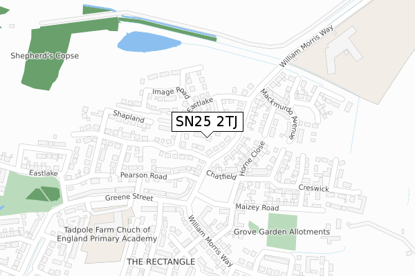
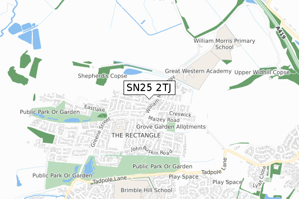
SN25 2TJ is located in the St Andrews electoral ward, within the unitary authority of Swindon and the English Parliamentary constituency of North Swindon. The Sub Integrated Care Board (ICB) Location is NHS Bath and North East Somerset, Swindon and Wiltshire ICB - 92 and the police force is Wiltshire. This postcode has been in use since June 2019.


GetTheData
Source: OS Open Zoomstack (Ordnance Survey)
Licence: Open Government Licence (requires attribution)
Attribution: Contains OS data © Crown copyright and database right 2024
Source: Open Postcode Geo
Licence: Open Government Licence (requires attribution)
Attribution: Contains OS data © Crown copyright and database right 2024; Contains Royal Mail data © Royal Mail copyright and database right 2024; Source: Office for National Statistics licensed under the Open Government Licence v.3.0
| Easting | 412613 |
| Northing | 190373 |
| Latitude | 51.612050 |
| Longitude | -1.819232 |
GetTheData
Source: Open Postcode Geo
Licence: Open Government Licence
| Country | England |
| Postcode District | SN25 |
| ➜ SN25 open data dashboard ➜ See where SN25 is on a map ➜ Where is Swindon? | |
GetTheData
Source: Land Registry Price Paid Data
Licence: Open Government Licence
| Ward | St Andrews |
| Constituency | North Swindon |
GetTheData
Source: ONS Postcode Database
Licence: Open Government Licence
| Isambard School (Redhouse Way) | Redhouse | 1,033m |
| Redhouse Village Centre (Millgrove Street) | Redhouse | 1,062m |
| Tortworth Road (Redhouse Way) | Redhouse | 1,073m |
| Dowland Close (Eastbury Way) | Eastbury | 1,078m |
| Redhouse Village Centre (Millgrove Street) | Redhouse | 1,085m |
GetTheData
Source: NaPTAN
Licence: Open Government Licence
| Percentage of properties with Next Generation Access | 90.9% |
| Percentage of properties with Superfast Broadband | 90.9% |
| Percentage of properties with Ultrafast Broadband | 90.9% |
| Percentage of properties with Full Fibre Broadband | 90.9% |
Superfast Broadband is between 30Mbps and 300Mbps
Ultrafast Broadband is > 300Mbps
| Percentage of properties unable to receive 2Mbps | 0.0% |
| Percentage of properties unable to receive 5Mbps | 0.0% |
| Percentage of properties unable to receive 10Mbps | 0.0% |
| Percentage of properties unable to receive 30Mbps | 9.1% |
GetTheData
Source: Ofcom
Licence: Ofcom Terms of Use (requires attribution)
GetTheData
Source: ONS Postcode Database
Licence: Open Government Licence


➜ Get more ratings from the Food Standards Agency
GetTheData
Source: Food Standards Agency
Licence: FSA terms & conditions
| Last Collection | |||
|---|---|---|---|
| Location | Mon-Fri | Sat | Distance |
| Oakhurst Way | 17:30 | 12:15 | 1,242m |
| Saltzgitter Drive | 17:30 | 12:00 | 1,514m |
| Pennine Way | 17:30 | 12:00 | 1,778m |
GetTheData
Source: Dracos
Licence: Creative Commons Attribution-ShareAlike
| Facility | Distance |
|---|---|
| Tadpole Farm Ce Primary Academy Greene Street, Tadpole Garden Village, Swindon Grass Pitches | 325m |
| Great Western Academy William Morris Way, William Morris Way, Tadpole Garden Village, Swindon Outdoor Tennis Courts, Grass Pitches, Sports Hall | 387m |
| Red Oaks Primary School Redhouse Way, Swindon Grass Pitches | 897m |
GetTheData
Source: Active Places
Licence: Open Government Licence
| School | Phase of Education | Distance |
|---|---|---|
| Great Western Academy William Morris Way, Tadpole Garden Village, Swindon, SN25 2PP | Secondary | 381m |
| William Morris Primary School William Morris Way, Tadpole Garden Village, Swindon, SN25 2PP | Primary | 387m |
| Churchward School William Morris Way, Swindon, SN25 2PP | Not applicable | 725m |
GetTheData
Source: Edubase
Licence: Open Government Licence
The below table lists the International Territorial Level (ITL) codes (formerly Nomenclature of Territorial Units for Statistics (NUTS) codes) and Local Administrative Units (LAU) codes for SN25 2TJ:
| ITL 1 Code | Name |
|---|---|
| TLK | South West (England) |
| ITL 2 Code | Name |
| TLK1 | Gloucestershire, Wiltshire and Bath/Bristol area |
| ITL 3 Code | Name |
| TLK14 | Swindon |
| LAU 1 Code | Name |
| E06000030 | Swindon |
GetTheData
Source: ONS Postcode Directory
Licence: Open Government Licence
The below table lists the Census Output Area (OA), Lower Layer Super Output Area (LSOA), and Middle Layer Super Output Area (MSOA) for SN25 2TJ:
| Code | Name | |
|---|---|---|
| OA | E00078246 | |
| LSOA | E01015474 | Swindon 008B |
| MSOA | E02003219 | Swindon 008 |
GetTheData
Source: ONS Postcode Directory
Licence: Open Government Licence
| SN25 2PP | William Morris Way | 69m |
| SN25 2PT | William Morris Way | 124m |
| SN25 2QG | Burne Jones Avenue | 316m |
| SN25 2QJ | Eglantyne Avenue | 325m |
| SN25 2PZ | De Morgan Crescent | 338m |
| SN25 2QN | Jebb Close | 354m |
| SN25 2PX | Malory Close | 394m |
| SN25 2PW | Malory Close | 425m |
| SN25 2PS | John Ruskin Road | 439m |
| SN25 2PU | John Ruskin Road | 439m |
GetTheData
Source: Open Postcode Geo; Land Registry Price Paid Data
Licence: Open Government Licence