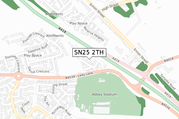
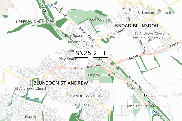
SN25 2TH is located in the St Andrews electoral ward, within the unitary authority of Swindon and the English Parliamentary constituency of North Swindon. The Sub Integrated Care Board (ICB) Location is NHS Bath and North East Somerset, Swindon and Wiltshire ICB - 92 and the police force is Wiltshire. This postcode has been in use since November 2018.


GetTheData
Source: OS Open Zoomstack (Ordnance Survey)
Licence: Open Government Licence (requires attribution)
Attribution: Contains OS data © Crown copyright and database right 2024
Source: Open Postcode Geo
Licence: Open Government Licence (requires attribution)
Attribution: Contains OS data © Crown copyright and database right 2024; Contains Royal Mail data © Royal Mail copyright and database right 2024; Source: Office for National Statistics licensed under the Open Government Licence v.3.0
| Easting | 414435 |
| Northing | 190084 |
| Latitude | 51.609408 |
| Longitude | -1.792931 |
GetTheData
Source: Open Postcode Geo
Licence: Open Government Licence
| Country | England |
| Postcode District | SN25 |
| ➜ SN25 open data dashboard ➜ See where SN25 is on a map ➜ Where is Blunsdon St Andrew? | |
GetTheData
Source: Land Registry Price Paid Data
Licence: Open Government Licence
| Ward | St Andrews |
| Constituency | North Swindon |
GetTheData
Source: ONS Postcode Database
Licence: Open Government Licence
| June 2022 | Violence and sexual offences | On or near Lady Lane | 234m |
| June 2022 | Anti-social behaviour | On or near B4534 | 336m |
| June 2022 | Violence and sexual offences | On or near B4534 | 336m |
| ➜ Get more crime data in our Crime section | |||
GetTheData
Source: data.police.uk
Licence: Open Government Licence
| Abbey Stadium (Lady Lane) | Broad Blunsdon | 72m |
| Abbey Stadium (Lady Lane) | Broad Blunsdon | 83m |
| Lady Lane (Ermin Street) | Broad Blunsdon | 238m |
| Hillside Way (Ermin Street) | Broad Blunsdon | 242m |
| High Street Top (High Street) | Broad Blunsdon | 305m |
| Swindon Station | 4.9km |
GetTheData
Source: NaPTAN
Licence: Open Government Licence
| Percentage of properties with Next Generation Access | 96.8% |
| Percentage of properties with Superfast Broadband | 96.8% |
| Percentage of properties with Ultrafast Broadband | 96.8% |
| Percentage of properties with Full Fibre Broadband | 96.8% |
Superfast Broadband is between 30Mbps and 300Mbps
Ultrafast Broadband is > 300Mbps
| Percentage of properties unable to receive 2Mbps | 0.0% |
| Percentage of properties unable to receive 5Mbps | 0.0% |
| Percentage of properties unable to receive 10Mbps | 0.0% |
| Percentage of properties unable to receive 30Mbps | 3.2% |
GetTheData
Source: Ofcom
Licence: Ofcom Terms of Use (requires attribution)
GetTheData
Source: ONS Postcode Database
Licence: Open Government Licence


➜ Get more ratings from the Food Standards Agency
GetTheData
Source: Food Standards Agency
Licence: FSA terms & conditions
| Last Collection | |||
|---|---|---|---|
| Location | Mon-Fri | Sat | Distance |
| Hillside Way | 16:00 | 08:00 | 261m |
| Saltzgitter Drive | 17:30 | 12:00 | 513m |
| High Street | 16:15 | 07:15 | 859m |
GetTheData
Source: Dracos
Licence: Creative Commons Attribution-ShareAlike
| Facility | Distance |
|---|---|
| Blunsdon Fitness + The Ridge, Blunsdon, Swindon Health and Fitness Gym, Swimming Pool, Golf, Studio, Squash Courts, Outdoor Tennis Courts | 549m |
| David Lloyd (Swindon) Latham Road, Swindon Swimming Pool, Health and Fitness Gym, Sports Hall, Indoor Tennis Centre, Studio, Outdoor Tennis Courts | 885m |
| Blunsdon Recreation Ground Sutton Park, Blunsdon, Swindon Grass Pitches | 921m |
GetTheData
Source: Active Places
Licence: Open Government Licence
| School | Phase of Education | Distance |
|---|---|---|
| Abbey Farm Educate Together Primary Diamond Crescent, Abbey Farm, Swindon, SN25 2SJ | Primary | 532m |
| St Leonard's Church of England Primary Academy Linley Road, Blunsdon, Swindon, SN26 7AP | Primary | 921m |
| Bridlewood Primary School Chartwell Road, Swindon, SN25 2EX | Primary | 1km |
GetTheData
Source: Edubase
Licence: Open Government Licence
The below table lists the International Territorial Level (ITL) codes (formerly Nomenclature of Territorial Units for Statistics (NUTS) codes) and Local Administrative Units (LAU) codes for SN25 2TH:
| ITL 1 Code | Name |
|---|---|
| TLK | South West (England) |
| ITL 2 Code | Name |
| TLK1 | Gloucestershire, Wiltshire and Bath/Bristol area |
| ITL 3 Code | Name |
| TLK14 | Swindon |
| LAU 1 Code | Name |
| E06000030 | Swindon |
GetTheData
Source: ONS Postcode Directory
Licence: Open Government Licence
The below table lists the Census Output Area (OA), Lower Layer Super Output Area (LSOA), and Middle Layer Super Output Area (MSOA) for SN25 2TH:
| Code | Name | |
|---|---|---|
| OA | E00078246 | |
| LSOA | E01015474 | Swindon 008B |
| MSOA | E02003219 | Swindon 008 |
GetTheData
Source: ONS Postcode Directory
Licence: Open Government Licence
| SN25 4DN | Lady Lane | 137m |
| SN26 8AA | Ermin Street | 220m |
| SN25 4EG | Greycing Street | 230m |
| SN25 4EP | Millard Road | 242m |
| SN25 4EQ | Byers Close | 273m |
| SN26 8DJ | Ermin Street | 283m |
| SN25 4EL | Richardson Road | 299m |
| SN25 4DS | Richardson Road | 344m |
| SN25 4DU | Holloway Close | 381m |
| SN25 4DW | Kilby Crescent | 392m |
GetTheData
Source: Open Postcode Geo; Land Registry Price Paid Data
Licence: Open Government Licence