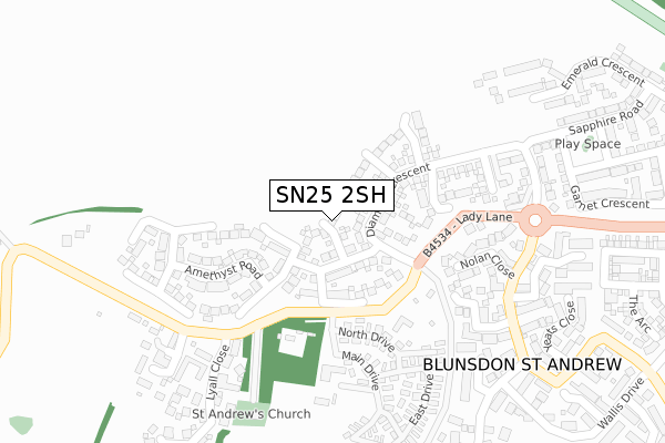
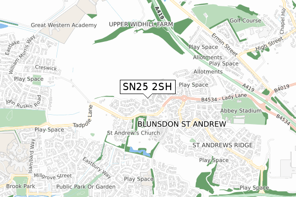
SN25 2SH is located in the St Andrews electoral ward, within the unitary authority of Swindon and the English Parliamentary constituency of North Swindon. The Sub Integrated Care Board (ICB) Location is NHS Bath and North East Somerset, Swindon and Wiltshire ICB - 92 and the police force is Wiltshire. This postcode has been in use since September 2017.


GetTheData
Source: OS Open Zoomstack (Ordnance Survey)
Licence: Open Government Licence (requires attribution)
Attribution: Contains OS data © Crown copyright and database right 2024
Source: Open Postcode Geo
Licence: Open Government Licence (requires attribution)
Attribution: Contains OS data © Crown copyright and database right 2024; Contains Royal Mail data © Royal Mail copyright and database right 2024; Source: Office for National Statistics licensed under the Open Government Licence v.3.0
| Easting | 413733 |
| Northing | 189990 |
| Latitude | 51.608581 |
| Longitude | -1.803072 |
GetTheData
Source: Open Postcode Geo
Licence: Open Government Licence
| Country | England |
| Postcode District | SN25 |
| ➜ SN25 open data dashboard ➜ See where SN25 is on a map ➜ Where is Blunsdon St Andrew? | |
GetTheData
Source: Land Registry Price Paid Data
Licence: Open Government Licence
| Ward | St Andrews |
| Constituency | North Swindon |
GetTheData
Source: ONS Postcode Database
Licence: Open Government Licence
| September 2023 | Violence and sexual offences | On or near Lyall Close | 319m |
| September 2023 | Violence and sexual offences | On or near Lyall Close | 319m |
| September 2023 | Anti-social behaviour | On or near Landor Road | 419m |
| ➜ Get more crime data in our Crime section | |||
GetTheData
Source: data.police.uk
Licence: Open Government Licence
| Blunsdon Abbey (Tadpole Lane) | Broad Blunsdon | 151m |
| Thornhill Drive (Salzgitter Drive) | St Andrew's Ridge | 321m |
| Thornhill Drive (Salzgitter Drive) | St Andrew's Ridge | 344m |
| Wallis Drive (Salzgitter Drive) | St Andrew's Ridge | 541m |
| Wallis Drive (Salzgitter Drive) | St Andrew's Ridge | 553m |
| Swindon Station | 4.9km |
GetTheData
Source: NaPTAN
Licence: Open Government Licence
| Percentage of properties with Next Generation Access | 100.0% |
| Percentage of properties with Superfast Broadband | 100.0% |
| Percentage of properties with Ultrafast Broadband | 100.0% |
| Percentage of properties with Full Fibre Broadband | 100.0% |
Superfast Broadband is between 30Mbps and 300Mbps
Ultrafast Broadband is > 300Mbps
| Percentage of properties unable to receive 2Mbps | 0.0% |
| Percentage of properties unable to receive 5Mbps | 0.0% |
| Percentage of properties unable to receive 10Mbps | 0.0% |
| Percentage of properties unable to receive 30Mbps | 0.0% |
GetTheData
Source: Ofcom
Licence: Ofcom Terms of Use (requires attribution)
GetTheData
Source: ONS Postcode Database
Licence: Open Government Licence


➜ Get more ratings from the Food Standards Agency
GetTheData
Source: Food Standards Agency
Licence: FSA terms & conditions
| Last Collection | |||
|---|---|---|---|
| Location | Mon-Fri | Sat | Distance |
| Saltzgitter Drive | 17:30 | 12:00 | 341m |
| Hillside Way | 16:00 | 08:00 | 803m |
| Pennine Way | 17:30 | 12:00 | 856m |
GetTheData
Source: Dracos
Licence: Creative Commons Attribution-ShareAlike
| Facility | Distance |
|---|---|
| Great Western Academy William Morris Way, William Morris Way, Tadpole Garden Village, Swindon Outdoor Tennis Courts, Grass Pitches, Sports Hall | 1km |
| Blunsdon Fitness + The Ridge, Blunsdon, Swindon Health and Fitness Gym, Swimming Pool, Golf, Studio, Squash Courts, Outdoor Tennis Courts | 1.1km |
| Abbey Park School (Northside Campus) Redhouse Way, Swindon Sports Hall, Artificial Grass Pitch, Grass Pitches, Studio | 1.2km |
GetTheData
Source: Active Places
Licence: Open Government Licence
| School | Phase of Education | Distance |
|---|---|---|
| Abbey Farm Educate Together Primary Diamond Crescent, Abbey Farm, Swindon, SN25 2SJ | Primary | 227m |
| Bridlewood Primary School Chartwell Road, Swindon, SN25 2EX | Primary | 637m |
| Tadpole Farm CofE Primary Academy Greene Street, Tadpole Garden Village, Swindon, SN25 2QS | Primary | 932m |
GetTheData
Source: Edubase
Licence: Open Government Licence
The below table lists the International Territorial Level (ITL) codes (formerly Nomenclature of Territorial Units for Statistics (NUTS) codes) and Local Administrative Units (LAU) codes for SN25 2SH:
| ITL 1 Code | Name |
|---|---|
| TLK | South West (England) |
| ITL 2 Code | Name |
| TLK1 | Gloucestershire, Wiltshire and Bath/Bristol area |
| ITL 3 Code | Name |
| TLK14 | Swindon |
| LAU 1 Code | Name |
| E06000030 | Swindon |
GetTheData
Source: ONS Postcode Directory
Licence: Open Government Licence
The below table lists the Census Output Area (OA), Lower Layer Super Output Area (LSOA), and Middle Layer Super Output Area (MSOA) for SN25 2SH:
| Code | Name | |
|---|---|---|
| OA | E00078246 | |
| LSOA | E01015474 | Swindon 008B |
| MSOA | E02003219 | Swindon 008 |
GetTheData
Source: ONS Postcode Directory
Licence: Open Government Licence
| SN25 2DW | Lady Lane | 188m |
| SN25 4GP | Nolan Close | 235m |
| SN25 2DU | Main Drive | 250m |
| SN25 4GR | Rubens Close | 266m |
| SN25 2DR | West Drive | 273m |
| SN25 2EJ | St Andrews Court | 296m |
| SN25 4WF | Southey Close | 301m |
| SN25 2EY | Wyld Court | 332m |
| SN25 4GS | Longfellow Close | 333m |
| SN25 2EE | Wyld Court | 351m |
GetTheData
Source: Open Postcode Geo; Land Registry Price Paid Data
Licence: Open Government Licence