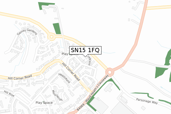
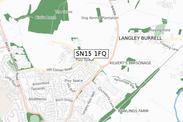
SN15 1FQ is located in the Chippenham Hardenhuish electoral ward, within the unitary authority of Wiltshire and the English Parliamentary constituency of North Wiltshire. The Sub Integrated Care Board (ICB) Location is NHS Bath and North East Somerset, Swindon and Wiltshire ICB - 92 and the police force is Wiltshire. This postcode has been in use since April 2019.


GetTheData
Source: OS Open Zoomstack (Ordnance Survey)
Licence: Open Government Licence (requires attribution)
Attribution: Contains OS data © Crown copyright and database right 2024
Source: Open Postcode Geo
Licence: Open Government Licence (requires attribution)
Attribution: Contains OS data © Crown copyright and database right 2024; Contains Royal Mail data © Royal Mail copyright and database right 2024; Source: Office for National Statistics licensed under the Open Government Licence v.3.0
| Easting | 392446 |
| Northing | 174937 |
| Latitude | 51.473343 |
| Longitude | -2.110147 |
GetTheData
Source: Open Postcode Geo
Licence: Open Government Licence
| Country | England |
| Postcode District | SN15 |
| ➜ SN15 open data dashboard ➜ See where SN15 is on a map ➜ Where is Chippenham? | |
GetTheData
Source: Land Registry Price Paid Data
Licence: Open Government Licence
| Ward | Chippenham Hardenhuish |
| Constituency | North Wiltshire |
GetTheData
Source: ONS Postcode Database
Licence: Open Government Licence
2023 3 FEB £357,500 |
2019 27 SEP £294,995 |
7, HAZEL CRESCENT, CHIPPENHAM, SN15 1FQ 2019 22 MAY £294,995 |
GetTheData
Source: HM Land Registry Price Paid Data
Licence: Contains HM Land Registry data © Crown copyright and database right 2024. This data is licensed under the Open Government Licence v3.0.
| November 2023 | Public order | On or near Heathfield | 236m |
| October 2023 | Anti-social behaviour | On or near Heathfield | 236m |
| September 2023 | Anti-social behaviour | On or near Heathfield | 236m |
| ➜ Get more crime data in our Crime section | |||
GetTheData
Source: data.police.uk
Licence: Open Government Licence
| Barrow Green | Chippenham | 336m |
| Theturn (B4069) | Langley Burrell | 442m |
| The Turn (B4069) | Langley Burrell | 446m |
| Hill Rise | Barrow Green | 483m |
| Maud Heath's Causeway (Birch Grove) | Barrow Green | 616m |
| Chippenham Station | 1.3km |
GetTheData
Source: NaPTAN
Licence: Open Government Licence
| Percentage of properties with Next Generation Access | 100.0% |
| Percentage of properties with Superfast Broadband | 100.0% |
| Percentage of properties with Ultrafast Broadband | 81.0% |
| Percentage of properties with Full Fibre Broadband | 81.0% |
Superfast Broadband is between 30Mbps and 300Mbps
Ultrafast Broadband is > 300Mbps
| Percentage of properties unable to receive 2Mbps | 0.0% |
| Percentage of properties unable to receive 5Mbps | 0.0% |
| Percentage of properties unable to receive 10Mbps | 0.0% |
| Percentage of properties unable to receive 30Mbps | 0.0% |
GetTheData
Source: Ofcom
Licence: Ofcom Terms of Use (requires attribution)
GetTheData
Source: ONS Postcode Database
Licence: Open Government Licence


➜ Get more ratings from the Food Standards Agency
GetTheData
Source: Food Standards Agency
Licence: FSA terms & conditions
| Last Collection | |||
|---|---|---|---|
| Location | Mon-Fri | Sat | Distance |
| Barrows Green | 18:00 | 12:30 | 332m |
| Willowbank | 17:30 | 12:00 | 696m |
| Langley Road | 18:15 | 12:30 | 803m |
GetTheData
Source: Dracos
Licence: Creative Commons Attribution-ShareAlike
| Facility | Distance |
|---|---|
| Langley Burrell Playing Pitch Langley Burrell, Chippenham Grass Pitches, Sports Hall | 1km |
| John Coles Park Park Lane, Park Lane, Chippenham Outdoor Tennis Courts | 1.2km |
| Puregym (Chippenham) Hathaway Retail Park, Foundry Lane, Chippenham Health and Fitness Gym | 1.2km |
GetTheData
Source: Active Places
Licence: Open Government Licence
| School | Phase of Education | Distance |
|---|---|---|
| St Paul's Primary School The Oaks, Chippenham, SN15 1DU | Primary | 706m |
| The Young People's Support Centre The Bridge Centre, Bath Road, Chippenham, SN15 1AA | Not applicable | 1km |
| Wiltshire College and University Centre Cocklebury Road, Chippenham, SN15 3QD | 16 plus | 1.2km |
GetTheData
Source: Edubase
Licence: Open Government Licence
The below table lists the International Territorial Level (ITL) codes (formerly Nomenclature of Territorial Units for Statistics (NUTS) codes) and Local Administrative Units (LAU) codes for SN15 1FQ:
| ITL 1 Code | Name |
|---|---|
| TLK | South West (England) |
| ITL 2 Code | Name |
| TLK1 | Gloucestershire, Wiltshire and Bath/Bristol area |
| ITL 3 Code | Name |
| TLK15 | Wiltshire |
| LAU 1 Code | Name |
| E06000054 | Wiltshire |
GetTheData
Source: ONS Postcode Directory
Licence: Open Government Licence
The below table lists the Census Output Area (OA), Lower Layer Super Output Area (LSOA), and Middle Layer Super Output Area (MSOA) for SN15 1FQ:
| Code | Name | |
|---|---|---|
| OA | E00162671 | |
| LSOA | E01031891 | Wiltshire 013A |
| MSOA | E02006655 | Wiltshire 013 |
GetTheData
Source: ONS Postcode Directory
Licence: Open Government Licence
| SN15 1BQ | Heathfield | 190m |
| SN15 1DX | Hill Corner Road | 221m |
| SN15 1DW | Hill Corner Road | 227m |
| SN15 1DL | Pew Hill | 232m |
| SN15 1BH | Heathfield | 260m |
| SN15 1ED | Moorlands | 292m |
| SN15 1FD | The Orchids | 321m |
| SN15 5LL | 331m | |
| SN15 1BD | Barrow Green | 358m |
| SN15 1DH | Pew Hill | 362m |
GetTheData
Source: Open Postcode Geo; Land Registry Price Paid Data
Licence: Open Government Licence