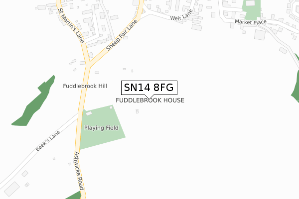
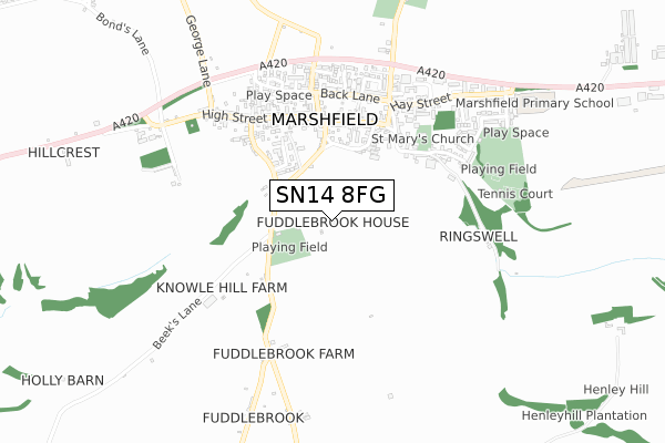
SN14 8FG is located in the Boyd Valley electoral ward, within the unitary authority of South Gloucestershire and the English Parliamentary constituency of Thornbury and Yate. The Sub Integrated Care Board (ICB) Location is NHS Bristol, North Somerset and South Gloucestershire ICB - 15C and the police force is Avon and Somerset. This postcode has been in use since October 2019.


GetTheData
Source: OS Open Zoomstack (Ordnance Survey)
Licence: Open Government Licence (requires attribution)
Attribution: Contains OS data © Crown copyright and database right 2024
Source: Open Postcode Geo
Licence: Open Government Licence (requires attribution)
Attribution: Contains OS data © Crown copyright and database right 2024; Contains Royal Mail data © Royal Mail copyright and database right 2024; Source: Office for National Statistics licensed under the Open Government Licence v.3.0
| Easting | 377878 |
| Northing | 173352 |
| Latitude | 51.458706 |
| Longitude | -2.319794 |
GetTheData
Source: Open Postcode Geo
Licence: Open Government Licence
| Country | England |
| Postcode District | SN14 |
| ➜ SN14 open data dashboard ➜ See where SN14 is on a map | |
GetTheData
Source: Land Registry Price Paid Data
Licence: Open Government Licence
| Ward | Boyd Valley |
| Constituency | Thornbury And Yate |
GetTheData
Source: ONS Postcode Database
Licence: Open Government Licence
| May 2022 | Burglary | On or near Petrol Station | 378m |
| May 2022 | Other theft | On or near Petrol Station | 473m |
| February 2022 | Violence and sexual offences | On or near St Martin'S Lane | 357m |
| ➜ Get more crime data in our Crime section | |||
GetTheData
Source: data.police.uk
Licence: Open Government Licence
| The Crown Hotel (High Street) | Marshfield | 388m |
| The Crown Hotel (High Street) | Marshfield | 404m |
| Herron Hall (High Street) | Marshfield | 444m |
| Herron Hall | Marshfield | 462m |
| Almshouses (High Street) | Marshfield | 622m |
GetTheData
Source: NaPTAN
Licence: Open Government Licence
GetTheData
Source: ONS Postcode Database
Licence: Open Government Licence


➜ Get more ratings from the Food Standards Agency
GetTheData
Source: Food Standards Agency
Licence: FSA terms & conditions
| Last Collection | |||
|---|---|---|---|
| Location | Mon-Fri | Sat | Distance |
| Marshfield Post Office | 16:15 | 10:30 | 365m |
| Marshfield Road | 17:30 | 12:00 | 824m |
| West Littleton | 16:00 | 10:30 | 2,689m |
GetTheData
Source: Dracos
Licence: Creative Commons Attribution-ShareAlike
| Facility | Distance |
|---|---|
| Marshfield Cricket Club Ashwicke, Chippenham Grass Pitches | 207m |
| Marshfield Playing Field Withymead Road, Marshfield Grass Pitches | 631m |
| Marshfield Tennis Club Withymead Recreation Ground, Withymead Road, Marshfield, Chippenham Outdoor Tennis Courts | 683m |
GetTheData
Source: Active Places
Licence: Open Government Licence
| School | Phase of Education | Distance |
|---|---|---|
| Marshfield Church of England Primary School Chippenham Road, Marshfield, Chippenham, SN14 8NY | Primary | 871m |
| Colerne CofE Primary School Quarry Lane, Colerne, Chippenham, SN14 8DU | Primary | 4.5km |
| Swainswick Church School Innox Lane, Upper Swainswick, Bath, BA1 8DB | Primary | 5.5km |
GetTheData
Source: Edubase
Licence: Open Government Licence
The below table lists the International Territorial Level (ITL) codes (formerly Nomenclature of Territorial Units for Statistics (NUTS) codes) and Local Administrative Units (LAU) codes for SN14 8FG:
| ITL 1 Code | Name |
|---|---|
| TLK | South West (England) |
| ITL 2 Code | Name |
| TLK1 | Gloucestershire, Wiltshire and Bath/Bristol area |
| ITL 3 Code | Name |
| TLK12 | Bath and North East Somerset, North Somerset and South Gloucestershire |
| LAU 1 Code | Name |
| E06000025 | South Gloucestershire |
GetTheData
Source: ONS Postcode Directory
Licence: Open Government Licence
The below table lists the Census Output Area (OA), Lower Layer Super Output Area (LSOA), and Middle Layer Super Output Area (MSOA) for SN14 8FG:
| Code | Name | |
|---|---|---|
| OA | E00075125 | |
| LSOA | E01014869 | South Gloucestershire 024B |
| MSOA | E02003113 | South Gloucestershire 024 |
GetTheData
Source: ONS Postcode Directory
Licence: Open Government Licence
| SN14 8NA | Sheep Fair Lane | 277m |
| SN14 8PQ | St Martins Park | 314m |
| SN14 8NB | Weir Lane | 330m |
| SN14 8RB | Old School Court | 343m |
| SN14 8LL | Mead View Close | 354m |
| SN14 8LR | High Street | 371m |
| SN14 8NR | Market Place | 386m |
| SN14 8LP | High Street | 402m |
| SN14 8LZ | St Martins Lane | 408m |
| SN14 8NS | Queens Terrace | 408m |
GetTheData
Source: Open Postcode Geo; Land Registry Price Paid Data
Licence: Open Government Licence