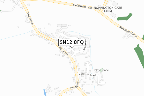
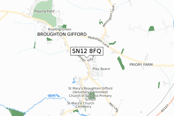
SN12 8FQ is located in the Melksham Without West & Rural electoral ward, within the unitary authority of Wiltshire and the English Parliamentary constituency of Chippenham. The Sub Integrated Care Board (ICB) Location is NHS Bath and North East Somerset, Swindon and Wiltshire ICB - 92 and the police force is Wiltshire. This postcode has been in use since July 2018.


GetTheData
Source: OS Open Zoomstack (Ordnance Survey)
Licence: Open Government Licence (requires attribution)
Attribution: Contains OS data © Crown copyright and database right 2024
Source: Open Postcode Geo
Licence: Open Government Licence (requires attribution)
Attribution: Contains OS data © Crown copyright and database right 2024; Contains Royal Mail data © Royal Mail copyright and database right 2024; Source: Office for National Statistics licensed under the Open Government Licence v.3.0
| Easting | 387892 |
| Northing | 163761 |
| Latitude | 51.372772 |
| Longitude | -2.175329 |
GetTheData
Source: Open Postcode Geo
Licence: Open Government Licence
| Country | England |
| Postcode District | SN12 |
| ➜ SN12 open data dashboard ➜ See where SN12 is on a map ➜ Where is Broughton Gifford? | |
GetTheData
Source: Land Registry Price Paid Data
Licence: Open Government Licence
| Ward | Melksham Without West & Rural |
| Constituency | Chippenham |
GetTheData
Source: ONS Postcode Database
Licence: Open Government Licence
2019 20 SEP £375,000 |
1, CANNINGS CLOSE, BROUGHTON GIFFORD, MELKSHAM, SN12 8FQ 2019 30 JUL £425,000 |
4, CANNINGS CLOSE, BROUGHTON GIFFORD, MELKSHAM, SN12 8FQ 2019 17 MAY £420,000 |
➜ Broughton Gifford house prices
GetTheData
Source: HM Land Registry Price Paid Data
Licence: Contains HM Land Registry data © Crown copyright and database right 2024. This data is licensed under the Open Government Licence v3.0.
| July 2023 | Anti-social behaviour | On or near Newleaze Park | 41m |
| May 2022 | Violence and sexual offences | On or near Newleaze Park | 41m |
| May 2022 | Criminal damage and arson | On or near Curtis Orchard | 242m |
| ➜ Get more crime data in our Crime section | |||
GetTheData
Source: data.police.uk
Licence: Open Government Licence
| The Fox (The Street) | Broughton Gifford | 106m |
| The Fox (The Street) | Broughton Gifford | 107m |
| Norrington Gate Farm (Melksham Lane) | Broughton Gifford | 432m |
| Norrington Gate Farm (Melksham Lane) | Broughton Gifford | 440m |
| Bell On The Common (Melksham Lane) | Broughton Gifford | 467m |
| Melksham Station | 2.3km |
GetTheData
Source: NaPTAN
Licence: Open Government Licence
➜ Broadband speed and availability dashboard for SN12 8FQ
| Percentage of properties with Next Generation Access | 100.0% |
| Percentage of properties with Superfast Broadband | 100.0% |
| Percentage of properties with Ultrafast Broadband | 0.0% |
| Percentage of properties with Full Fibre Broadband | 0.0% |
Superfast Broadband is between 30Mbps and 300Mbps
Ultrafast Broadband is > 300Mbps
| Median download speed | 55.0Mbps |
| Average download speed | 52.5Mbps |
| Maximum download speed | 78.12Mbps |
| Median upload speed | 10.0Mbps |
| Average upload speed | 12.0Mbps |
| Maximum upload speed | 19.53Mbps |
| Percentage of properties unable to receive 2Mbps | 0.0% |
| Percentage of properties unable to receive 5Mbps | 0.0% |
| Percentage of properties unable to receive 10Mbps | 0.0% |
| Percentage of properties unable to receive 30Mbps | 0.0% |
➜ Broadband speed and availability dashboard for SN12 8FQ
GetTheData
Source: Ofcom
Licence: Ofcom Terms of Use (requires attribution)
GetTheData
Source: ONS Postcode Database
Licence: Open Government Licence


➜ Get more ratings from the Food Standards Agency
GetTheData
Source: Food Standards Agency
Licence: FSA terms & conditions
| Last Collection | |||
|---|---|---|---|
| Location | Mon-Fri | Sat | Distance |
| Hazelwood Road | 17:45 | 12:30 | 2,299m |
| Leigh Park | 16:00 | 11:30 | 2,333m |
| Hornbeam Cresent | 17:45 | 12:30 | 2,342m |
GetTheData
Source: Dracos
Licence: Creative Commons Attribution-ShareAlike
| Facility | Distance |
|---|---|
| Broughton Gifford Common Broughton Gifford, Melksham Grass Pitches | 759m |
| Shaw Village Hall The Beeches, Shaw Grass Pitches | 2km |
| The George Ward School (Closed) Shurnhold, Melksham Grass Pitches, Sports Hall | 2.1km |
GetTheData
Source: Active Places
Licence: Open Government Licence
| School | Phase of Education | Distance |
|---|---|---|
| St Mary's Broughton Gifford Voluntary Controlled Church of England Primary School The Street, Broughton Gifford, Melksham, SN12 8PR | Primary | 510m |
| Holt Voluntary Controlled Primary School The Gravel, Holt, Trowbridge, BA14 6RA | Primary | 2.1km |
| Shaw CE Primary School Corsham Road, Shaw, Melksham, SN12 8EQ | Primary | 2.2km |
GetTheData
Source: Edubase
Licence: Open Government Licence
The below table lists the International Territorial Level (ITL) codes (formerly Nomenclature of Territorial Units for Statistics (NUTS) codes) and Local Administrative Units (LAU) codes for SN12 8FQ:
| ITL 1 Code | Name |
|---|---|
| TLK | South West (England) |
| ITL 2 Code | Name |
| TLK1 | Gloucestershire, Wiltshire and Bath/Bristol area |
| ITL 3 Code | Name |
| TLK15 | Wiltshire |
| LAU 1 Code | Name |
| E06000054 | Wiltshire |
GetTheData
Source: ONS Postcode Directory
Licence: Open Government Licence
The below table lists the Census Output Area (OA), Lower Layer Super Output Area (LSOA), and Middle Layer Super Output Area (MSOA) for SN12 8FQ:
| Code | Name | |
|---|---|---|
| OA | E00163508 | |
| LSOA | E01032057 | Wiltshire 021C |
| MSOA | E02006679 | Wiltshire 021 |
GetTheData
Source: ONS Postcode Directory
Licence: Open Government Licence
| SN12 8PD | The Street | 38m |
| SN12 8PL | Newleaze Park | 61m |
| SN12 8PJ | Newleaze Park | 75m |
| SN12 8PN | The Street | 122m |
| SN12 8PW | The Street | 131m |
| SN12 8PH | The Street | 168m |
| SN12 8PU | Curtis Orchard | 178m |
| SN12 8PP | The Street | 243m |
| SN12 8PX | Curtis Orchard | 265m |
| SN12 8LW | Norrington Gate | 396m |
GetTheData
Source: Open Postcode Geo; Land Registry Price Paid Data
Licence: Open Government Licence