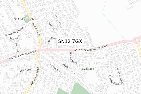
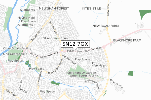
SN12 7GX is located in the Melksham East electoral ward, within the unitary authority of Wiltshire and the English Parliamentary constituency of Chippenham. The Sub Integrated Care Board (ICB) Location is NHS Bath and North East Somerset, Swindon and Wiltshire ICB - 92 and the police force is Wiltshire. This postcode has been in use since September 2018.


GetTheData
Source: OS Open Zoomstack (Ordnance Survey)
Licence: Open Government Licence (requires attribution)
Attribution: Contains OS data © Crown copyright and database right 2024
Source: Open Postcode Geo
Licence: Open Government Licence (requires attribution)
Attribution: Contains OS data © Crown copyright and database right 2024; Contains Royal Mail data © Royal Mail copyright and database right 2024; Source: Office for National Statistics licensed under the Open Government Licence v.3.0
| Easting | 391671 |
| Northing | 164245 |
| Latitude | 51.377193 |
| Longitude | -2.121050 |
GetTheData
Source: Open Postcode Geo
Licence: Open Government Licence
| Country | England |
| Postcode District | SN12 |
| ➜ SN12 open data dashboard ➜ See where SN12 is on a map ➜ Where is Melksham? | |
GetTheData
Source: Land Registry Price Paid Data
Licence: Open Government Licence
| Ward | Melksham East |
| Constituency | Chippenham |
GetTheData
Source: ONS Postcode Database
Licence: Open Government Licence
2020 21 FEB £342,500 |
2018 28 SEP £364,995 |
GetTheData
Source: HM Land Registry Price Paid Data
Licence: Contains HM Land Registry data © Crown copyright and database right 2024. This data is licensed under the Open Government Licence v3.0.
| January 2024 | Violence and sexual offences | On or near Malvern Close | 255m |
| December 2023 | Violence and sexual offences | On or near Malvern Close | 255m |
| November 2023 | Anti-social behaviour | On or near Blackmore Road | 356m |
| ➜ Get more crime data in our Crime section | |||
GetTheData
Source: data.police.uk
Licence: Open Government Licence
| Sandridge Garage | Melksham | 123m |
| Sandridge Garage (Sandridge Road) | Melksham | 154m |
| Ingram Road (Blackmore Road) | Melksham | 261m |
| Foresters Arms (Sandridge Road) | Melksham | 264m |
| Tower Road (Blackmore Road) | Melksham | 268m |
| Melksham Station | 1.7km |
GetTheData
Source: NaPTAN
Licence: Open Government Licence
| Percentage of properties with Next Generation Access | 100.0% |
| Percentage of properties with Superfast Broadband | 100.0% |
| Percentage of properties with Ultrafast Broadband | 100.0% |
| Percentage of properties with Full Fibre Broadband | 100.0% |
Superfast Broadband is between 30Mbps and 300Mbps
Ultrafast Broadband is > 300Mbps
| Percentage of properties unable to receive 2Mbps | 0.0% |
| Percentage of properties unable to receive 5Mbps | 0.0% |
| Percentage of properties unable to receive 10Mbps | 0.0% |
| Percentage of properties unable to receive 30Mbps | 0.0% |
GetTheData
Source: Ofcom
Licence: Ofcom Terms of Use (requires attribution)
GetTheData
Source: ONS Postcode Database
Licence: Open Government Licence

➜ Get more ratings from the Food Standards Agency
GetTheData
Source: Food Standards Agency
Licence: FSA terms & conditions
| Last Collection | |||
|---|---|---|---|
| Location | Mon-Fri | Sat | Distance |
| Church Lane | 17:30 | 11:30 | 230m |
| Forest Road | 17:30 | 11:15 | 831m |
| Lowbourne Bridge | 17:30 | 11:15 | 832m |
GetTheData
Source: Dracos
Licence: Creative Commons Attribution-ShareAlike
| Facility | Distance |
|---|---|
| Foresters Park Foresters Park Road, Melksham Grass Pitches | 363m |
| St Michaels C Of E Primary School (Closed) Queensway, Melksham Grass Pitches | 802m |
| King George V Playing Field (Melksham) Lowbourne, Melksham Grass Pitches, Outdoor Tennis Courts | 946m |
GetTheData
Source: Active Places
Licence: Open Government Licence
| School | Phase of Education | Distance |
|---|---|---|
| Forest and Sandridge Church of England Primary School Cranesbill Road, Melksham, SN12 7GN | Primary | 588m |
| River Mead School Lowbourne, Melksham, SN12 7ED | Primary | 910m |
| The Manor CofE VC Primary School Ruskin Avenue, Melksham, SN12 7NG | Primary | 1km |
GetTheData
Source: Edubase
Licence: Open Government Licence
The below table lists the International Territorial Level (ITL) codes (formerly Nomenclature of Territorial Units for Statistics (NUTS) codes) and Local Administrative Units (LAU) codes for SN12 7GX:
| ITL 1 Code | Name |
|---|---|
| TLK | South West (England) |
| ITL 2 Code | Name |
| TLK1 | Gloucestershire, Wiltshire and Bath/Bristol area |
| ITL 3 Code | Name |
| TLK15 | Wiltshire |
| LAU 1 Code | Name |
| E06000054 | Wiltshire |
GetTheData
Source: ONS Postcode Directory
Licence: Open Government Licence
The below table lists the Census Output Area (OA), Lower Layer Super Output Area (LSOA), and Middle Layer Super Output Area (MSOA) for SN12 7GX:
| Code | Name | |
|---|---|---|
| OA | E00163583 | |
| LSOA | E01032071 | Wiltshire 021E |
| MSOA | E02006679 | Wiltshire 021 |
GetTheData
Source: ONS Postcode Directory
Licence: Open Government Licence
| SN12 7JS | Burniston Close | 47m |
| SN12 7JU | Talbot Close | 75m |
| SN12 7GE | Buzzard Close | 94m |
| SN12 7JE | Churchill Avenue | 115m |
| SN12 7FQ | Skylark Road | 119m |
| SN12 7GF | The Bramblings | 131m |
| SN12 7QW | Snarlton Lane | 167m |
| SN12 7JH | Ingram Road | 174m |
| SN12 7JP | Maple Close | 178m |
| SN12 7JN | Churchill Avenue | 191m |
GetTheData
Source: Open Postcode Geo; Land Registry Price Paid Data
Licence: Open Government Licence