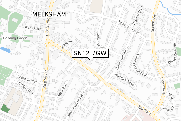
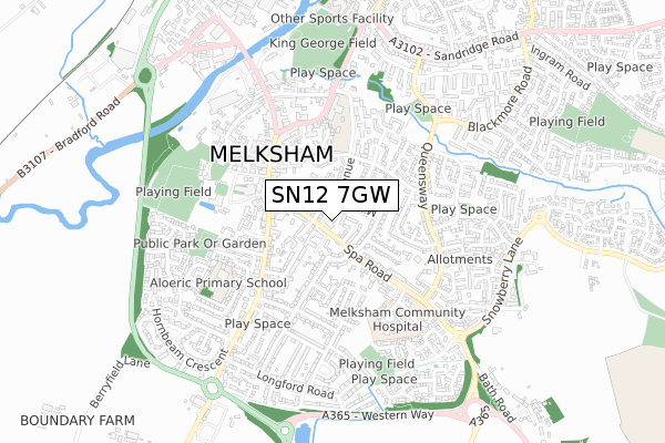
SN12 7GW is located in the Melksham South electoral ward, within the unitary authority of Wiltshire and the English Parliamentary constituency of Chippenham. The Sub Integrated Care Board (ICB) Location is NHS Bath and North East Somerset, Swindon and Wiltshire ICB - 92 and the police force is Wiltshire. This postcode has been in use since April 2018.


GetTheData
Source: OS Open Zoomstack (Ordnance Survey)
Licence: Open Government Licence (requires attribution)
Attribution: Contains OS data © Crown copyright and database right 2024
Source: Open Postcode Geo
Licence: Open Government Licence (requires attribution)
Attribution: Contains OS data © Crown copyright and database right 2024; Contains Royal Mail data © Royal Mail copyright and database right 2024; Source: Office for National Statistics licensed under the Open Government Licence v.3.0
| Easting | 390706 |
| Northing | 163508 |
| Latitude | 51.370551 |
| Longitude | -2.134895 |
GetTheData
Source: Open Postcode Geo
Licence: Open Government Licence
| Country | England |
| Postcode District | SN12 |
| ➜ SN12 open data dashboard ➜ See where SN12 is on a map ➜ Where is Melksham? | |
GetTheData
Source: Land Registry Price Paid Data
Licence: Open Government Licence
| Ward | Melksham South |
| Constituency | Chippenham |
GetTheData
Source: ONS Postcode Database
Licence: Open Government Licence
5, MEADOWSWEET PLACE, MELKSHAM, SN12 7GW 2016 7 JUN £877,500 |
GetTheData
Source: HM Land Registry Price Paid Data
Licence: Contains HM Land Registry data © Crown copyright and database right 2024. This data is licensed under the Open Government Licence v3.0.
| January 2024 | Criminal damage and arson | On or near Parking Area | 184m |
| January 2024 | Anti-social behaviour | On or near Parking Area | 417m |
| January 2024 | Criminal damage and arson | On or near Parking Area | 417m |
| ➜ Get more crime data in our Crime section | |||
GetTheData
Source: data.police.uk
Licence: Open Government Licence
| Coronation Road (Spa Road) | Melksham | 170m |
| Coronation Road (Spa Road) | Melksham | 177m |
| Pembroke Road (Ruskin Avenue) | Melksham | 271m |
| Pembroke Road (Ruskin Avenue) | Melksham | 272m |
| Market Place (High Street) | Melksham | 289m |
| Melksham Station | 1.2km |
GetTheData
Source: NaPTAN
Licence: Open Government Licence
➜ Broadband speed and availability dashboard for SN12 7GW
| Percentage of properties with Next Generation Access | 100.0% |
| Percentage of properties with Superfast Broadband | 100.0% |
| Percentage of properties with Ultrafast Broadband | 100.0% |
| Percentage of properties with Full Fibre Broadband | 0.0% |
Superfast Broadband is between 30Mbps and 300Mbps
Ultrafast Broadband is > 300Mbps
| Median download speed | 39.6Mbps |
| Average download speed | 45.3Mbps |
| Maximum download speed | 80.00Mbps |
| Median upload speed | 9.9Mbps |
| Average upload speed | 9.3Mbps |
| Maximum upload speed | 20.00Mbps |
| Percentage of properties unable to receive 2Mbps | 0.0% |
| Percentage of properties unable to receive 5Mbps | 0.0% |
| Percentage of properties unable to receive 10Mbps | 0.0% |
| Percentage of properties unable to receive 30Mbps | 0.0% |
➜ Broadband speed and availability dashboard for SN12 7GW
GetTheData
Source: Ofcom
Licence: Ofcom Terms of Use (requires attribution)
GetTheData
Source: ONS Postcode Database
Licence: Open Government Licence


➜ Get more ratings from the Food Standards Agency
GetTheData
Source: Food Standards Agency
Licence: FSA terms & conditions
| Last Collection | |||
|---|---|---|---|
| Location | Mon-Fri | Sat | Distance |
| Coronation Road | 17:45 | 11:30 | 154m |
| Market Place | 17:45 | 12:30 | 293m |
| Dorset Cresent | 17:45 | 11:30 | 337m |
GetTheData
Source: Dracos
Licence: Creative Commons Attribution-ShareAlike
| Facility | Distance |
|---|---|
| Melksham Blue Pool (Closed) Market Place, Melksham Swimming Pool, Health and Fitness Gym | 356m |
| The Manor C Of E Vc Primary School Ruskin Avenue, Melksham Grass Pitches | 414m |
| The Conigre (Closed) Market Place, Melksham Grass Pitches | 418m |
GetTheData
Source: Active Places
Licence: Open Government Licence
| School | Phase of Education | Distance |
|---|---|---|
| The Manor CofE VC Primary School Ruskin Avenue, Melksham, SN12 7NG | Primary | 414m |
| Aloeric Primary School St Michael's Road, Melksham, SN12 6HN | Primary | 451m |
| River Mead School Lowbourne, Melksham, SN12 7ED | Primary | 833m |
GetTheData
Source: Edubase
Licence: Open Government Licence
The below table lists the International Territorial Level (ITL) codes (formerly Nomenclature of Territorial Units for Statistics (NUTS) codes) and Local Administrative Units (LAU) codes for SN12 7GW:
| ITL 1 Code | Name |
|---|---|
| TLK | South West (England) |
| ITL 2 Code | Name |
| TLK1 | Gloucestershire, Wiltshire and Bath/Bristol area |
| ITL 3 Code | Name |
| TLK15 | Wiltshire |
| LAU 1 Code | Name |
| E06000054 | Wiltshire |
GetTheData
Source: ONS Postcode Directory
Licence: Open Government Licence
The below table lists the Census Output Area (OA), Lower Layer Super Output Area (LSOA), and Middle Layer Super Output Area (MSOA) for SN12 7GW:
| Code | Name | |
|---|---|---|
| OA | E00163551 | |
| LSOA | E01032068 | Wiltshire 022D |
| MSOA | E02006680 | Wiltshire 022 |
GetTheData
Source: ONS Postcode Directory
Licence: Open Government Licence
| SN12 7UB | New Lawns | 52m |
| SN12 7PW | Rope Walk | 66m |
| SN12 7PH | Milton Avenue | 94m |
| SN12 7NS | Spa Road | 95m |
| SN12 7NN | Oakwood Drive | 110m |
| SN12 6AB | Warwick Crescent | 110m |
| SN12 7RH | Spa Court | 127m |
| SN12 6AA | Warwick Crescent | 132m |
| SN12 7NP | Spa Road | 135m |
| SN12 7PE | Coronation Road | 140m |
GetTheData
Source: Open Postcode Geo; Land Registry Price Paid Data
Licence: Open Government Licence