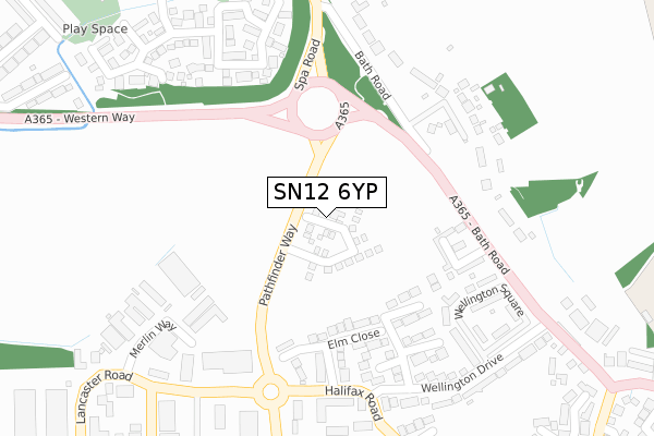
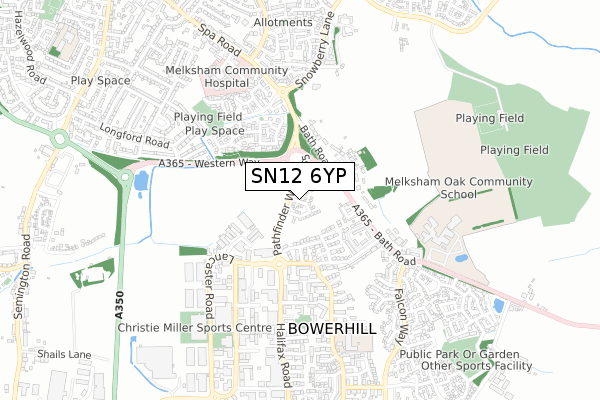
SN12 6YP is located in the Bowerhill electoral ward, within the unitary authority of Wiltshire and the English Parliamentary constituency of Chippenham. The Sub Integrated Care Board (ICB) Location is NHS Bath and North East Somerset, Swindon and Wiltshire ICB - 92 and the police force is Wiltshire. This postcode has been in use since September 2019.


GetTheData
Source: OS Open Zoomstack (Ordnance Survey)
Licence: Open Government Licence (requires attribution)
Attribution: Contains OS data © Crown copyright and database right 2024
Source: Open Postcode Geo
Licence: Open Government Licence (requires attribution)
Attribution: Contains OS data © Crown copyright and database right 2024; Contains Royal Mail data © Royal Mail copyright and database right 2024; Source: Office for National Statistics licensed under the Open Government Licence v.3.0
| Easting | 391230 |
| Northing | 162611 |
| Latitude | 51.362493 |
| Longitude | -2.127345 |
GetTheData
Source: Open Postcode Geo
Licence: Open Government Licence
| Country | England |
| Postcode District | SN12 |
| ➜ SN12 open data dashboard ➜ See where SN12 is on a map ➜ Where is Bowerhill? | |
GetTheData
Source: Land Registry Price Paid Data
Licence: Open Government Licence
| Ward | Bowerhill |
| Constituency | Chippenham |
GetTheData
Source: ONS Postcode Database
Licence: Open Government Licence
2022 26 AUG £395,000 |
2022 12 AUG £310,295 |
1, PILE PLACE, BOWERHILL, MELKSHAM, SN12 6YP 2020 13 AUG £330,000 |
3, PILE PLACE, BOWERHILL, MELKSHAM, SN12 6YP 2020 9 APR £300,000 |
4, PILE PLACE, BOWERHILL, MELKSHAM, SN12 6YP 2020 3 APR £320,000 |
2, PILE PLACE, BOWERHILL, MELKSHAM, SN12 6YP 2020 13 MAR £290,000 |
2019 19 DEC £310,295 |
GetTheData
Source: HM Land Registry Price Paid Data
Licence: Contains HM Land Registry data © Crown copyright and database right 2024. This data is licensed under the Open Government Licence v3.0.
| March 2023 | Other theft | On or near Speedwell Close | 318m |
| February 2023 | Violence and sexual offences | On or near Speedwell Close | 318m |
| June 2022 | Violence and sexual offences | On or near Mallory Place | 247m |
| ➜ Get more crime data in our Crime section | |||
GetTheData
Source: data.police.uk
Licence: Open Government Licence
| Lancaster Road (Halifax Road) | Bowerhill | 314m |
| Lancaster Road (Halifax Road) | Bowerhill | 317m |
| The Spa (Spa Road) | Melksham | 350m |
| The Spa (Spa Road) | Melksham | 413m |
| Spa Road | Melksham | 501m |
| Melksham Station | 2.3km |
GetTheData
Source: NaPTAN
Licence: Open Government Licence
| Percentage of properties with Next Generation Access | 0.0% |
| Percentage of properties with Superfast Broadband | 0.0% |
| Percentage of properties with Ultrafast Broadband | 0.0% |
| Percentage of properties with Full Fibre Broadband | 0.0% |
Superfast Broadband is between 30Mbps and 300Mbps
Ultrafast Broadband is > 300Mbps
| Percentage of properties unable to receive 2Mbps | 0.0% |
| Percentage of properties unable to receive 5Mbps | 0.0% |
| Percentage of properties unable to receive 10Mbps | 0.0% |
| Percentage of properties unable to receive 30Mbps | 0.0% |
GetTheData
Source: Ofcom
Licence: Ofcom Terms of Use (requires attribution)
GetTheData
Source: ONS Postcode Database
Licence: Open Government Licence


➜ Get more ratings from the Food Standards Agency
GetTheData
Source: Food Standards Agency
Licence: FSA terms & conditions
| Last Collection | |||
|---|---|---|---|
| Location | Mon-Fri | Sat | Distance |
| Burnet Close | 17:30 | 11:45 | 436m |
| Snowberry Lane | 17:30 | 11:45 | 578m |
| Sarum Avenue | 17:45 | 12:30 | 681m |
GetTheData
Source: Dracos
Licence: Creative Commons Attribution-ShareAlike
| Facility | Distance |
|---|---|
| Hospital Pitch Campion Drive Cornflower Way, Melksham Grass Pitches | 492m |
| Melksham Oak Community School Bowerhill, Melksham Sports Hall, Studio, Artificial Grass Pitch, Grass Pitches, Health and Fitness Gym, Outdoor Tennis Courts | 594m |
| Bowerhill Primary School Halifax Road, Melksham Grass Pitches, Sports Hall | 616m |
GetTheData
Source: Active Places
Licence: Open Government Licence
| School | Phase of Education | Distance |
|---|---|---|
| Melksham Oak Community School Bowerhill, Melksham, SN12 6QZ | Secondary | 594m |
| Bowerhill Primary School Halifax Road, Melksham, SN12 6YH | Primary | 616m |
| Aloeric Primary School St Michael's Road, Melksham, SN12 6HN | Primary | 1.2km |
GetTheData
Source: Edubase
Licence: Open Government Licence
The below table lists the International Territorial Level (ITL) codes (formerly Nomenclature of Territorial Units for Statistics (NUTS) codes) and Local Administrative Units (LAU) codes for SN12 6YP:
| ITL 1 Code | Name |
|---|---|
| TLK | South West (England) |
| ITL 2 Code | Name |
| TLK1 | Gloucestershire, Wiltshire and Bath/Bristol area |
| ITL 3 Code | Name |
| TLK15 | Wiltshire |
| LAU 1 Code | Name |
| E06000054 | Wiltshire |
GetTheData
Source: ONS Postcode Directory
Licence: Open Government Licence
The below table lists the Census Output Area (OA), Lower Layer Super Output Area (LSOA), and Middle Layer Super Output Area (MSOA) for SN12 6YP:
| Code | Name | |
|---|---|---|
| OA | E00163573 | |
| LSOA | E01032070 | Wiltshire 021D |
| MSOA | E02006679 | Wiltshire 021 |
GetTheData
Source: ONS Postcode Directory
Licence: Open Government Licence
| SN12 6SD | Elm Close | 193m |
| SN12 6YB | Mallory Place | 215m |
| SN12 6QN | 230m | |
| SN12 6SB | Birch Grove | 232m |
| SN12 6QX | Wellington Square | 281m |
| SN12 6TJ | Merlin Way | 288m |
| SN12 6QL | The Spa | 291m |
| SN12 6SH | Trenchard Way | 313m |
| SN12 6SL | Halifax Road | 320m |
| SN12 7TE | Speedwell Close | 322m |
GetTheData
Source: Open Postcode Geo; Land Registry Price Paid Data
Licence: Open Government Licence