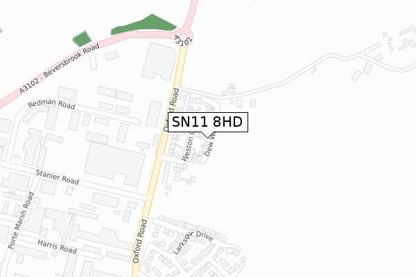
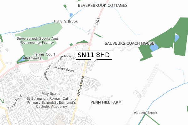
SN11 8HD is located in the Calne North electoral ward, within the unitary authority of Wiltshire and the English Parliamentary constituency of North Wiltshire. The Sub Integrated Care Board (ICB) Location is NHS Bath and North East Somerset, Swindon and Wiltshire ICB - 92 and the police force is Wiltshire. This postcode has been in use since March 2019.


GetTheData
Source: OS Open Zoomstack (Ordnance Survey)
Licence: Open Government Licence (requires attribution)
Attribution: Contains OS data © Crown copyright and database right 2024
Source: Open Postcode Geo
Licence: Open Government Licence (requires attribution)
Attribution: Contains OS data © Crown copyright and database right 2024; Contains Royal Mail data © Royal Mail copyright and database right 2024; Source: Office for National Statistics licensed under the Open Government Licence v.3.0
| Easting | 400640 |
| Northing | 172588 |
| Latitude | 51.452273 |
| Longitude | -1.992173 |
GetTheData
Source: Open Postcode Geo
Licence: Open Government Licence
| Country | England |
| Postcode District | SN11 |
| ➜ SN11 open data dashboard ➜ See where SN11 is on a map ➜ Where is Calne? | |
GetTheData
Source: Land Registry Price Paid Data
Licence: Open Government Licence
| Ward | Calne North |
| Constituency | North Wiltshire |
GetTheData
Source: ONS Postcode Database
Licence: Open Government Licence
18, DEW WAY, CALNE, SN11 8HD 2020 1 OCT £415,000 |
19, DEW WAY, CALNE, SN11 8HD 2020 27 MAR £420,000 |
21, DEW WAY, CALNE, SN11 8HD 2020 20 MAR £340,000 |
35, DEW WAY, CALNE, SN11 8HD 2019 19 DEC £385,000 |
16, DEW WAY, CALNE, SN11 8HD 2019 27 SEP £310,000 |
14, DEW WAY, CALNE, SN11 8HD 2019 27 SEP £450,000 |
12, DEW WAY, CALNE, SN11 8HD 2019 28 JUN £455,000 |
10, DEW WAY, CALNE, SN11 8HD 2019 14 JUN £445,000 |
8, DEW WAY, CALNE, SN11 8HD 2019 7 JUN £360,000 |
2, DEW WAY, CALNE, SN11 8HD 2019 24 MAY £308,000 |
GetTheData
Source: HM Land Registry Price Paid Data
Licence: Contains HM Land Registry data © Crown copyright and database right 2024. This data is licensed under the Open Government Licence v3.0.
| June 2022 | Criminal damage and arson | On or near Redman Road | 321m |
| May 2022 | Criminal damage and arson | On or near Redman Road | 321m |
| May 2022 | Violence and sexual offences | On or near Redman Road | 321m |
| ➜ Get more crime data in our Crime section | |||
GetTheData
Source: data.police.uk
Licence: Open Government Licence
| High Penn | Calne | 149m |
| High Penn | Calne | 167m |
| Porte Marsh Industrial Estate (Oxford Road) | Calne | 183m |
| Porte Marsh Industrial Estate (Oxford Road) | Calne | 209m |
| Porte Marsh Road (Stanier Road) | Calne | 408m |
GetTheData
Source: NaPTAN
Licence: Open Government Licence
| Percentage of properties with Next Generation Access | 100.0% |
| Percentage of properties with Superfast Broadband | 100.0% |
| Percentage of properties with Ultrafast Broadband | 0.0% |
| Percentage of properties with Full Fibre Broadband | 0.0% |
Superfast Broadband is between 30Mbps and 300Mbps
Ultrafast Broadband is > 300Mbps
| Percentage of properties unable to receive 2Mbps | 0.0% |
| Percentage of properties unable to receive 5Mbps | 0.0% |
| Percentage of properties unable to receive 10Mbps | 0.0% |
| Percentage of properties unable to receive 30Mbps | 0.0% |
GetTheData
Source: Ofcom
Licence: Ofcom Terms of Use (requires attribution)
GetTheData
Source: ONS Postcode Database
Licence: Open Government Licence


➜ Get more ratings from the Food Standards Agency
GetTheData
Source: Food Standards Agency
Licence: FSA terms & conditions
| Last Collection | |||
|---|---|---|---|
| Location | Mon-Fri | Sat | Distance |
| Porte Marsh Industrial Estate | 18:00 | 12:00 | 512m |
| Calne March | 17:45 | 12:00 | 937m |
| William Street | 17:45 | 12:00 | 1,006m |
GetTheData
Source: Dracos
Licence: Creative Commons Attribution-ShareAlike
| Facility | Distance |
|---|---|
| Beversbrook Sports Facility Beversbrook Road, Calne Sports Hall, Grass Pitches, Outdoor Tennis Courts, Artificial Grass Pitch | 750m |
| St Edmunds Rc Primary School Duncan Street, Calne Grass Pitches, Artificial Grass Pitch | 793m |
| Mardon Vale Academy William Street, Calne Grass Pitches | 918m |
GetTheData
Source: Active Places
Licence: Open Government Licence
| School | Phase of Education | Distance |
|---|---|---|
| Saint Edmund's Roman Catholic Primary School Duncan Street, Calne, SN11 9BX | Primary | 770m |
| Marden Vale CofE Academy William Street, Calne, SN11 9BD | Primary | 927m |
| Fynamore Primary School School Road, Calne, SN11 9UG | Primary | 1.5km |
GetTheData
Source: Edubase
Licence: Open Government Licence
The below table lists the International Territorial Level (ITL) codes (formerly Nomenclature of Territorial Units for Statistics (NUTS) codes) and Local Administrative Units (LAU) codes for SN11 8HD:
| ITL 1 Code | Name |
|---|---|
| TLK | South West (England) |
| ITL 2 Code | Name |
| TLK1 | Gloucestershire, Wiltshire and Bath/Bristol area |
| ITL 3 Code | Name |
| TLK15 | Wiltshire |
| LAU 1 Code | Name |
| E06000054 | Wiltshire |
GetTheData
Source: ONS Postcode Directory
Licence: Open Government Licence
The below table lists the Census Output Area (OA), Lower Layer Super Output Area (LSOA), and Middle Layer Super Output Area (MSOA) for SN11 8HD:
| Code | Name | |
|---|---|---|
| OA | E00162687 | |
| LSOA | E01031895 | Wiltshire 015A |
| MSOA | E02006657 | Wiltshire 015 |
GetTheData
Source: ONS Postcode Directory
Licence: Open Government Licence
| SN11 8RS | Oxford Road | 122m |
| SN11 9RA | Redman Road | 264m |
| SN11 9PL | Beversbrook Industrial Estate | 321m |
| SN11 9PT | Harris Road | 386m |
| SN11 8RU | 393m | |
| SN11 9PX | Stanier Road | 459m |
| SN11 9RD | Clarke Avenue | 614m |
| SN11 9BW | Porte Marsh Road | 614m |
| SN11 8AW | Oxford Road | 618m |
| SN11 9RN | Linnet Road | 711m |
GetTheData
Source: Open Postcode Geo; Land Registry Price Paid Data
Licence: Open Government Licence