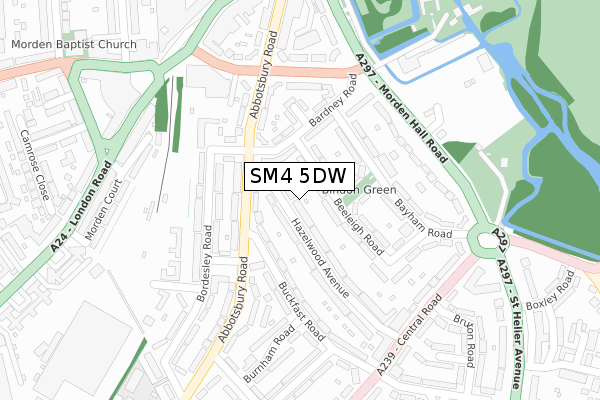
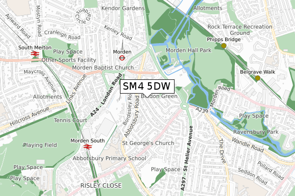
SM4 5DW is located in the Lower Morden electoral ward, within the London borough of Merton and the English Parliamentary constituency of Mitcham and Morden. The Sub Integrated Care Board (ICB) Location is NHS South West London ICB - 36L and the police force is Metropolitan Police. This postcode has been in use since May 2019.


GetTheData
Source: OS Open Zoomstack (Ordnance Survey)
Licence: Open Government Licence (requires attribution)
Attribution: Contains OS data © Crown copyright and database right 2024
Source: Open Postcode Geo
Licence: Open Government Licence (requires attribution)
Attribution: Contains OS data © Crown copyright and database right 2024; Contains Royal Mail data © Royal Mail copyright and database right 2024; Source: Office for National Statistics licensed under the Open Government Licence v.3.0
| Easting | 525207 |
| Northing | 167183 |
| Latitude | 51.389883 |
| Longitude | -0.201880 |
GetTheData
Source: Open Postcode Geo
Licence: Open Government Licence
| Country | England |
| Postcode District | SM4 |
| ➜ SM4 open data dashboard ➜ See where SM4 is on a map ➜ Where is Morden? | |
GetTheData
Source: Land Registry Price Paid Data
Licence: Open Government Licence
| Ward | Lower Morden |
| Constituency | Mitcham And Morden |
GetTheData
Source: ONS Postcode Database
Licence: Open Government Licence
| January 2024 | Vehicle crime | On or near Flaxley Road | 453m |
| November 2023 | Vehicle crime | On or near Claymore Close | 459m |
| November 2023 | Vehicle crime | On or near Claymore Close | 459m |
| ➜ Get more crime data in our Crime section | |||
GetTheData
Source: data.police.uk
Licence: Open Government Licence
| Central Road | Morden Park | 199m |
| Central Road (Green Lane) | Morden Park | 208m |
| London Road The George (Epsom Road) | Morden Park | 209m |
| St Helier (Green Lane) | Morden Park | 276m |
| Rutland Drive (Epsom Road) | Morden Park | 292m |
| Morden Underground Station | Morden | 1,449m |
| St Helier (London) Station | 0.2km |
| Morden South Station | 0.7km |
| South Merton Station | 1.5km |
GetTheData
Source: NaPTAN
Licence: Open Government Licence
| Percentage of properties with Next Generation Access | 100.0% |
| Percentage of properties with Superfast Broadband | 100.0% |
| Percentage of properties with Ultrafast Broadband | 100.0% |
| Percentage of properties with Full Fibre Broadband | 100.0% |
Superfast Broadband is between 30Mbps and 300Mbps
Ultrafast Broadband is > 300Mbps
| Percentage of properties unable to receive 2Mbps | 0.0% |
| Percentage of properties unable to receive 5Mbps | 0.0% |
| Percentage of properties unable to receive 10Mbps | 0.0% |
| Percentage of properties unable to receive 30Mbps | 0.0% |
GetTheData
Source: Ofcom
Licence: Ofcom Terms of Use (requires attribution)
GetTheData
Source: ONS Postcode Database
Licence: Open Government Licence


➜ Get more ratings from the Food Standards Agency
GetTheData
Source: Food Standards Agency
Licence: FSA terms & conditions
| Last Collection | |||
|---|---|---|---|
| Location | Mon-Fri | Sat | Distance |
| Green Lane (3) | 17:30 | 12:00 | 225m |
| Cardinal Avenue (37 - Bottom) | 17:30 | 12:00 | 388m |
| Monkleigh Road (181) | 17:00 | 12:00 | 803m |
GetTheData
Source: Dracos
Licence: Creative Commons Attribution-ShareAlike
| Facility | Distance |
|---|---|
| Morden Primary School London Road, Morden Grass Pitches | 332m |
| Perseid Upper School Middleton Road, Morden Grass Pitches, Swimming Pool | 374m |
| Morden Park Pools (Closed) London Road, Morden Swimming Pool, Health and Fitness Gym | 403m |
GetTheData
Source: Active Places
Licence: Open Government Licence
| School | Phase of Education | Distance |
|---|---|---|
| Morden Primary School London Road, Morden, SM4 5PX | Primary | 325m |
| Abbey Primary School Glastonbury Road, Morden, SM4 6NY | Primary | 698m |
| Abbotsbury Primary School Abbotsbury Road, Morden, SM4 5JS | Primary | 717m |
GetTheData
Source: Edubase
Licence: Open Government Licence
The below table lists the International Territorial Level (ITL) codes (formerly Nomenclature of Territorial Units for Statistics (NUTS) codes) and Local Administrative Units (LAU) codes for SM4 5DW:
| ITL 1 Code | Name |
|---|---|
| TLI | London |
| ITL 2 Code | Name |
| TLI6 | Outer London - South |
| ITL 3 Code | Name |
| TLI63 | Merton, Kingston upon Thames and Sutton |
| LAU 1 Code | Name |
| E09000024 | Merton |
GetTheData
Source: ONS Postcode Directory
Licence: Open Government Licence
The below table lists the Census Output Area (OA), Lower Layer Super Output Area (LSOA), and Middle Layer Super Output Area (MSOA) for SM4 5DW:
| Code | Name | |
|---|---|---|
| OA | E00017462 | |
| LSOA | E01003451 | Merton 024D |
| MSOA | E02000712 | Merton 024 |
GetTheData
Source: ONS Postcode Directory
Licence: Open Government Licence
| SM4 5PY | Rougemont Avenue | 57m |
| SM4 5PZ | Rougemont Avenue | 87m |
| SM4 5QB | Holne Chase | 149m |
| SM4 5QA | Torrington Way | 192m |
| SM4 5PN | Epsom Road | 213m |
| SM4 6DZ | Yenston Close | 264m |
| SM4 5QD | Rutland Drive | 265m |
| SM4 6FE | Green Lane | 269m |
| SM4 6FD | Yenston Close | 270m |
| SM4 6PJ | Goldcliff Close | 279m |
GetTheData
Source: Open Postcode Geo; Land Registry Price Paid Data
Licence: Open Government Licence