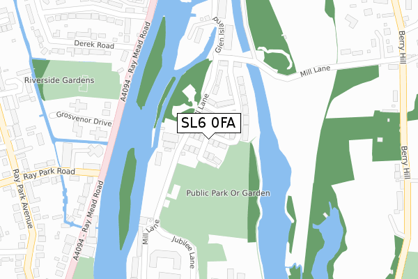
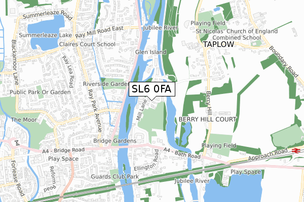
SL6 0FA maps, stats, and open data
SL6 0FA is located in the Cliveden electoral ward, within the unitary authority of Buckinghamshire and the English Parliamentary constituency of Beaconsfield. The Sub Integrated Care Board (ICB) Location is NHS Buckinghamshire, Oxfordshire and Berkshire West ICB - 14Y and the police force is Thames Valley. This postcode has been in use since April 2019.
SL6 0FA maps


Licence: Open Government Licence (requires attribution)
Attribution: Contains OS data © Crown copyright and database right 2025
Source: Open Postcode Geo
Licence: Open Government Licence (requires attribution)
Attribution: Contains OS data © Crown copyright and database right 2025; Contains Royal Mail data © Royal Mail copyright and database right 2025; Source: Office for National Statistics licensed under the Open Government Licence v.3.0
SL6 0FA geodata
| Easting | 490370 |
| Northing | 181698 |
| Latitude | 51.526976 |
| Longitude | -0.698696 |
Where is SL6 0FA?
| Country | England |
| Postcode District | SL6 |
Politics
| Ward | Cliveden |
|---|---|
| Constituency | Beaconsfield |
House Prices
Sales of detached houses in SL6 0FA
2020 26 MAR £1,650,000 |
2, RUTLAND CLOSE, TAPLOW, MAIDENHEAD, SL6 0FA 2019 27 SEP £1,150,000 |
3, RUTLAND CLOSE, TAPLOW, MAIDENHEAD, SL6 0FA 2019 27 AUG £1,150,000 |
5, RUTLAND CLOSE, TAPLOW, MAIDENHEAD, SL6 0FA 2019 21 AUG £1,165,000 |
6, RUTLAND CLOSE, TAPLOW, MAIDENHEAD, SL6 0FA 2019 17 MAY £1,675,000 |
Licence: Contains HM Land Registry data © Crown copyright and database right 2025. This data is licensed under the Open Government Licence v3.0.
Transport
Nearest bus stops to SL6 0FA
| Ellington Road (Bath Road) | Taplow | 371m |
| Ellington Road (Bath Road) | Taplow | 384m |
| Somerford Close (Ray Park Avenue) | Maidenhead | 471m |
| Maidenhead Bridge (Bridge Road) | Maidenhead | 556m |
| Maidenhead Bridge (Bridge Road) | Maidenhead | 560m |
Nearest railway stations to SL6 0FA
| Taplow Station | 1.3km |
| Maidenhead Station | 1.9km |
| Furze Platt Station | 2.2km |
Broadband
Broadband access in SL6 0FA (2020 data)
| Percentage of properties with Next Generation Access | 100.0% |
| Percentage of properties with Superfast Broadband | 100.0% |
| Percentage of properties with Ultrafast Broadband | 100.0% |
| Percentage of properties with Full Fibre Broadband | 100.0% |
Superfast Broadband is between 30Mbps and 300Mbps
Ultrafast Broadband is > 300Mbps
Broadband limitations in SL6 0FA (2020 data)
| Percentage of properties unable to receive 2Mbps | 0.0% |
| Percentage of properties unable to receive 5Mbps | 0.0% |
| Percentage of properties unable to receive 10Mbps | 0.0% |
| Percentage of properties unable to receive 30Mbps | 0.0% |
Deprivation
17.7% of English postcodes are less deprived than SL6 0FA:Food Standards Agency
Three nearest food hygiene ratings to SL6 0FA (metres)


➜ Get more ratings from the Food Standards Agency
Nearest post box to SL6 0FA
| Last Collection | |||
|---|---|---|---|
| Location | Mon-Fri | Sat | Distance |
| Raypark Avenue | 16:00 | 11:30 | 801m |
| Bridge Road Post Office | 17:15 | 11:30 | 805m |
| Lower Cookham Road | 17:15 | 11:30 | 957m |
Environment
| Risk of SL6 0FA flooding from rivers and sea | Low |
SL6 0FA ITL and SL6 0FA LAU
The below table lists the International Territorial Level (ITL) codes (formerly Nomenclature of Territorial Units for Statistics (NUTS) codes) and Local Administrative Units (LAU) codes for SL6 0FA:
| ITL 1 Code | Name |
|---|---|
| TLJ | South East (England) |
| ITL 2 Code | Name |
| TLJ1 | Berkshire, Buckinghamshire and Oxfordshire |
| ITL 3 Code | Name |
| TLJ13 | Buckinghamshire |
| LAU 1 Code | Name |
| E06000060 | Buckinghamshire |
SL6 0FA census areas
The below table lists the Census Output Area (OA), Lower Layer Super Output Area (LSOA), and Middle Layer Super Output Area (MSOA) for SL6 0FA:
| Code | Name | |
|---|---|---|
| OA | E00089980 | |
| LSOA | E01017833 | South Bucks 006D |
| MSOA | E02003693 | South Bucks 006 |
Nearest postcodes to SL6 0FA
| SL6 0AG | Mill Lane | 151m |
| SL6 0AA | Mill Lane | 217m |
| SL6 8NP | Ray Mead Road | 259m |
| SL6 0AD | Pages Wharf | 260m |
| SL6 0AH | Bath Road | 308m |
| SL6 8PF | Grosvenor Drive | 318m |
| SL6 8NN | Ray Park Road | 323m |
| SL6 8NJ | Ray Mead Road | 324m |
| SL6 8UP | Ray Park Road | 337m |
| SL6 8NS | Derek Road | 367m |