SL6 0BN maps, stats, and open data
SL6 0BN is located in the Cliveden electoral ward, within the unitary authority of Buckinghamshire and the English Parliamentary constituency of Beaconsfield. The Sub Integrated Care Board (ICB) Location is NHS Buckinghamshire, Oxfordshire and Berkshire West ICB - 14Y and the police force is Thames Valley. This postcode has been in use since January 2018.
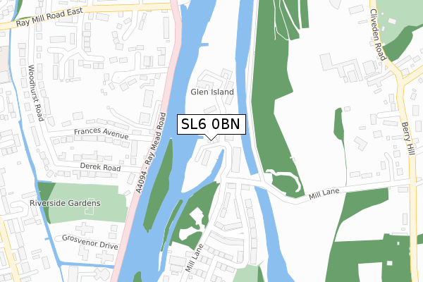
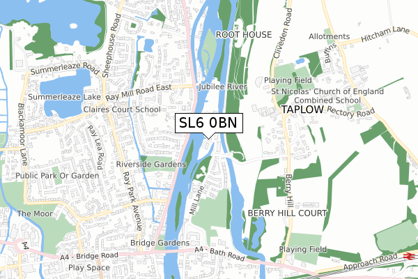
SL6 0BN maps


Licence: Open Government Licence (requires attribution)
Attribution: Contains OS data © Crown copyright and database right 2025
Source: Open Postcode Geo
Licence: Open Government Licence (requires attribution)
Attribution: Contains OS data © Crown copyright and database right 2025; Contains Royal Mail data © Royal Mail copyright and database right 2025; Source: Office for National Statistics licensed under the Open Government Licence v.3.0
SL6 0BN geodata
| Easting | 490402 |
| Northing | 182052 |
| Latitude | 51.530153 |
| Longitude | -0.698144 |
Where is SL6 0BN?
| Country | England |
| Postcode District | SL6 |
Politics
| Ward | Cliveden |
|---|---|
| Constituency | Beaconsfield |
House Prices
Sales of detached houses in SL6 0BN
2, MILL ISLAND HOUSE, GLEN ISLAND, TAPLOW, MAIDENHEAD, SL6 0BN 2019 31 MAY £1,400,000 |
MILL ISLAND COTTAGE, GLEN ISLAND, TAPLOW, MAIDENHEAD, SL6 0BN 2019 18 APR £1,250,000 |
Licence: Contains HM Land Registry data © Crown copyright and database right 2025. This data is licensed under the Open Government Licence v3.0.
Transport
Nearest bus stops to SL6 0BN
| Boulters Lock (A4094) | Maidenhead | 359m |
| Boulters Gardens (Ray Mill Road East) | Maidenhead | 377m |
| Addison Court (Ray Park Avenue) | Maidenhead | 628m |
| Somerford Close (Ray Park Avenue) | Maidenhead | 630m |
| Claires Court School (Ray Mill Road East) | Maidenhead | 642m |
Nearest railway stations to SL6 0BN
| Taplow Station | 1.4km |
| Maidenhead Station | 2.1km |
| Furze Platt Station | 2.1km |
Broadband
Broadband access in SL6 0BN (2020 data)
| Percentage of properties with Next Generation Access | 100.0% |
| Percentage of properties with Superfast Broadband | 100.0% |
| Percentage of properties with Ultrafast Broadband | 95.2% |
| Percentage of properties with Full Fibre Broadband | 95.2% |
Superfast Broadband is between 30Mbps and 300Mbps
Ultrafast Broadband is > 300Mbps
Broadband limitations in SL6 0BN (2020 data)
| Percentage of properties unable to receive 2Mbps | 0.0% |
| Percentage of properties unable to receive 5Mbps | 0.0% |
| Percentage of properties unable to receive 10Mbps | 0.0% |
| Percentage of properties unable to receive 30Mbps | 0.0% |
Deprivation
17.7% of English postcodes are less deprived than SL6 0BN:Food Standards Agency
Three nearest food hygiene ratings to SL6 0BN (metres)


➜ Get more ratings from the Food Standards Agency
Nearest post box to SL6 0BN
| Last Collection | |||
|---|---|---|---|
| Location | Mon-Fri | Sat | Distance |
| Lower Cookham Road | 17:15 | 11:30 | 612m |
| Raypark Avenue | 16:00 | 11:30 | 666m |
| Berry Hill | 16:15 | 09:30 | 874m |
Environment
| Risk of SL6 0BN flooding from rivers and sea | Medium |
SL6 0BN ITL and SL6 0BN LAU
The below table lists the International Territorial Level (ITL) codes (formerly Nomenclature of Territorial Units for Statistics (NUTS) codes) and Local Administrative Units (LAU) codes for SL6 0BN:
| ITL 1 Code | Name |
|---|---|
| TLJ | South East (England) |
| ITL 2 Code | Name |
| TLJ1 | Berkshire, Buckinghamshire and Oxfordshire |
| ITL 3 Code | Name |
| TLJ13 | Buckinghamshire |
| LAU 1 Code | Name |
| E06000060 | Buckinghamshire |
SL6 0BN census areas
The below table lists the Census Output Area (OA), Lower Layer Super Output Area (LSOA), and Middle Layer Super Output Area (MSOA) for SL6 0BN:
| Code | Name | |
|---|---|---|
| OA | E00089980 | |
| LSOA | E01017833 | South Bucks 006D |
| MSOA | E02003693 | South Bucks 006 |
Nearest postcodes to SL6 0BN
| SL6 8NZ | Ray Mead Road | 193m |
| SL6 8PH | Ray Mead Road | 201m |
| SL6 0AG | Mill Lane | 204m |
| SL6 8NY | Ray Mead Road | 220m |
| SL6 8XA | Longworth Drive | 249m |
| SL6 8PD | Ray Mead Road | 273m |
| SL6 8NT | Derek Road | 312m |
| SL6 8NX | Frances Avenue | 319m |
| SL6 8NS | Derek Road | 320m |
| SL6 8TP | Horton Close | 337m |