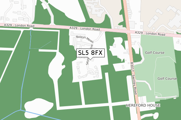
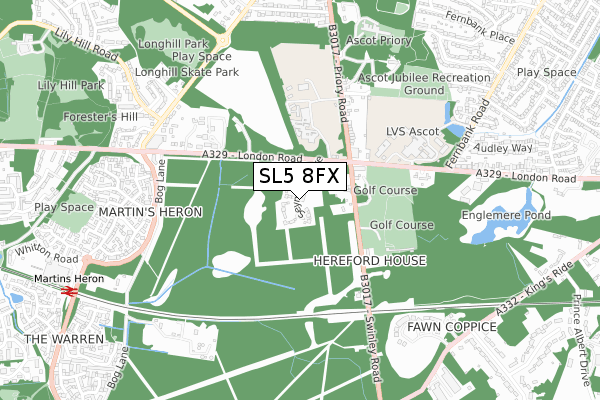
SL5 8FX is located in the Swinley Forest electoral ward, within the unitary authority of Bracknell Forest and the English Parliamentary constituency of Windsor. The Sub Integrated Care Board (ICB) Location is NHS Frimley ICB - D4U1Y and the police force is Thames Valley. This postcode has been in use since February 2019.


GetTheData
Source: OS Open Zoomstack (Ordnance Survey)
Licence: Open Government Licence (requires attribution)
Attribution: Contains OS data © Crown copyright and database right 2024
Source: Open Postcode Geo
Licence: Open Government Licence (requires attribution)
Attribution: Contains OS data © Crown copyright and database right 2024; Contains Royal Mail data © Royal Mail copyright and database right 2024; Source: Office for National Statistics licensed under the Open Government Licence v.3.0
| Easting | 489792 |
| Northing | 168748 |
| Latitude | 51.410655 |
| Longitude | -0.710313 |
GetTheData
Source: Open Postcode Geo
Licence: Open Government Licence
| Country | England |
| Postcode District | SL5 |
| ➜ SL5 open data dashboard ➜ See where SL5 is on a map ➜ Where is North Ascot? | |
GetTheData
Source: Land Registry Price Paid Data
Licence: Open Government Licence
| Ward | Swinley Forest |
| Constituency | Windsor |
GetTheData
Source: ONS Postcode Database
Licence: Open Government Licence
CUINCHY HOUSE, 19, SEYMOUR DRIVE, ASCOT, SL5 8FX 2023 18 AUG £1,900,000 |
4, SEYMOUR DRIVE, ASCOT, SL5 8FX 2020 11 DEC £1,100,000 |
1, SEYMOUR DRIVE, ASCOT, SL5 8FX 2020 3 DEC £1,045,000 |
2, SEYMOUR DRIVE, ASCOT, SL5 8FX 2020 5 NOV £1,045,000 |
15, SEYMOUR DRIVE, ASCOT, SL5 8FX 2020 1 SEP £1,410,000 |
23, SEYMOUR DRIVE, ASCOT, SL5 8FX 2020 7 AUG £1,550,000 |
22, SEYMOUR DRIVE, ASCOT, SL5 8FX 2020 21 JUL £1,700,000 |
25, SEYMOUR DRIVE, ASCOT, SL5 8FX 2020 30 JUN £1,355,250 |
24, SEYMOUR DRIVE, ASCOT, SL5 8FX 2020 30 JUN £1,400,000 |
21, SEYMOUR DRIVE, ASCOT, SL5 8FX 2020 15 JUN £1,500,000 |
GetTheData
Source: HM Land Registry Price Paid Data
Licence: Contains HM Land Registry data © Crown copyright and database right 2024. This data is licensed under the Open Government Licence v3.0.
| The Royal Foresters Hotel (London Road) | North Ascot | 194m |
| The Royal Foresters Hotel (London Road) | North Ascot | 314m |
| The Brackens (London Road) | North Ascot | 421m |
| The Brackens (London Road) | North Ascot | 455m |
| Fernbank Corner (London Road) | North Ascot | 550m |
| Martins Heron Station | 1km |
| Ascot Station | 2.4km |
| Bracknell Station | 2.9km |
GetTheData
Source: NaPTAN
Licence: Open Government Licence
| Percentage of properties with Next Generation Access | 100.0% |
| Percentage of properties with Superfast Broadband | 100.0% |
| Percentage of properties with Ultrafast Broadband | 26.9% |
| Percentage of properties with Full Fibre Broadband | 26.9% |
Superfast Broadband is between 30Mbps and 300Mbps
Ultrafast Broadband is > 300Mbps
| Percentage of properties unable to receive 2Mbps | 0.0% |
| Percentage of properties unable to receive 5Mbps | 0.0% |
| Percentage of properties unable to receive 10Mbps | 0.0% |
| Percentage of properties unable to receive 30Mbps | 0.0% |
GetTheData
Source: Ofcom
Licence: Ofcom Terms of Use (requires attribution)
GetTheData
Source: ONS Postcode Database
Licence: Open Government Licence


➜ Get more ratings from the Food Standards Agency
GetTheData
Source: Food Standards Agency
Licence: FSA terms & conditions
| Last Collection | |||
|---|---|---|---|
| Location | Mon-Fri | Sat | Distance |
| New Forest Road | 16:15 | 11:15 | 1,243m |
| London Road | 16:00 | 11:45 | 1,245m |
| Harmanswater Post Office | 17:15 | 12:00 | 1,621m |
GetTheData
Source: Dracos
Licence: Creative Commons Attribution-ShareAlike
| Facility | Distance |
|---|---|
| Heathfield School London Road, Ascot Swimming Pool, Sports Hall, Health and Fitness Gym, Grass Pitches, Squash Courts, Studio, Outdoor Tennis Courts | 292m |
| Lavender Park Golf Centre Swinley Road, Ascot Golf | 350m |
| Licensed Victuallers' School London Road, Ascot Swimming Pool, Health and Fitness Gym, Grass Pitches, Sports Hall, Artificial Grass Pitch, Outdoor Tennis Courts | 519m |
GetTheData
Source: Active Places
Licence: Open Government Licence
| School | Phase of Education | Distance |
|---|---|---|
| Heathfield School London Road, Ascot, SL5 8BQ | Not applicable | 301m |
| LVS Ascot London Road, Ascot, SL5 8DR | Not applicable | 532m |
| Holly Spring Primary School Lily Hill Road, Bracknell, RG12 2SW | Primary | 1.7km |
GetTheData
Source: Edubase
Licence: Open Government Licence
The below table lists the International Territorial Level (ITL) codes (formerly Nomenclature of Territorial Units for Statistics (NUTS) codes) and Local Administrative Units (LAU) codes for SL5 8FX:
| ITL 1 Code | Name |
|---|---|
| TLJ | South East (England) |
| ITL 2 Code | Name |
| TLJ1 | Berkshire, Buckinghamshire and Oxfordshire |
| ITL 3 Code | Name |
| TLJ11 | Berkshire |
| LAU 1 Code | Name |
| E06000036 | Bracknell Forest |
GetTheData
Source: ONS Postcode Directory
Licence: Open Government Licence
The below table lists the Census Output Area (OA), Lower Layer Super Output Area (LSOA), and Middle Layer Super Output Area (MSOA) for SL5 8FX:
| Code | Name | |
|---|---|---|
| OA | E00081782 | |
| LSOA | E01016181 | Bracknell Forest 005B |
| MSOA | E02003356 | Bracknell Forest 005 |
GetTheData
Source: ONS Postcode Directory
Licence: Open Government Licence
| SL5 8BA | Swinley Road | 203m |
| SL5 8BD | Lavender Park | 254m |
| SL5 8DU | Chelsea Cottages | 334m |
| SL5 8DX | Driffield Cottages | 349m |
| SL5 8DY | Ellesmere Cottages | 358m |
| SL5 8DZ | Priory Road | 371m |
| SL5 8EA | Priory Road | 381m |
| SL5 8EB | Priory Road | 449m |
| SL5 8DW | Forest Close | 512m |
| RG12 9FR | London Road | 539m |
GetTheData
Source: Open Postcode Geo; Land Registry Price Paid Data
Licence: Open Government Licence