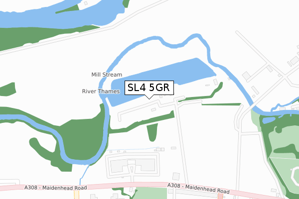
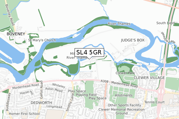
SL4 5GR is located in the Clewer & Dedworth East electoral ward, within the unitary authority of Windsor and Maidenhead and the English Parliamentary constituency of Windsor. The Sub Integrated Care Board (ICB) Location is NHS Frimley ICB - D4U1Y and the police force is Thames Valley. This postcode has been in use since May 2019.


GetTheData
Source: OS Open Zoomstack (Ordnance Survey)
Licence: Open Government Licence (requires attribution)
Attribution: Contains OS data © Crown copyright and database right 2025
Source: Open Postcode Geo
Licence: Open Government Licence (requires attribution)
Attribution: Contains OS data © Crown copyright and database right 2025; Contains Royal Mail data © Royal Mail copyright and database right 2025; Source: Office for National Statistics licensed under the Open Government Licence v.3.0
| Easting | 494627 |
| Northing | 177399 |
| Latitude | 51.487636 |
| Longitude | -0.638503 |
GetTheData
Source: Open Postcode Geo
Licence: Open Government Licence
| Country | England |
| Postcode District | SL4 |
➜ See where SL4 is on a map | |
GetTheData
Source: Land Registry Price Paid Data
Licence: Open Government Licence
| Ward | Clewer & Dedworth East |
| Constituency | Windsor |
GetTheData
Source: ONS Postcode Database
Licence: Open Government Licence
| Centrica Car Park (Private Road) | Dedworth | 265m |
| Centrica Millstream (Maidenhead Road) | Dedworth | 269m |
| Centrica Millstream (Maidenhead Road) | Dedworth | 285m |
| Vale Road | Clewer | 427m |
| Smiths Lane Flats (Smiths Lane) | Dedworth | 437m |
| Windsor & Eton Central Station | 2km |
| Windsor & Eton Riverside Station | 2.2km |
| Burnham (Berks) Station | 4km |
GetTheData
Source: NaPTAN
Licence: Open Government Licence
GetTheData
Source: ONS Postcode Database
Licence: Open Government Licence


➜ Get more ratings from the Food Standards Agency
GetTheData
Source: Food Standards Agency
Licence: FSA terms & conditions
| Last Collection | |||
|---|---|---|---|
| Location | Mon-Fri | Sat | Distance |
| Hatch Lane | 17:30 | 11:45 | 1,362m |
| Alma Road | 17:15 | 11:30 | 1,824m |
| Goswell Road | 17:15 | 09:00 | 1,946m |
GetTheData
Source: Dracos
Licence: Creative Commons Attribution-ShareAlike
| Risk of SL4 5GR flooding from rivers and sea | Medium |
| ➜ SL4 5GR flood map | |
GetTheData
Source: Open Flood Risk by Postcode
Licence: Open Government Licence
The below table lists the International Territorial Level (ITL) codes (formerly Nomenclature of Territorial Units for Statistics (NUTS) codes) and Local Administrative Units (LAU) codes for SL4 5GR:
| ITL 1 Code | Name |
|---|---|
| TLJ | South East (England) |
| ITL 2 Code | Name |
| TLJ1 | Berkshire, Buckinghamshire and Oxfordshire |
| ITL 3 Code | Name |
| TLJ11 | Berkshire |
| LAU 1 Code | Name |
| E06000040 | Windsor and Maidenhead |
GetTheData
Source: ONS Postcode Directory
Licence: Open Government Licence
The below table lists the Census Output Area (OA), Lower Layer Super Output Area (LSOA), and Middle Layer Super Output Area (MSOA) for SL4 5GR:
| Code | Name | |
|---|---|---|
| OA | E00083581 | |
| LSOA | E01016552 | Windsor and Maidenhead 012D |
| MSOA | E02003432 | Windsor and Maidenhead 012 |
GetTheData
Source: ONS Postcode Directory
Licence: Open Government Licence
| SL4 5HL | Sawyers Close | 325m |
| SL4 5HJ | Sawyers Close | 353m |
| SL4 5HF | Maidenhead Road | 356m |
| SL4 5HG | Rays Avenue | 381m |
| SL4 5HW | Sawyers Close | 417m |
| SL4 5HN | Sawyers Close | 470m |
| SL4 5PL | Burnetts Road | 479m |
| SL4 5JT | Buckland Crescent | 490m |
| SL4 5JS | Buckland Crescent | 500m |
| SL4 5JR | Vale Road | 511m |
GetTheData
Source: Open Postcode Geo; Land Registry Price Paid Data
Licence: Open Government Licence