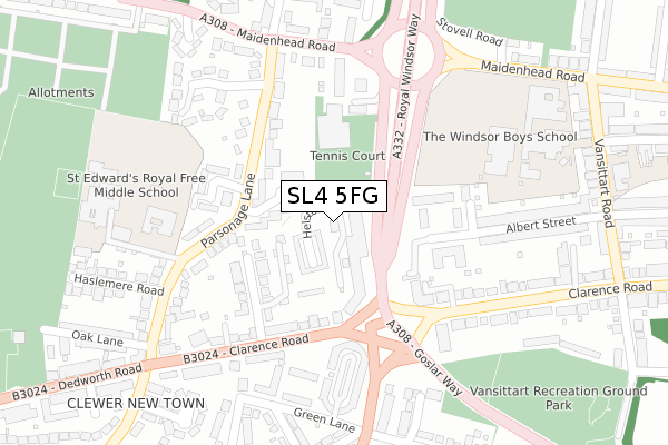
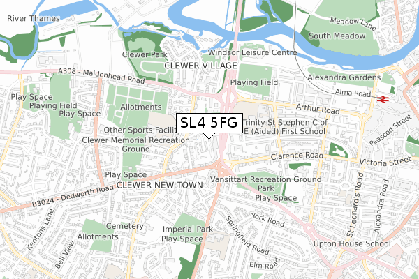
SL4 5FG is located in the Clewer East electoral ward, within the unitary authority of Windsor and Maidenhead and the English Parliamentary constituency of Windsor. The Sub Integrated Care Board (ICB) Location is NHS Frimley ICB - D4U1Y and the police force is Thames Valley. This postcode has been in use since May 2019.


GetTheData
Source: OS Open Zoomstack (Ordnance Survey)
Licence: Open Government Licence (requires attribution)
Attribution: Contains OS data © Crown copyright and database right 2025
Source: Open Postcode Geo
Licence: Open Government Licence (requires attribution)
Attribution: Contains OS data © Crown copyright and database right 2025; Contains Royal Mail data © Royal Mail copyright and database right 2025; Source: Office for National Statistics licensed under the Open Government Licence v.3.0
| Easting | 495552 |
| Northing | 176712 |
| Latitude | 51.481305 |
| Longitude | -0.625371 |
GetTheData
Source: Open Postcode Geo
Licence: Open Government Licence
| Country | England |
| Postcode District | SL4 |
➜ See where SL4 is on a map ➜ Where is Windsor? | |
GetTheData
Source: Land Registry Price Paid Data
Licence: Open Government Licence
| Ward | Clewer East |
| Constituency | Windsor |
GetTheData
Source: ONS Postcode Database
Licence: Open Government Licence
| Orchard Avenue (Clarence Road) | Windsor | 181m |
| Clewer Village (Maidenhead Road) | Clewer | 284m |
| Parsonage Lane (Clarence Road) | Clewer | 290m |
| Boys School (Maidenhead Road) | Windsor | 306m |
| Parsonage Lane (Clarence Road) | Clewer | 318m |
| Windsor & Eton Central Station | 1.1km |
| Windsor & Eton Riverside Station | 1.4km |
| Datchet Station | 3.2km |
GetTheData
Source: NaPTAN
Licence: Open Government Licence
GetTheData
Source: ONS Postcode Database
Licence: Open Government Licence


➜ Get more ratings from the Food Standards Agency
GetTheData
Source: Food Standards Agency
Licence: FSA terms & conditions
| Last Collection | |||
|---|---|---|---|
| Location | Mon-Fri | Sat | Distance |
| Alma Road | 17:15 | 11:30 | 685m |
| Hatch Lane | 17:30 | 11:45 | 727m |
| Saint Marks Road | 17:15 | 11:30 | 935m |
GetTheData
Source: Dracos
Licence: Creative Commons Attribution-ShareAlike
| Risk of SL4 5FG flooding from rivers and sea | Low |
| ➜ SL4 5FG flood map | |
GetTheData
Source: Open Flood Risk by Postcode
Licence: Open Government Licence
The below table lists the International Territorial Level (ITL) codes (formerly Nomenclature of Territorial Units for Statistics (NUTS) codes) and Local Administrative Units (LAU) codes for SL4 5FG:
| ITL 1 Code | Name |
|---|---|
| TLJ | South East (England) |
| ITL 2 Code | Name |
| TLJ1 | Berkshire, Buckinghamshire and Oxfordshire |
| ITL 3 Code | Name |
| TLJ11 | Berkshire |
| LAU 1 Code | Name |
| E06000040 | Windsor and Maidenhead |
GetTheData
Source: ONS Postcode Directory
Licence: Open Government Licence
The below table lists the Census Output Area (OA), Lower Layer Super Output Area (LSOA), and Middle Layer Super Output Area (MSOA) for SL4 5FG:
| Code | Name | |
|---|---|---|
| OA | E00083563 | |
| LSOA | E01016552 | Windsor and Maidenhead 012D |
| MSOA | E02003432 | Windsor and Maidenhead 012 |
GetTheData
Source: ONS Postcode Directory
Licence: Open Government Licence
| SL4 5HS | Helston Lane | 45m |
| SL4 5ER | Rectory Close | 79m |
| SL4 5AA | Orchard Avenue | 89m |
| SL4 5AW | Orchard Avenue | 140m |
| SL4 5AP | Clarence Road | 150m |
| SL4 5EW | Parsonage Lane | 153m |
| SL4 5EP | Chantry Close | 164m |
| SL4 5GE | Pavilions | 181m |
| SL4 3SE | Trevelyan Court | 214m |
| SL4 5EN | Parsonage Lane | 219m |
GetTheData
Source: Open Postcode Geo; Land Registry Price Paid Data
Licence: Open Government Licence