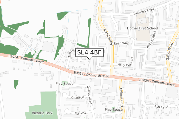
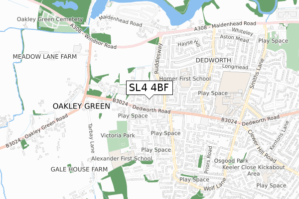
SL4 4BF is located in the Clewer & Dedworth West electoral ward, within the unitary authority of Windsor and Maidenhead and the English Parliamentary constituency of Windsor. The Sub Integrated Care Board (ICB) Location is NHS Frimley ICB - D4U1Y and the police force is Thames Valley. This postcode has been in use since January 2019.


GetTheData
Source: OS Open Zoomstack (Ordnance Survey)
Licence: Open Government Licence (requires attribution)
Attribution: Contains OS data © Crown copyright and database right 2024
Source: Open Postcode Geo
Licence: Open Government Licence (requires attribution)
Attribution: Contains OS data © Crown copyright and database right 2024; Contains Royal Mail data © Royal Mail copyright and database right 2024; Source: Office for National Statistics licensed under the Open Government Licence v.3.0
| Easting | 493455 |
| Northing | 176474 |
| Latitude | 51.479515 |
| Longitude | -0.655623 |
GetTheData
Source: Open Postcode Geo
Licence: Open Government Licence
| Country | England |
| Postcode District | SL4 |
| ➜ SL4 open data dashboard ➜ See where SL4 is on a map ➜ Where is Windsor? | |
GetTheData
Source: Land Registry Price Paid Data
Licence: Open Government Licence
| Ward | Clewer & Dedworth West |
| Constituency | Windsor |
GetTheData
Source: ONS Postcode Database
Licence: Open Government Licence
| June 2022 | Other theft | On or near Newberry Crescent | 97m |
| June 2022 | Violence and sexual offences | On or near Newberry Crescent | 97m |
| June 2022 | Violence and sexual offences | On or near The Limes | 114m |
| ➜ Get more crime data in our Crime section | |||
GetTheData
Source: data.police.uk
Licence: Open Government Licence
| Guards Road (Dedworth Road) | Dedworth | 102m |
| Holly Crescent (Ruddlesway) | Dedworth | 124m |
| Guards Road (Dedworth Road) | Dedworth | 128m |
| Martin Close (Ruddlesway) | Dedworth | 179m |
| Martin Close (Ruddlesway) | Dedworth | 182m |
| Windsor & Eton Central Station | 3.2km |
| Windsor & Eton Riverside Station | 3.5km |
| Burnham (Berks) Station | 4.9km |
GetTheData
Source: NaPTAN
Licence: Open Government Licence
| Percentage of properties with Next Generation Access | 100.0% |
| Percentage of properties with Superfast Broadband | 100.0% |
| Percentage of properties with Ultrafast Broadband | 9.1% |
| Percentage of properties with Full Fibre Broadband | 0.0% |
Superfast Broadband is between 30Mbps and 300Mbps
Ultrafast Broadband is > 300Mbps
| Percentage of properties unable to receive 2Mbps | 0.0% |
| Percentage of properties unable to receive 5Mbps | 0.0% |
| Percentage of properties unable to receive 10Mbps | 0.0% |
| Percentage of properties unable to receive 30Mbps | 0.0% |
GetTheData
Source: Ofcom
Licence: Ofcom Terms of Use (requires attribution)
GetTheData
Source: ONS Postcode Database
Licence: Open Government Licence


➜ Get more ratings from the Food Standards Agency
GetTheData
Source: Food Standards Agency
Licence: FSA terms & conditions
| Last Collection | |||
|---|---|---|---|
| Location | Mon-Fri | Sat | Distance |
| Hatch Lane | 17:30 | 11:45 | 1,698m |
| Clewer Hill Road | 17:30 | 11:45 | 2,035m |
| Cavalry Crescent | 16:45 | 11:30 | 2,521m |
GetTheData
Source: Dracos
Licence: Creative Commons Attribution-ShareAlike
| Facility | Distance |
|---|---|
| Alexander First School Kenneally Road, Windsor Grass Pitches | 521m |
| Dedworth Middle School Smiths Lane, Windsor Sports Hall, Grass Pitches, Outdoor Tennis Courts, Artificial Grass Pitch | 740m |
| Dedworth Manor Playing Fields Maidenhead Road, Windsor Grass Pitches | 1.3km |
GetTheData
Source: Active Places
Licence: Open Government Licence
| School | Phase of Education | Distance |
|---|---|---|
| Homer First School and Nursery Testwood Road, Windsor, SL4 5RL | Primary | 362m |
| Alexander First School Kenneally, Oakley Green, Windsor, SL4 4XP | Primary | 521m |
| Dedworth Green First School Smiths Lane, Windsor, SL4 5PE | Primary | 716m |
GetTheData
Source: Edubase
Licence: Open Government Licence
The below table lists the International Territorial Level (ITL) codes (formerly Nomenclature of Territorial Units for Statistics (NUTS) codes) and Local Administrative Units (LAU) codes for SL4 4BF:
| ITL 1 Code | Name |
|---|---|
| TLJ | South East (England) |
| ITL 2 Code | Name |
| TLJ1 | Berkshire, Buckinghamshire and Oxfordshire |
| ITL 3 Code | Name |
| TLJ11 | Berkshire |
| LAU 1 Code | Name |
| E06000040 | Windsor and Maidenhead |
GetTheData
Source: ONS Postcode Directory
Licence: Open Government Licence
The below table lists the Census Output Area (OA), Lower Layer Super Output Area (LSOA), and Middle Layer Super Output Area (MSOA) for SL4 4BF:
| Code | Name | |
|---|---|---|
| OA | E00083586 | |
| LSOA | E01016553 | Windsor and Maidenhead 013B |
| MSOA | E02003433 | Windsor and Maidenhead 013 |
GetTheData
Source: ONS Postcode Directory
Licence: Open Government Licence
| SL4 5SN | Newberry Crescent | 72m |
| SL4 4US | The Limes | 81m |
| SL4 4LJ | Dedworth Road | 83m |
| SL4 4LH | Dedworth Road | 100m |
| SL4 5SP | Martin Close | 108m |
| SL4 4LL | Dedworth Road | 115m |
| SL4 5SW | Ruddlesway | 119m |
| SL4 5SJ | Ruddlesway | 152m |
| SL4 5SH | Ruddlesway | 201m |
| SL4 4LA | Dedworth Road | 207m |
GetTheData
Source: Open Postcode Geo; Land Registry Price Paid Data
Licence: Open Government Licence