Property/Postcode Data Search:
SL4 2FB maps, stats, and open data
SL4 2FB is located in the Old Windsor electoral ward, within the unitary authority of Windsor and Maidenhead and the English Parliamentary constituency of Windsor. The Sub Integrated Care Board (ICB) Location is NHS Frimley ICB - D4U1Y and the police force is Thames Valley. This postcode has been in use since June 2018.
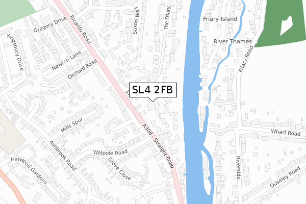
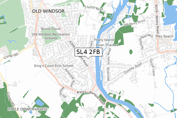
SL4 2FB maps


Source: OS Open Zoomstack (Ordnance Survey)
Licence: Open Government Licence (requires attribution)
Attribution: Contains OS data © Crown copyright and database right 2025
Source: Open Postcode Geo
Licence: Open Government Licence (requires attribution)
Attribution: Contains OS data © Crown copyright and database right 2025; Contains Royal Mail data © Royal Mail copyright and database right 2025; Source: Office for National Statistics licensed under the Open Government Licence v.3.0
Licence: Open Government Licence (requires attribution)
Attribution: Contains OS data © Crown copyright and database right 2025
Source: Open Postcode Geo
Licence: Open Government Licence (requires attribution)
Attribution: Contains OS data © Crown copyright and database right 2025; Contains Royal Mail data © Royal Mail copyright and database right 2025; Source: Office for National Statistics licensed under the Open Government Licence v.3.0
SL4 2FB geodata
| Easting | 499043 |
| Northing | 173948 |
| Latitude | 51.455859 |
| Longitude | -0.575888 |
Where is SL4 2FB?
| Country | England |
| Postcode District | SL4 |
Politics
| Ward | Old Windsor |
|---|---|
| Constituency | Windsor |
Transport
Nearest bus stops to SL4 2FB
| Malt House Close (Straight Road) | Old Windsor | 53m |
| Malt House Close (Straight Road) | Old Windsor | 66m |
| Orchard Road (A308) | Old Windsor | 264m |
| Meadow Way (Straight Road) | Old Windsor | 370m |
| Bells Of Ouzeley (Straight Road) | Old Windsor | 374m |
Nearest railway stations to SL4 2FB
| Sunnymeads Station | 2km |
| Wraysbury Station | 2.4km |
| Datchet Station | 3km |
Deprivation
1% of English postcodes are less deprived than SL4 2FB:Food Standards Agency
Three nearest food hygiene ratings to SL4 2FB (metres)
BP Oil UK Ltd

BP Petrol Station
69m
The Old W Cafe

The Old Windsor Cafe
231m
Cater Link At Kings Court First School

Kings Court First School
399m
➜ Get more ratings from the Food Standards Agency
Nearest post box to SL4 2FB
| Last Collection | |||
|---|---|---|---|
| Location | Mon-Fri | Sat | Distance |
| Old Friary Post Office | 17:00 | 11:00 | 296m |
| Church Road Old Windsor | 17:00 | 07:45 | 750m |
| Albany Road Old Windsor | 17:15 | 07:30 | 1,281m |
Environment
| Risk of SL4 2FB flooding from rivers and sea | Medium |
SL4 2FB ITL and SL4 2FB LAU
The below table lists the International Territorial Level (ITL) codes (formerly Nomenclature of Territorial Units for Statistics (NUTS) codes) and Local Administrative Units (LAU) codes for SL4 2FB:
| ITL 1 Code | Name |
|---|---|
| TLJ | South East (England) |
| ITL 2 Code | Name |
| TLJ1 | Berkshire, Buckinghamshire and Oxfordshire |
| ITL 3 Code | Name |
| TLJ11 | Berkshire |
| LAU 1 Code | Name |
| E06000040 | Windsor and Maidenhead |
SL4 2FB census areas
The below table lists the Census Output Area (OA), Lower Layer Super Output Area (LSOA), and Middle Layer Super Output Area (MSOA) for SL4 2FB:
| Code | Name | |
|---|---|---|
| OA | E00083746 | |
| LSOA | E01016589 | Windsor and Maidenhead 016E |
| MSOA | E02003436 | Windsor and Maidenhead 016 |
Nearest postcodes to SL4 2FB
| SL4 2SE | Straight Road | 102m |
| SL4 2NP | The Friary | 107m |
| SL4 2SD | Malt House Close | 111m |
| SL4 2JL | Windsor Road | 125m |
| SL4 2SB | Straight Road | 146m |
| SL4 2NS | The Friary | 155m |
| SL4 2SS | Straight Road | 156m |
| TW19 5JR | Friary Island | 164m |
| SL4 2NW | Straight Road | 174m |
| SL4 2SG | Straight Road | 188m |