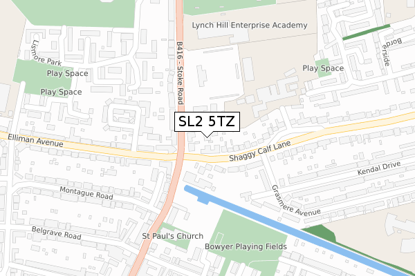
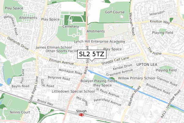
SL2 5TZ is located in the Wexham Court electoral ward, within the unitary authority of Slough and the English Parliamentary constituency of Slough. The Sub Integrated Care Board (ICB) Location is NHS Frimley ICB - D4U1Y and the police force is Thames Valley. This postcode has been in use since April 2018.


GetTheData
Source: OS Open Zoomstack (Ordnance Survey)
Licence: Open Government Licence (requires attribution)
Attribution: Contains OS data © Crown copyright and database right 2024
Source: Open Postcode Geo
Licence: Open Government Licence (requires attribution)
Attribution: Contains OS data © Crown copyright and database right 2024; Contains Royal Mail data © Royal Mail copyright and database right 2024; Source: Office for National Statistics licensed under the Open Government Licence v.3.0
| Easting | 498006 |
| Northing | 180893 |
| Latitude | 51.518467 |
| Longitude | -0.588882 |
GetTheData
Source: Open Postcode Geo
Licence: Open Government Licence
| Country | England |
| Postcode District | SL2 |
| ➜ SL2 open data dashboard ➜ See where SL2 is on a map ➜ Where is Slough? | |
GetTheData
Source: Land Registry Price Paid Data
Licence: Open Government Licence
| Ward | Wexham Court |
| Constituency | Slough |
GetTheData
Source: ONS Postcode Database
Licence: Open Government Licence
| January 2024 | Anti-social behaviour | On or near Charlotte Avenue | 305m |
| January 2024 | Other theft | On or near Shaggy Calf Lane | 320m |
| January 2024 | Vehicle crime | On or near School Lane | 388m |
| ➜ Get more crime data in our Crime section | |||
GetTheData
Source: data.police.uk
Licence: Open Government Licence
| Shaggy Calf Lane (Stoke Road) | Elliman | 65m |
| Shaggy Calf Lane (Stoke Road) | Elliman | 124m |
| Myrtle Crescent (Elliman Avenue) | Elliman | 164m |
| Myrtle Crescent (Elliman Avenue) | Elliman | 217m |
| Lismore Park (Stoke Road) | Elliman | 243m |
| Slough Station | 0.8km |
| Langley (Berks) Station | 3.5km |
| Windsor & Eton Riverside Station | 3.9km |
GetTheData
Source: NaPTAN
Licence: Open Government Licence
| Percentage of properties with Next Generation Access | 100.0% |
| Percentage of properties with Superfast Broadband | 100.0% |
| Percentage of properties with Ultrafast Broadband | 100.0% |
| Percentage of properties with Full Fibre Broadband | 0.0% |
Superfast Broadband is between 30Mbps and 300Mbps
Ultrafast Broadband is > 300Mbps
| Percentage of properties unable to receive 2Mbps | 0.0% |
| Percentage of properties unable to receive 5Mbps | 0.0% |
| Percentage of properties unable to receive 10Mbps | 0.0% |
| Percentage of properties unable to receive 30Mbps | 0.0% |
GetTheData
Source: Ofcom
Licence: Ofcom Terms of Use (requires attribution)
GetTheData
Source: ONS Postcode Database
Licence: Open Government Licence


➜ Get more ratings from the Food Standards Agency
GetTheData
Source: Food Standards Agency
Licence: FSA terms & conditions
| Last Collection | |||
|---|---|---|---|
| Location | Mon-Fri | Sat | Distance |
| Stoke Road | 18:00 | 11:00 | 122m |
| Lismore Park | 17:45 | 11:00 | 273m |
| Petersfield Avenue | 18:30 | 10:30 | 575m |
GetTheData
Source: Dracos
Licence: Creative Commons Attribution-ShareAlike
| Facility | Distance |
|---|---|
| Arbour Park Community Sports Stadium Stoke Road, Slough Artificial Grass Pitch | 162m |
| St Joseph's Catholic High School Shaggy Calf Lane, Shaggy Calf Lane, Slough Sports Hall, Grass Pitches | 194m |
| Lynch Hill Enterprise Academy Stoke Road, Slough Sports Hall, Grass Pitches | 264m |
GetTheData
Source: Active Places
Licence: Open Government Licence
| School | Phase of Education | Distance |
|---|---|---|
| St Joseph's Catholic High School Shaggy Calf Lane, Slough, SL2 5HW | Secondary | 192m |
| Lynch Hill Enterprise Academy Stoke Road, Slough, SL2 5AY | Secondary | 264m |
| Khalsa Primary School Wexham Road, Slough, SL2 5QR | Primary | 493m |
GetTheData
Source: Edubase
Licence: Open Government Licence
The below table lists the International Territorial Level (ITL) codes (formerly Nomenclature of Territorial Units for Statistics (NUTS) codes) and Local Administrative Units (LAU) codes for SL2 5TZ:
| ITL 1 Code | Name |
|---|---|
| TLJ | South East (England) |
| ITL 2 Code | Name |
| TLJ1 | Berkshire, Buckinghamshire and Oxfordshire |
| ITL 3 Code | Name |
| TLJ11 | Berkshire |
| LAU 1 Code | Name |
| E06000039 | Slough |
GetTheData
Source: ONS Postcode Directory
Licence: Open Government Licence
The below table lists the Census Output Area (OA), Lower Layer Super Output Area (LSOA), and Middle Layer Super Output Area (MSOA) for SL2 5TZ:
| Code | Name | |
|---|---|---|
| OA | E00083111 | |
| LSOA | E01016460 | Slough 007E |
| MSOA | E02003413 | Slough 007 |
GetTheData
Source: ONS Postcode Directory
Licence: Open Government Licence
| SL2 5AY | Stoke Road | 34m |
| SL2 5BL | Stokesay | 54m |
| SL2 5HL | Shaggy Calf Lane | 66m |
| SL2 5HJ | Shaggy Calf Lane | 101m |
| SL2 5BQ | Stoke Road | 156m |
| SL2 5HY | Grasmere Avenue | 174m |
| SL2 5AS | Stoke Road | 190m |
| SL2 5HX | Kendal Close | 194m |
| SL1 3RX | Whitehaven | 195m |
| SL2 5HN | Shaggy Calf Lane | 209m |
GetTheData
Source: Open Postcode Geo; Land Registry Price Paid Data
Licence: Open Government Licence