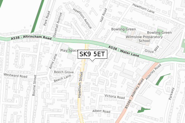
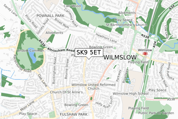
SK9 5ET is located in the Wilmslow West and Chorley electoral ward, within the unitary authority of Cheshire East and the English Parliamentary constituency of Tatton. The Sub Integrated Care Board (ICB) Location is NHS Cheshire and Merseyside ICB - 27D and the police force is Cheshire. This postcode has been in use since August 2019.


GetTheData
Source: OS Open Zoomstack (Ordnance Survey)
Licence: Open Government Licence (requires attribution)
Attribution: Contains OS data © Crown copyright and database right 2024
Source: Open Postcode Geo
Licence: Open Government Licence (requires attribution)
Attribution: Contains OS data © Crown copyright and database right 2024; Contains Royal Mail data © Royal Mail copyright and database right 2024; Source: Office for National Statistics licensed under the Open Government Licence v.3.0
| Easting | 384244 |
| Northing | 381017 |
| Latitude | 53.325851 |
| Longitude | -2.238016 |
GetTheData
Source: Open Postcode Geo
Licence: Open Government Licence
| Country | England |
| Postcode District | SK9 |
| ➜ SK9 open data dashboard ➜ See where SK9 is on a map ➜ Where is Wilmslow? | |
GetTheData
Source: Land Registry Price Paid Data
Licence: Open Government Licence
| Ward | Wilmslow West And Chorley |
| Constituency | Tatton |
GetTheData
Source: ONS Postcode Database
Licence: Open Government Licence
| November 2023 | Other theft | On or near Petrol Station | 54m |
| October 2023 | Violence and sexual offences | On or near Petrol Station | 54m |
| October 2023 | Violence and sexual offences | On or near Petrol Station | 54m |
| ➜ Get more crime data in our Crime section | |||
GetTheData
Source: data.police.uk
Licence: Open Government Licence
| Fire Station (Water Lane) | Wilmslow | 123m |
| Stuart House (Alderley Road) | Wilmslow | 271m |
| Park Road (Water Lane) | Wilmslow | 271m |
| Alderley Road (Water Lane) | Wilmslow | 289m |
| Alderley Road (Water Lane) | Wilmslow | 304m |
| Wilmslow Station | 0.8km |
| Alderley Edge Station | 2.5km |
| Styal Station | 2.5km |
GetTheData
Source: NaPTAN
Licence: Open Government Licence
GetTheData
Source: ONS Postcode Database
Licence: Open Government Licence


➜ Get more ratings from the Food Standards Agency
GetTheData
Source: Food Standards Agency
Licence: FSA terms & conditions
| Last Collection | |||
|---|---|---|---|
| Location | Mon-Fri | Sat | Distance |
| Hall Road | 17:45 | 11:45 | 140m |
| Water Lane | 18:00 | 11:45 | 214m |
| Bourne Street | 17:45 | 11:45 | 297m |
GetTheData
Source: Dracos
Licence: Creative Commons Attribution-ShareAlike
| Facility | Distance |
|---|---|
| Wilmslow Prep School Grove Avenue, Wilmslow Sports Hall, Artificial Grass Pitch | 299m |
| Carnival Field Altrincham Road, Wilmslow Grass Pitches | 493m |
| The Rectory Field Alderley Road, Wilmslow Grass Pitches | 616m |
GetTheData
Source: Active Places
Licence: Open Government Licence
| School | Phase of Education | Distance |
|---|---|---|
| Wilmslow Preparatory School Grove Avenue, Wilmslow, SK9 5EG | Not applicable | 285m |
| St Anne's Fulshaw C of E Primary School Nursery Lane, Wilmslow, SK9 5JQ | Primary | 581m |
| Wilmslow High School Holly Road, Wilmslow, SK9 1LZ | Secondary | 673m |
GetTheData
Source: Edubase
Licence: Open Government Licence
The below table lists the International Territorial Level (ITL) codes (formerly Nomenclature of Territorial Units for Statistics (NUTS) codes) and Local Administrative Units (LAU) codes for SK9 5ET:
| ITL 1 Code | Name |
|---|---|
| TLD | North West (England) |
| ITL 2 Code | Name |
| TLD6 | Cheshire |
| ITL 3 Code | Name |
| TLD62 | Cheshire East |
| LAU 1 Code | Name |
| E06000049 | Cheshire East |
GetTheData
Source: ONS Postcode Directory
Licence: Open Government Licence
The below table lists the Census Output Area (OA), Lower Layer Super Output Area (LSOA), and Middle Layer Super Output Area (MSOA) for SK9 5ET:
| Code | Name | |
|---|---|---|
| OA | E00093875 | |
| LSOA | E01018601 | Cheshire East 006B |
| MSOA | E02003858 | Cheshire East 006 |
GetTheData
Source: ONS Postcode Directory
Licence: Open Government Licence
| SK9 5AD | St James Drive | 44m |
| SK9 5EH | Hawthorn Street | 56m |
| SK9 5DA | Kensington Court | 74m |
| SK9 5BQ | Water Lane | 77m |
| SK9 5AY | Wycliffe Avenue | 84m |
| SK9 5QW | Gatcombe Mews | 105m |
| SK9 5DB | Highgrove Mews | 116m |
| SK9 5BB | Water Lane | 124m |
| SK9 5QJ | Sandringham Way | 145m |
| SK9 5BN | Hall Road | 148m |
GetTheData
Source: Open Postcode Geo; Land Registry Price Paid Data
Licence: Open Government Licence