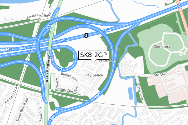
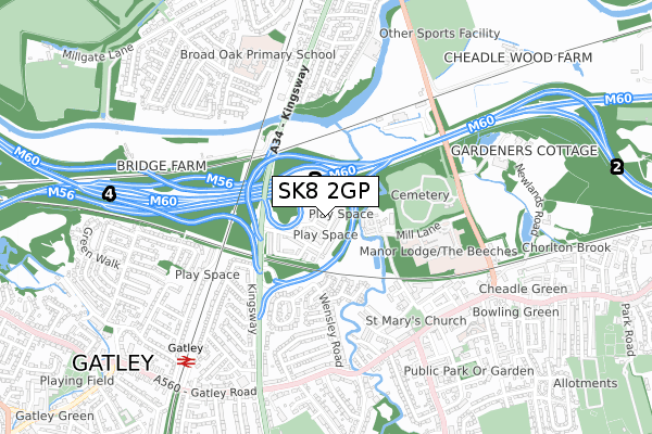
SK8 2GP is located in the Cheadle West & Gatley electoral ward, within the metropolitan district of Stockport and the English Parliamentary constituency of Cheadle. The Sub Integrated Care Board (ICB) Location is NHS Greater Manchester ICB - 01W and the police force is Greater Manchester. This postcode has been in use since February 2019.


GetTheData
Source: OS Open Zoomstack (Ordnance Survey)
Licence: Open Government Licence (requires attribution)
Attribution: Contains OS data © Crown copyright and database right 2024
Source: Open Postcode Geo
Licence: Open Government Licence (requires attribution)
Attribution: Contains OS data © Crown copyright and database right 2024; Contains Royal Mail data © Royal Mail copyright and database right 2024; Source: Office for National Statistics licensed under the Open Government Licence v.3.0
| Easting | 385286 |
| Northing | 389032 |
| Latitude | 53.397924 |
| Longitude | -2.222749 |
GetTheData
Source: Open Postcode Geo
Licence: Open Government Licence
| Country | England |
| Postcode District | SK8 |
| ➜ SK8 open data dashboard ➜ See where SK8 is on a map ➜ Where is Cheadle? | |
GetTheData
Source: Land Registry Price Paid Data
Licence: Open Government Licence
| Ward | Cheadle West & Gatley |
| Constituency | Cheadle |
GetTheData
Source: ONS Postcode Database
Licence: Open Government Licence
| June 2021 | Violence and sexual offences | On or near Whitby Close | 267m |
| ➜ Get more crime data in our Crime section | |||
GetTheData
Source: data.police.uk
Licence: Open Government Licence
| Kingsway/The Barnes (Kingsway) | Gatley | 262m |
| Manchester Rd/Alexandra Hospital (Manchester Road) | Cheadle | 528m |
| Manchester Rd/Alexandra Hospital (Manchester Rd) | Cheadle | 548m |
| Gatley Rd/White Hart (Gatley Rd) | Cheadle | 565m |
| Kingsway/Brayston Gardens (Kingsway) | Gatley | 573m |
| Gatley Station | 0.8km |
| East Didsbury Station | 1.3km |
| Burnage Station | 2.6km |
GetTheData
Source: NaPTAN
Licence: Open Government Licence
| Percentage of properties with Next Generation Access | 100.0% |
| Percentage of properties with Superfast Broadband | 100.0% |
| Percentage of properties with Ultrafast Broadband | 100.0% |
| Percentage of properties with Full Fibre Broadband | 0.0% |
Superfast Broadband is between 30Mbps and 300Mbps
Ultrafast Broadband is > 300Mbps
| Percentage of properties unable to receive 2Mbps | 0.0% |
| Percentage of properties unable to receive 5Mbps | 0.0% |
| Percentage of properties unable to receive 10Mbps | 0.0% |
| Percentage of properties unable to receive 30Mbps | 0.0% |
GetTheData
Source: Ofcom
Licence: Ofcom Terms of Use (requires attribution)
GetTheData
Source: ONS Postcode Database
Licence: Open Government Licence


➜ Get more ratings from the Food Standards Agency
GetTheData
Source: Food Standards Agency
Licence: FSA terms & conditions
| Last Collection | |||
|---|---|---|---|
| Location | Mon-Fri | Sat | Distance |
| Eden Place | 18:45 | 618m | |
| Richmond Hill Road | 17:30 | 11:30 | 651m |
| High Street | 17:30 | 11:30 | 651m |
GetTheData
Source: Dracos
Licence: Creative Commons Attribution-ShareAlike
| Facility | Distance |
|---|---|
| Waterside Hotel & Leisure Club Wilmslow Road, Manchester Swimming Pool, Health and Fitness Gym, Studio | 670m |
| Broad Oak Primary School Broad Oak Lane, Manchester Grass Pitches | 689m |
| Ladies Workout Express (Closed) Ashfield Road, Cheadle Health and Fitness Gym | 714m |
GetTheData
Source: Active Places
Licence: Open Government Licence
| School | Phase of Education | Distance |
|---|---|---|
| Broad Oak Primary School Broad Oak Lane, East Didsbury, Manchester, M20 5QB | Primary | 688m |
| Cheadle Village Primary School Ashfield Road, Cheadle, SK8 1BB | Primary | 705m |
| Parrs Wood High School Wilmslow Road, East Didsbury, Manchester, M20 5PG | Secondary | 1.1km |
GetTheData
Source: Edubase
Licence: Open Government Licence
The below table lists the International Territorial Level (ITL) codes (formerly Nomenclature of Territorial Units for Statistics (NUTS) codes) and Local Administrative Units (LAU) codes for SK8 2GP:
| ITL 1 Code | Name |
|---|---|
| TLD | North West (England) |
| ITL 2 Code | Name |
| TLD3 | Greater Manchester |
| ITL 3 Code | Name |
| TLD35 | Greater Manchester South East |
| LAU 1 Code | Name |
| E08000007 | Stockport |
GetTheData
Source: ONS Postcode Directory
Licence: Open Government Licence
The below table lists the Census Output Area (OA), Lower Layer Super Output Area (LSOA), and Middle Layer Super Output Area (MSOA) for SK8 2GP:
| Code | Name | |
|---|---|---|
| OA | E00029221 | |
| LSOA | E01005768 | Stockport 025A |
| MSOA | E02001211 | Stockport 025 |
GetTheData
Source: ONS Postcode Directory
Licence: Open Government Licence
| SK8 2NW | Hearthstone Close | 163m |
| SK8 1QN | Whitby Close | 248m |
| SK8 1QJ | Wensleydale Avenue | 286m |
| SK8 1QL | Airedale Close | 302m |
| SK8 1QW | Ingleton Close | 320m |
| SK8 1PE | Grosvenor Court | 374m |
| SK8 1PQ | Brook Road | 392m |
| SK8 1QP | Aysgarth Avenue | 400m |
| SK8 1QY | Marchbank Drive | 403m |
| SK8 1PN | Ernest Street | 415m |
GetTheData
Source: Open Postcode Geo; Land Registry Price Paid Data
Licence: Open Government Licence