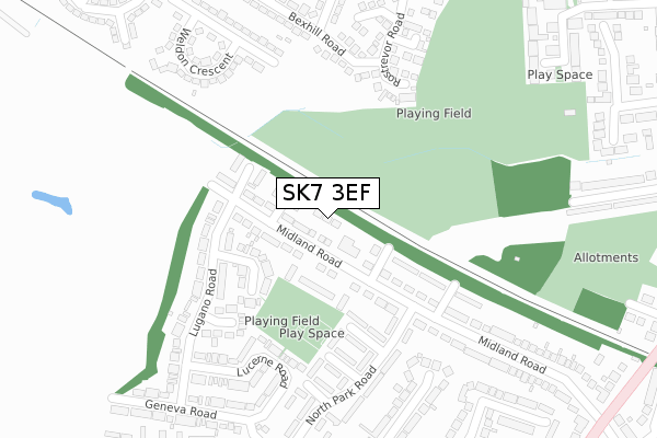
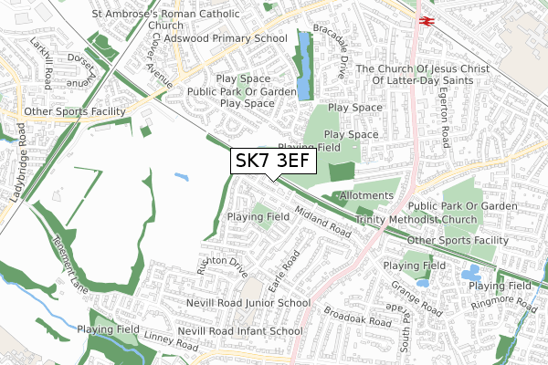
SK7 3EF is located in the Bramhall North electoral ward, within the metropolitan district of Stockport and the English Parliamentary constituency of Cheadle. The Sub Integrated Care Board (ICB) Location is NHS Greater Manchester ICB - 01W and the police force is Greater Manchester. This postcode has been in use since October 2018.


GetTheData
Source: OS Open Zoomstack (Ordnance Survey)
Licence: Open Government Licence (requires attribution)
Attribution: Contains OS data © Crown copyright and database right 2024
Source: Open Postcode Geo
Licence: Open Government Licence (requires attribution)
Attribution: Contains OS data © Crown copyright and database right 2024; Contains Royal Mail data © Royal Mail copyright and database right 2024; Source: Office for National Statistics licensed under the Open Government Licence v.3.0
| Easting | 389262 |
| Northing | 387496 |
| Latitude | 53.384215 |
| Longitude | -2.162900 |
GetTheData
Source: Open Postcode Geo
Licence: Open Government Licence
| Country | England |
| Postcode District | SK7 |
| ➜ SK7 open data dashboard ➜ See where SK7 is on a map ➜ Where is Bramhall? | |
GetTheData
Source: Land Registry Price Paid Data
Licence: Open Government Licence
| Ward | Bramhall North |
| Constituency | Cheadle |
GetTheData
Source: ONS Postcode Database
Licence: Open Government Licence
| June 2022 | Anti-social behaviour | On or near Heaton Avenue | 490m |
| January 2022 | Violence and sexual offences | On or near Geneva Road | 365m |
| January 2022 | Violence and sexual offences | On or near Geneva Road | 365m |
| ➜ Get more crime data in our Crime section | |||
GetTheData
Source: data.police.uk
Licence: Open Government Licence
| Midland Rd/Parkside Social Club (Midland Rd) | Bramhall Green | 56m |
| Lugano Road | Bramhall Green | 162m |
| Lugano Rd/Zurich Gardens (Lugano Rd) | Bramhall Green | 223m |
| North Park Rd/Handley Rd (North Park Rd) | Bramhall Green | 358m |
| Geneva Rd (Geneva Road) | Bramhall Green | 366m |
| Davenport Station | 1km |
| Woodsmoor Station | 1.4km |
| Cheadle Hulme Station | 1.9km |
GetTheData
Source: NaPTAN
Licence: Open Government Licence
| Percentage of properties with Next Generation Access | 100.0% |
| Percentage of properties with Superfast Broadband | 100.0% |
| Percentage of properties with Ultrafast Broadband | 0.0% |
| Percentage of properties with Full Fibre Broadband | 0.0% |
Superfast Broadband is between 30Mbps and 300Mbps
Ultrafast Broadband is > 300Mbps
| Percentage of properties unable to receive 2Mbps | 0.0% |
| Percentage of properties unable to receive 5Mbps | 0.0% |
| Percentage of properties unable to receive 10Mbps | 0.0% |
| Percentage of properties unable to receive 30Mbps | 0.0% |
GetTheData
Source: Ofcom
Licence: Ofcom Terms of Use (requires attribution)
GetTheData
Source: ONS Postcode Database
Licence: Open Government Licence


➜ Get more ratings from the Food Standards Agency
GetTheData
Source: Food Standards Agency
Licence: FSA terms & conditions
| Last Collection | |||
|---|---|---|---|
| Location | Mon-Fri | Sat | Distance |
| North Park Road | 18:00 | 12:45 | 392m |
| Bracadale Drive | 17:30 | 12:00 | 547m |
| Grange Road | 17:45 | 12:30 | 623m |
GetTheData
Source: Dracos
Licence: Creative Commons Attribution-ShareAlike
| Facility | Distance |
|---|---|
| Davenport Playing Fields Highfield Close, Davenport, Stockport Grass Pitches | 403m |
| Nevill Road Junior School Nevill Road, Bramhall, Stockport Grass Pitches | 606m |
| Adswood Primary School Garners Lane, Stockport Grass Pitches | 660m |
GetTheData
Source: Active Places
Licence: Open Government Licence
| School | Phase of Education | Distance |
|---|---|---|
| Nevill Road Junior School Nevill Road, Bramhall, Stockport, SK7 3ET | Primary | 606m |
| Nevill Road Infant School Nevill Road, Bramhall, Stockport, SK7 3ET | Primary | 658m |
| Adswood Primary School Garners Lane, Adswood, Stockport, SK3 8PQ | Primary | 751m |
GetTheData
Source: Edubase
Licence: Open Government Licence
The below table lists the International Territorial Level (ITL) codes (formerly Nomenclature of Territorial Units for Statistics (NUTS) codes) and Local Administrative Units (LAU) codes for SK7 3EF:
| ITL 1 Code | Name |
|---|---|
| TLD | North West (England) |
| ITL 2 Code | Name |
| TLD3 | Greater Manchester |
| ITL 3 Code | Name |
| TLD35 | Greater Manchester South East |
| LAU 1 Code | Name |
| E08000007 | Stockport |
GetTheData
Source: ONS Postcode Directory
Licence: Open Government Licence
The below table lists the Census Output Area (OA), Lower Layer Super Output Area (LSOA), and Middle Layer Super Output Area (MSOA) for SK7 3EF:
| Code | Name | |
|---|---|---|
| OA | E00030012 | |
| LSOA | E01005928 | Stockport 032B |
| MSOA | E02001218 | Stockport 032 |
GetTheData
Source: ONS Postcode Directory
Licence: Open Government Licence
| SK7 3DU | Basle Close | 50m |
| SK7 3DT | Midland Road | 74m |
| SK7 3JD | Parkside Walk | 105m |
| SK7 3DX | Berne Close | 122m |
| SK7 3HY | Lausanne Road | 157m |
| SK7 3HX | Lugano Road | 178m |
| SK7 3DS | Midland Walk | 180m |
| SK7 3HR | Yeardsley Close | 189m |
| SK7 3HP | Chinley Close | 206m |
| SK3 8UZ | Bexhill Road | 235m |
GetTheData
Source: Open Postcode Geo; Land Registry Price Paid Data
Licence: Open Government Licence