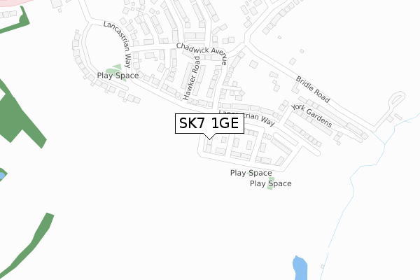
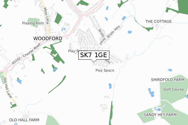
SK7 1GE is located in the Bramhall South & Woodford electoral ward, within the metropolitan district of Stockport and the English Parliamentary constituency of Cheadle. The Sub Integrated Care Board (ICB) Location is NHS Greater Manchester ICB - 01W and the police force is Greater Manchester. This postcode has been in use since November 2018.


GetTheData
Source: OS Open Zoomstack (Ordnance Survey)
Licence: Open Government Licence (requires attribution)
Attribution: Contains OS data © Crown copyright and database right 2024
Source: Open Postcode Geo
Licence: Open Government Licence (requires attribution)
Attribution: Contains OS data © Crown copyright and database right 2024; Contains Royal Mail data © Royal Mail copyright and database right 2024; Source: Office for National Statistics licensed under the Open Government Licence v.3.0
| Easting | 389757 |
| Northing | 382332 |
| Latitude | 53.337808 |
| Longitude | -2.155290 |
GetTheData
Source: Open Postcode Geo
Licence: Open Government Licence
| Country | England |
| Postcode District | SK7 |
| ➜ SK7 open data dashboard ➜ See where SK7 is on a map ➜ Where is Woodford? | |
GetTheData
Source: Land Registry Price Paid Data
Licence: Open Government Licence
| Ward | Bramhall South & Woodford |
| Constituency | Cheadle |
GetTheData
Source: ONS Postcode Database
Licence: Open Government Licence
49, RINGWAY AVENUE, WOODFORD, STOCKPORT, SK7 1GE 2022 16 DEC £622,995 |
47, RINGWAY AVENUE, WOODFORD, STOCKPORT, SK7 1GE 2022 16 DEC £550,995 |
39, RINGWAY AVENUE, WOODFORD, STOCKPORT, SK7 1GE 2022 18 NOV £548,995 |
37, RINGWAY AVENUE, WOODFORD, STOCKPORT, SK7 1GE 2022 11 NOV £598,995 |
35, RINGWAY AVENUE, WOODFORD, STOCKPORT, SK7 1GE 2022 4 NOV £605,995 |
33, RINGWAY AVENUE, WOODFORD, STOCKPORT, SK7 1GE 2022 28 OCT £649,995 |
31, RINGWAY AVENUE, WOODFORD, STOCKPORT, SK7 1GE 2022 21 OCT £568,995 |
29, RINGWAY AVENUE, WOODFORD, STOCKPORT, SK7 1GE 2022 14 OCT £542,995 |
27, RINGWAY AVENUE, WOODFORD, STOCKPORT, SK7 1GE 2022 7 OCT £496,995 |
2021 29 JUN £615,000 |
GetTheData
Source: HM Land Registry Price Paid Data
Licence: Contains HM Land Registry data © Crown copyright and database right 2024. This data is licensed under the Open Government Licence v3.0.
| February 2021 | Anti-social behaviour | On or near Bridle Road | 494m |
| ➜ Get more crime data in our Crime section | |||
GetTheData
Source: data.police.uk
Licence: Open Government Licence
| Chester Rd/British Aerospace (Chester Rd) | Woodford | 652m |
| Chester Rd/British Aerospace (Chester Rd) | Woodford | 670m |
| Chester Rd/Woodford Rd (Chester Rd) | Woodford | 682m |
| Chester Rd/Woodford Rd (Chester Rd) | Woodford | 718m |
| Chester Rd/Woodford Rd (Chester Rd) | Woodford | 781m |
| Poynton Station | 2km |
| Adlington (Cheshire) Station | 2.5km |
| Bramhall Station | 2.6km |
GetTheData
Source: NaPTAN
Licence: Open Government Licence
| Percentage of properties with Next Generation Access | 100.0% |
| Percentage of properties with Superfast Broadband | 100.0% |
| Percentage of properties with Ultrafast Broadband | 100.0% |
| Percentage of properties with Full Fibre Broadband | 100.0% |
Superfast Broadband is between 30Mbps and 300Mbps
Ultrafast Broadband is > 300Mbps
| Percentage of properties unable to receive 2Mbps | 0.0% |
| Percentage of properties unable to receive 5Mbps | 0.0% |
| Percentage of properties unable to receive 10Mbps | 0.0% |
| Percentage of properties unable to receive 30Mbps | 0.0% |
GetTheData
Source: Ofcom
Licence: Ofcom Terms of Use (requires attribution)
GetTheData
Source: ONS Postcode Database
Licence: Open Government Licence


➜ Get more ratings from the Food Standards Agency
GetTheData
Source: Food Standards Agency
Licence: FSA terms & conditions
| Last Collection | |||
|---|---|---|---|
| Location | Mon-Fri | Sat | Distance |
| Woodford Store | 17:15 | 11:30 | 704m |
| Bridle Road | 17:00 | 11:30 | 834m |
| Woodford Church | 17:00 | 08:00 | 1,201m |
GetTheData
Source: Dracos
Licence: Creative Commons Attribution-ShareAlike
| Facility | Distance |
|---|---|
| Avro Golf Club Old Hall Lane, Woodford, Stockport Golf | 889m |
| Woodford Cricket Club Moor Lane, Woodford, Stockport Grass Pitches | 960m |
| Adlington Golf Centre London Road, Adlington, Macclesfield Golf | 1km |
GetTheData
Source: Active Places
Licence: Open Government Licence
| School | Phase of Education | Distance |
|---|---|---|
| Woodford Primary School 1 Saunders Roe Way, Woodford, Stockport, SK7 1GX | Primary | 220m |
| Lostock Hall Primary School Mallard Crescent, Poynton, Stockport, SK12 1XG | Primary | 1.4km |
| Queensgate Primary School Albany Road, Bramhall, Stockport, SK7 1NE | Primary | 1.5km |
GetTheData
Source: Edubase
Licence: Open Government Licence
The below table lists the International Territorial Level (ITL) codes (formerly Nomenclature of Territorial Units for Statistics (NUTS) codes) and Local Administrative Units (LAU) codes for SK7 1GE:
| ITL 1 Code | Name |
|---|---|
| TLD | North West (England) |
| ITL 2 Code | Name |
| TLD3 | Greater Manchester |
| ITL 3 Code | Name |
| TLD35 | Greater Manchester South East |
| LAU 1 Code | Name |
| E08000007 | Stockport |
GetTheData
Source: ONS Postcode Directory
Licence: Open Government Licence
The below table lists the Census Output Area (OA), Lower Layer Super Output Area (LSOA), and Middle Layer Super Output Area (MSOA) for SK7 1GE:
| Code | Name | |
|---|---|---|
| OA | E00030010 | |
| LSOA | E01005926 | Stockport 042C |
| MSOA | E02001228 | Stockport 042 |
GetTheData
Source: ONS Postcode Directory
Licence: Open Government Licence
| SK7 1QN | Bridle Road | 422m |
| SK7 1QL | Bridle Way | 546m |
| SK7 1QP | Chester Road | 590m |
| SK7 1QJ | Bridle Road | 606m |
| SK7 1QH | Bridle Road | 643m |
| SK7 1QW | Bridle Court | 654m |
| SK7 1QS | Chester Road | 714m |
| SK7 1QQ | Chester Road | 859m |
| SK7 1PP | Moor Lane | 873m |
| SK7 1PR | Chester Road | 905m |
GetTheData
Source: Open Postcode Geo; Land Registry Price Paid Data
Licence: Open Government Licence