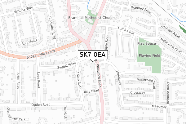
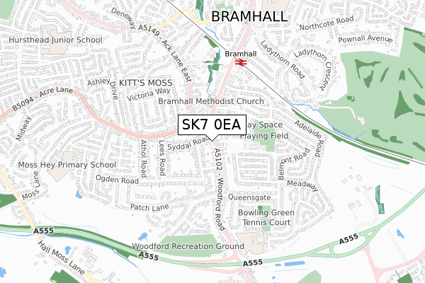
SK7 0EA is located in the Bramhall South & Woodford electoral ward, within the metropolitan district of Stockport and the English Parliamentary constituency of Cheadle. The Sub Integrated Care Board (ICB) Location is NHS Greater Manchester ICB - 01W and the police force is Greater Manchester. This postcode has been in use since August 2018.


GetTheData
Source: OS Open Zoomstack (Ordnance Survey)
Licence: Open Government Licence (requires attribution)
Attribution: Contains OS data © Crown copyright and database right 2024
Source: Open Postcode Geo
Licence: Open Government Licence (requires attribution)
Attribution: Contains OS data © Crown copyright and database right 2024; Contains Royal Mail data © Royal Mail copyright and database right 2024; Source: Office for National Statistics licensed under the Open Government Licence v.3.0
| Easting | 389081 |
| Northing | 384401 |
| Latitude | 53.356392 |
| Longitude | -2.165514 |
GetTheData
Source: Open Postcode Geo
Licence: Open Government Licence
| Country | England |
| Postcode District | SK7 |
| ➜ SK7 open data dashboard ➜ See where SK7 is on a map ➜ Where is Bramhall? | |
GetTheData
Source: Land Registry Price Paid Data
Licence: Open Government Licence
| Ward | Bramhall South & Woodford |
| Constituency | Cheadle |
GetTheData
Source: ONS Postcode Database
Licence: Open Government Licence
| Woodford Rd/Meadway (Woodford Rd) | Bramhall | 28m |
| Woodford Rd/Meadway (Woodford Rd) | Bramhall | 83m |
| Moss Ln/Ack Ln East (Moss Ln) | Bramhall | 146m |
| Moss Ln/Ack Ln East (Moss Ln) | Bramhall | 157m |
| Bramhall Ln South/Bramhall Village (Bramhall Ln Sth) | Bramhall | 182m |
| Bramhall Station | 0.5km |
| Poynton Station | 2.2km |
| Cheadle Hulme Station | 2.7km |
GetTheData
Source: NaPTAN
Licence: Open Government Licence
GetTheData
Source: ONS Postcode Database
Licence: Open Government Licence

➜ Get more ratings from the Food Standards Agency
GetTheData
Source: Food Standards Agency
Licence: FSA terms & conditions
| Last Collection | |||
|---|---|---|---|
| Location | Mon-Fri | Sat | Distance |
| Woodford Road | 18:00 | 11:30 | 14m |
| Maple Road | 18:00 | 11:45 | 82m |
| Maple Road | 18:00 | 11:45 | 88m |
GetTheData
Source: Dracos
Licence: Creative Commons Attribution-ShareAlike
| Facility | Distance |
|---|---|
| Anytime Fitness (Bramhall) The Bramhall Centre, Bramhall, Stockport Health and Fitness Gym, Studio | 191m |
| Lumb Lane Recreation Ground Lumb Lane, Bramhall, Stockport Grass Pitches | 293m |
| Bramhall Queensgate Tennis Club Queensgate, Bramhall, Stockport Sports Hall, Outdoor Tennis Courts | 552m |
GetTheData
Source: Active Places
Licence: Open Government Licence
| School | Phase of Education | Distance |
|---|---|---|
| Queensgate Primary School Albany Road, Bramhall, Stockport, SK7 1NE | Primary | 650m |
| Moss Hey Primary School Eskdale Avenue, Bramhall, Stockport, SK7 1DS | Primary | 820m |
| Valley School Whitehaven Road, Bramhall, Stockport, SK7 1EN | Not applicable | 917m |
GetTheData
Source: Edubase
Licence: Open Government Licence
The below table lists the International Territorial Level (ITL) codes (formerly Nomenclature of Territorial Units for Statistics (NUTS) codes) and Local Administrative Units (LAU) codes for SK7 0EA:
| ITL 1 Code | Name |
|---|---|
| TLD | North West (England) |
| ITL 2 Code | Name |
| TLD3 | Greater Manchester |
| ITL 3 Code | Name |
| TLD35 | Greater Manchester South East |
| LAU 1 Code | Name |
| E08000007 | Stockport |
GetTheData
Source: ONS Postcode Directory
Licence: Open Government Licence
The below table lists the Census Output Area (OA), Lower Layer Super Output Area (LSOA), and Middle Layer Super Output Area (MSOA) for SK7 0EA:
| Code | Name | |
|---|---|---|
| OA | E00030042 | |
| LSOA | E01005924 | Stockport 042A |
| MSOA | E02001228 | Stockport 042 |
GetTheData
Source: ONS Postcode Directory
Licence: Open Government Licence
| SK7 1JN | Woodford Road | 61m |
| SK7 1JJ | Woodford Road | 80m |
| SK7 2DJ | Maple Road | 83m |
| SK7 1PA | Woodford Road | 108m |
| SK7 2DH | Maple Road | 130m |
| SK7 1AF | Bramhall Lane South | 146m |
| SK7 1HG | Thorn Road | 150m |
| SK7 1JR | Woodford Road | 155m |
| SK7 1HQ | Thorn Road | 159m |
| SK7 1AL | Bramhall Lane South | 162m |
GetTheData
Source: Open Postcode Geo; Land Registry Price Paid Data
Licence: Open Government Licence