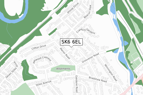
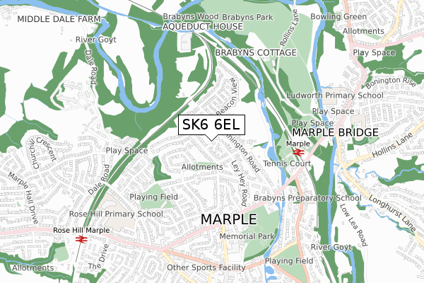
SK6 6EL is located in the Marple North electoral ward, within the metropolitan district of Stockport and the English Parliamentary constituency of Hazel Grove. The Sub Integrated Care Board (ICB) Location is NHS Greater Manchester ICB - 01W and the police force is Greater Manchester. This postcode has been in use since November 2018.


GetTheData
Source: OS Open Zoomstack (Ordnance Survey)
Licence: Open Government Licence (requires attribution)
Attribution: Contains OS data © Crown copyright and database right 2024
Source: Open Postcode Geo
Licence: Open Government Licence (requires attribution)
Attribution: Contains OS data © Crown copyright and database right 2024; Contains Royal Mail data © Royal Mail copyright and database right 2024; Source: Office for National Statistics licensed under the Open Government Licence v.3.0
| Easting | 395784 |
| Northing | 389382 |
| Latitude | 53.401260 |
| Longitude | -2.064873 |
GetTheData
Source: Open Postcode Geo
Licence: Open Government Licence
| Country | England |
| Postcode District | SK6 |
| ➜ SK6 open data dashboard ➜ See where SK6 is on a map ➜ Where is Marple? | |
GetTheData
Source: Land Registry Price Paid Data
Licence: Open Government Licence
| Ward | Marple North |
| Constituency | Hazel Grove |
GetTheData
Source: ONS Postcode Database
Licence: Open Government Licence
2, BRAMLEY GARDENS, MARPLE, STOCKPORT, SK6 6EL 2018 7 DEC £585,000 |
1, BRAMLEY GARDENS, MARPLE, STOCKPORT, SK6 6EL 2018 31 OCT £658,317 |
GetTheData
Source: HM Land Registry Price Paid Data
Licence: Contains HM Land Registry data © Crown copyright and database right 2024. This data is licensed under the Open Government Licence v3.0.
| Grosvenor Rd (Ebd) (Grosvenor Road) | Marple | 143m |
| Winnington Rd (Nwbd) (Winnington Road) | Marple | 410m |
| Oakdene Rd (Wbd) (Oakdene Road) | Marple | 422m |
| Station Rd/Ley Hey Rd (Station Rd) | Marple | 458m |
| Brabyns Brow/Marple Stn (Brabyns Brow) | Marple | 553m |
| Marple Station | 0.5km |
| Rose Hill Marple Station | 1km |
| Romiley Station | 2.2km |
GetTheData
Source: NaPTAN
Licence: Open Government Licence
➜ Broadband speed and availability dashboard for SK6 6EL
| Percentage of properties with Next Generation Access | 100.0% |
| Percentage of properties with Superfast Broadband | 100.0% |
| Percentage of properties with Ultrafast Broadband | 100.0% |
| Percentage of properties with Full Fibre Broadband | 0.0% |
Superfast Broadband is between 30Mbps and 300Mbps
Ultrafast Broadband is > 300Mbps
| Median download speed | 37.2Mbps |
| Average download speed | 38.5Mbps |
| Maximum download speed | 43.99Mbps |
| Median upload speed | 9.0Mbps |
| Average upload speed | 9.6Mbps |
| Maximum upload speed | 13.52Mbps |
| Percentage of properties unable to receive 2Mbps | 0.0% |
| Percentage of properties unable to receive 5Mbps | 0.0% |
| Percentage of properties unable to receive 10Mbps | 0.0% |
| Percentage of properties unable to receive 30Mbps | 0.0% |
➜ Broadband speed and availability dashboard for SK6 6EL
GetTheData
Source: Ofcom
Licence: Ofcom Terms of Use (requires attribution)
GetTheData
Source: ONS Postcode Database
Licence: Open Government Licence


➜ Get more ratings from the Food Standards Agency
GetTheData
Source: Food Standards Agency
Licence: FSA terms & conditions
| Last Collection | |||
|---|---|---|---|
| Location | Mon-Fri | Sat | Distance |
| Manor Road | 17:45 | 11:30 | 141m |
| Jessop Dr | 17:45 | 11:30 | 208m |
| Station Road | 17:45 | 11:30 | 448m |
GetTheData
Source: Dracos
Licence: Creative Commons Attribution-ShareAlike
| Facility | Distance |
|---|---|
| Brabyns Lawn Tennis Club Brabyns Brow, Brabyns Brow, Marple Bridge, Stockport Outdoor Tennis Courts | 434m |
| Marple Sports Club Bowden Lane, Marple, Stockport Grass Pitches, Squash Courts | 451m |
| Rose Hill Primary School Elmfield Drive, Marple, Stockport Grass Pitches, Sports Hall | 736m |
GetTheData
Source: Active Places
Licence: Open Government Licence
| School | Phase of Education | Distance |
|---|---|---|
| Brabyns Preparatory School 34-36 Arkwright Road, Marple, Stockport, SK6 7DB | Not applicable | 652m |
| Rose Hill Primary School Elmfield Drive, Marple, Stockport, SK6 6DW | Primary | 735m |
| Ludworth Primary School Ludworth Primary School, Lower Fold, Marple Bridge, Stockport, SK6 5DU | Primary | 827m |
GetTheData
Source: Edubase
Licence: Open Government Licence
The below table lists the International Territorial Level (ITL) codes (formerly Nomenclature of Territorial Units for Statistics (NUTS) codes) and Local Administrative Units (LAU) codes for SK6 6EL:
| ITL 1 Code | Name |
|---|---|
| TLD | North West (England) |
| ITL 2 Code | Name |
| TLD3 | Greater Manchester |
| ITL 3 Code | Name |
| TLD35 | Greater Manchester South East |
| LAU 1 Code | Name |
| E08000007 | Stockport |
GetTheData
Source: ONS Postcode Directory
Licence: Open Government Licence
The below table lists the Census Output Area (OA), Lower Layer Super Output Area (LSOA), and Middle Layer Super Output Area (MSOA) for SK6 6EL:
| Code | Name | |
|---|---|---|
| OA | E00029795 | |
| LSOA | E01005883 | Stockport 017C |
| MSOA | E02001203 | Stockport 017 |
GetTheData
Source: ONS Postcode Directory
Licence: Open Government Licence
| SK6 6PW | Manor Road | 40m |
| SK6 6PS | Ley Hey Avenue | 73m |
| SK6 6PT | Winnington Road | 76m |
| SK6 6PU | Crompton Close | 110m |
| SK6 6QF | Green Meadows | 127m |
| SK6 6PR | Grosvenor Road | 132m |
| SK6 6LD | Limefield Close | 140m |
| SK6 6QQ | Cranford Gardens | 192m |
| SK6 6PY | Kenilworth Close | 194m |
| SK6 6QE | Green Meadows Drive | 216m |
GetTheData
Source: Open Postcode Geo; Land Registry Price Paid Data
Licence: Open Government Licence