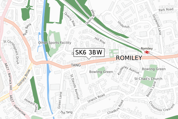
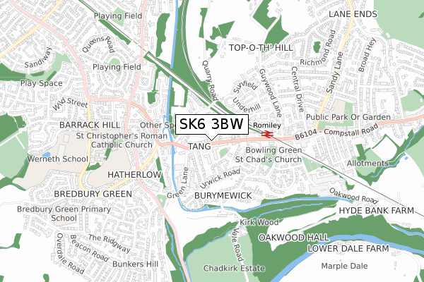
SK6 3BW is located in the Bredbury Green & Romiley electoral ward, within the metropolitan district of Stockport and the English Parliamentary constituency of Hazel Grove. The Sub Integrated Care Board (ICB) Location is NHS Greater Manchester ICB - 01W and the police force is Greater Manchester. This postcode has been in use since July 2018.


GetTheData
Source: OS Open Zoomstack (Ordnance Survey)
Licence: Open Government Licence (requires attribution)
Attribution: Contains OS data © Crown copyright and database right 2024
Source: Open Postcode Geo
Licence: Open Government Licence (requires attribution)
Attribution: Contains OS data © Crown copyright and database right 2024; Contains Royal Mail data © Royal Mail copyright and database right 2024; Source: Office for National Statistics licensed under the Open Government Licence v.3.0
| Easting | 393816 |
| Northing | 390773 |
| Latitude | 53.413744 |
| Longitude | -2.094500 |
GetTheData
Source: Open Postcode Geo
Licence: Open Government Licence
| Country | England |
| Postcode District | SK6 |
| ➜ SK6 open data dashboard ➜ See where SK6 is on a map ➜ Where is Romiley? | |
GetTheData
Source: Land Registry Price Paid Data
Licence: Open Government Licence
| Ward | Bredbury Green & Romiley |
| Constituency | Hazel Grove |
GetTheData
Source: ONS Postcode Database
Licence: Open Government Licence
| Stockport Rd/Duke Of York (Stockport Rd) | Romiley | 139m |
| Stockport Rd/Duke Of York (Stockport Rd) | Romiley | 175m |
| Stockport Rd/Romiley Stn (Stockport Rd) | Romiley | 317m |
| Stockport Rd/Romiley Stn (Stockport Rd) | Romiley | 345m |
| Underhill/Sunfield (Underhill) | Romiley | 377m |
| Romiley Station | 0.3km |
| Bredbury Station | 1.5km |
| Woodley Station | 1.7km |
GetTheData
Source: NaPTAN
Licence: Open Government Licence
GetTheData
Source: ONS Postcode Database
Licence: Open Government Licence


➜ Get more ratings from the Food Standards Agency
GetTheData
Source: Food Standards Agency
Licence: FSA terms & conditions
| Last Collection | |||
|---|---|---|---|
| Location | Mon-Fri | Sat | Distance |
| Romiley Precinct | 17:30 | 12:00 | 225m |
| Crossmoor Cres | 17:30 | 11:30 | 388m |
| Underhill | 17:15 | 11:30 | 397m |
GetTheData
Source: Dracos
Licence: Creative Commons Attribution-ShareAlike
| Facility | Distance |
|---|---|
| Romiley Methodist Church Stockport Road, Romiley, Stockport Sports Hall | 130m |
| Life Leisure Romiley Hole House Fold, Romiley, Stockport Swimming Pool, Health and Fitness Gym, Studio | 219m |
| Woodley Sports Centre Sports Village (Closed) Woodley, Stockport Grass Pitches | 317m |
GetTheData
Source: Active Places
Licence: Open Government Licence
| School | Phase of Education | Distance |
|---|---|---|
| St Christopher's Catholic Primary School Warwick Road, Romiley, Stockport, SK6 3AX | Primary | 610m |
| Harrytown Catholic High School Harrytown, Romiley, Stockport, SK6 3BU | Secondary | 664m |
| Romiley Primary School Sandy Lane, Romiley, Stockport, SK6 4NE | Primary | 688m |
GetTheData
Source: Edubase
Licence: Open Government Licence
The below table lists the International Territorial Level (ITL) codes (formerly Nomenclature of Territorial Units for Statistics (NUTS) codes) and Local Administrative Units (LAU) codes for SK6 3BW:
| ITL 1 Code | Name |
|---|---|
| TLD | North West (England) |
| ITL 2 Code | Name |
| TLD3 | Greater Manchester |
| ITL 3 Code | Name |
| TLD35 | Greater Manchester South East |
| LAU 1 Code | Name |
| E08000007 | Stockport |
GetTheData
Source: ONS Postcode Directory
Licence: Open Government Licence
The below table lists the Census Output Area (OA), Lower Layer Super Output Area (LSOA), and Middle Layer Super Output Area (MSOA) for SK6 3BW:
| Code | Name | |
|---|---|---|
| OA | E00029884 | |
| LSOA | E01005900 | Stockport 010C |
| MSOA | E02001196 | Stockport 010 |
GetTheData
Source: ONS Postcode Directory
Licence: Open Government Licence
| SK6 3BJ | Metcalfe Drive | 52m |
| SK6 3BF | Metcalfe Drive | 76m |
| SK6 3BG | Metcalfe Drive | 104m |
| SK6 3AN | Stockport Road | 107m |
| SK6 3AP | Hill Rise | 108m |
| SK6 4BD | Rocklynes | 115m |
| SK6 3AR | Bonnyfields | 123m |
| SK6 3JL | Green Tree Gardens | 133m |
| SK6 3AQ | Stockport Road | 134m |
| SK6 3AA | Stockport Road | 143m |
GetTheData
Source: Open Postcode Geo; Land Registry Price Paid Data
Licence: Open Government Licence