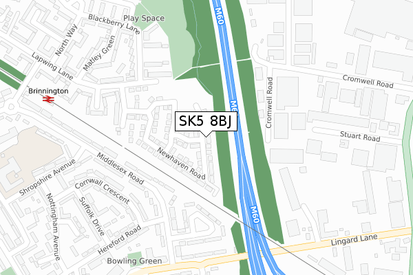
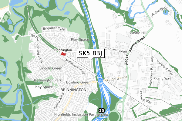
SK5 8BJ is located in the Brinnington & Stockport Central electoral ward, within the metropolitan district of Stockport and the English Parliamentary constituency of Stockport. The Sub Integrated Care Board (ICB) Location is NHS Greater Manchester ICB - 01W and the police force is Greater Manchester. This postcode has been in use since August 2019.


GetTheData
Source: OS Open Zoomstack (Ordnance Survey)
Licence: Open Government Licence (requires attribution)
Attribution: Contains OS data © Crown copyright and database right 2024
Source: Open Postcode Geo
Licence: Open Government Licence (requires attribution)
Attribution: Contains OS data © Crown copyright and database right 2024; Contains Royal Mail data © Royal Mail copyright and database right 2024; Source: Office for National Statistics licensed under the Open Government Licence v.3.0
| Easting | 391566 |
| Northing | 392751 |
| Latitude | 53.431491 |
| Longitude | -2.128403 |
GetTheData
Source: Open Postcode Geo
Licence: Open Government Licence
| Country | England |
| Postcode District | SK5 |
| ➜ SK5 open data dashboard ➜ See where SK5 is on a map ➜ Where is Stockport? | |
GetTheData
Source: Land Registry Price Paid Data
Licence: Open Government Licence
| Ward | Brinnington & Stockport Central |
| Constituency | Stockport |
GetTheData
Source: ONS Postcode Database
Licence: Open Government Licence
43, EASTBOURNE CRESCENT, STOCKPORT, SK5 8BJ 2020 31 MAR £234,995 |
GetTheData
Source: HM Land Registry Price Paid Data
Licence: Contains HM Land Registry data © Crown copyright and database right 2024. This data is licensed under the Open Government Licence v3.0.
| Middlesex Rd/Shropshire Ave (Middlesex Rd) | Brinnington | 233m |
| Middlesex Road | Brinnington | 269m |
| Middlesex Rd/Brinnington Hall (Middlesex Rd) | Brinnington | 312m |
| Middlesex Road | Brinnington | 324m |
| Lingard Lane/Essex Road (Lingard Lane) | Brinnington | 330m |
| Brinnington Station | 0.5km |
| Bredbury Station | 1.5km |
| Reddish South Station | 2.1km |
GetTheData
Source: NaPTAN
Licence: Open Government Licence
GetTheData
Source: ONS Postcode Database
Licence: Open Government Licence


➜ Get more ratings from the Food Standards Agency
GetTheData
Source: Food Standards Agency
Licence: FSA terms & conditions
| Last Collection | |||
|---|---|---|---|
| Location | Mon-Fri | Sat | Distance |
| The Link | 17:15 | 12:15 | 523m |
| Cromwell Road | 17:30 | 11:30 | 526m |
| Brinnington Tso | 17:15 | 12:00 | 625m |
GetTheData
Source: Dracos
Licence: Creative Commons Attribution-ShareAlike
| Facility | Distance |
|---|---|
| Life Leisure Lapwing (Closed) Lapwing Lane, Stockport Sports Hall, Health and Fitness Gym, Grass Pitches | 140m |
| Castle Hill High School (Closed) Lapwing Lane, Stockport Grass Pitches, Sports Hall | 141m |
| Westmorland Primary School Westmorland Drive, Stockport Grass Pitches, Artificial Grass Pitch | 508m |
GetTheData
Source: Active Places
Licence: Open Government Licence
| School | Phase of Education | Distance |
|---|---|---|
| The Retreat Ercall Heath, Telford, Shopshire, Tf6 6pn | Not applicable | 458m |
| Rosa House School Bronte Farm, Halifax Road, Briercliffe, Burnley, BB10 3RB | Not applicable | 458m |
| Bridge House School 1 Stuart Road, Bredbury, Stockport, SK6 2SR | Not applicable | 458m |
GetTheData
Source: Edubase
Licence: Open Government Licence
The below table lists the International Territorial Level (ITL) codes (formerly Nomenclature of Territorial Units for Statistics (NUTS) codes) and Local Administrative Units (LAU) codes for SK5 8BJ:
| ITL 1 Code | Name |
|---|---|
| TLD | North West (England) |
| ITL 2 Code | Name |
| TLD3 | Greater Manchester |
| ITL 3 Code | Name |
| TLD35 | Greater Manchester South East |
| LAU 1 Code | Name |
| E08000007 | Stockport |
GetTheData
Source: ONS Postcode Directory
Licence: Open Government Licence
The below table lists the Census Output Area (OA), Lower Layer Super Output Area (LSOA), and Middle Layer Super Output Area (MSOA) for SK5 8BJ:
| Code | Name | |
|---|---|---|
| OA | E00029166 | |
| LSOA | E01005756 | Stockport 004D |
| MSOA | E02001190 | Stockport 004 |
GetTheData
Source: ONS Postcode Directory
Licence: Open Government Licence
| SK5 8LF | Lapwing Lane | 177m |
| SK5 8LG | Polletts Avenue | 219m |
| SK5 8LE | Grasscroft | 222m |
| SK5 8HS | Middlesex Road | 225m |
| SK5 8HU | Rutland Crescent | 225m |
| SK5 8JQ | Naburn Close | 263m |
| SK5 8LB | Blackberry Lane | 263m |
| SK5 8JF | Lapwing Lane | 297m |
| SK5 8HB | Cornwall Crescent | 300m |
| SK5 8HT | Middlesex Road | 301m |
GetTheData
Source: Open Postcode Geo; Land Registry Price Paid Data
Licence: Open Government Licence