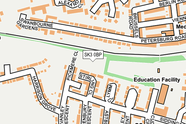
SK3 0BP is located in the Davenport & Cale Green electoral ward, within the metropolitan district of Stockport and the English Parliamentary constituency of Stockport. The Sub Integrated Care Board (ICB) Location is NHS Greater Manchester ICB - 01W and the police force is Greater Manchester. This postcode has been in use since July 2017.


GetTheData
Source: OS OpenMap – Local (Ordnance Survey)
Source: OS VectorMap District (Ordnance Survey)
Licence: Open Government Licence (requires attribution)
| Easting | 388506 |
| Northing | 388744 |
| Latitude | 53.395416 |
| Longitude | -2.174312 |
GetTheData
Source: Open Postcode Geo
Licence: Open Government Licence
| Country | England |
| Postcode District | SK3 |
| ➜ SK3 open data dashboard ➜ See where SK3 is on a map ➜ Where is Stockport? | |
GetTheData
Source: Land Registry Price Paid Data
Licence: Open Government Licence
| Ward | Davenport & Cale Green |
| Constituency | Stockport |
GetTheData
Source: ONS Postcode Database
Licence: Open Government Licence
2, PANAMA CLOSE, STOCKPORT, SK3 0BP 2019 25 JAN £196,995 |
GetTheData
Source: HM Land Registry Price Paid Data
Licence: Contains HM Land Registry data © Crown copyright and database right 2024. This data is licensed under the Open Government Licence v3.0.
| August 2022 | Violence and sexual offences | On or near Orchard Vale | 425m |
| March 2022 | Criminal damage and arson | On or near Europa Way | 458m |
| March 2022 | Public order | On or near Europa Way | 458m |
| ➜ Get more crime data in our Crime section | |||
GetTheData
Source: data.police.uk
Licence: Open Government Licence
| Siddington Ave/Stirling Cl (Siddington Ave) | Adswood | 106m |
| Alvanley Cres/Rainow Rd (Alvanley Cres) | Adswood | 234m |
| Siddington Ave/Primary Sch (Siddington Ave) | Adswood | 264m |
| Dale St/Vienna Rd (Dale St) | Edgeley | 288m |
| Chelford Gr/Daresbury Cl (Chelford Gr) | Adswood | 303m |
| Stockport Station | 1.4km |
| Davenport Station | 1.5km |
| Cheadle Hulme Station | 2.4km |
GetTheData
Source: NaPTAN
Licence: Open Government Licence
➜ Broadband speed and availability dashboard for SK3 0BP
| Percentage of properties with Next Generation Access | 100.0% |
| Percentage of properties with Superfast Broadband | 88.9% |
| Percentage of properties with Ultrafast Broadband | 0.0% |
| Percentage of properties with Full Fibre Broadband | 0.0% |
Superfast Broadband is between 30Mbps and 300Mbps
Ultrafast Broadband is > 300Mbps
| Median download speed | 73.9Mbps |
| Average download speed | 54.3Mbps |
| Maximum download speed | 78.12Mbps |
| Median upload speed | 19.5Mbps |
| Average upload speed | 14.2Mbps |
| Maximum upload speed | 20.00Mbps |
| Percentage of properties unable to receive 2Mbps | 11.1% |
| Percentage of properties unable to receive 5Mbps | 11.1% |
| Percentage of properties unable to receive 10Mbps | 11.1% |
| Percentage of properties unable to receive 30Mbps | 11.1% |
➜ Broadband speed and availability dashboard for SK3 0BP
GetTheData
Source: Ofcom
Licence: Ofcom Terms of Use (requires attribution)
GetTheData
Source: ONS Postcode Database
Licence: Open Government Licence


➜ Get more ratings from the Food Standards Agency
GetTheData
Source: Food Standards Agency
Licence: FSA terms & conditions
| Last Collection | |||
|---|---|---|---|
| Location | Mon-Fri | Sat | Distance |
| Bridge Hall Tso | 17:15 | 12:15 | 266m |
| 129 Edgerley Road | 17:30 | 11:45 | 533m |
| Berlin Road | 17:30 | 11:45 | 537m |
GetTheData
Source: Dracos
Licence: Creative Commons Attribution-ShareAlike
| Facility | Distance |
|---|---|
| Bridge Hall Primary School Cuddington Crescent, Stockport Grass Pitches | 227m |
| Bakery Bridge Rostrevor Road, Adswood, Stockport Grass Pitches | 620m |
| St Ambrose Rc Primary School Rostrevor Road, Stockport Grass Pitches | 646m |
GetTheData
Source: Active Places
Licence: Open Government Licence
| School | Phase of Education | Distance |
|---|---|---|
| Bridge Hall Primary School Cuddington Crescent, Bridge Hall, Stockport, SK3 8LX | Primary | 227m |
| Alexandra Park Primary School Bombay Road, Edgeley, Stockport, SK3 9RF | Primary | 468m |
| St Ambrose Catholic Primary School Rostrevor Road, Adswood, Stockport, SK3 8LQ | Primary | 625m |
GetTheData
Source: Edubase
Licence: Open Government Licence
The below table lists the International Territorial Level (ITL) codes (formerly Nomenclature of Territorial Units for Statistics (NUTS) codes) and Local Administrative Units (LAU) codes for SK3 0BP:
| ITL 1 Code | Name |
|---|---|
| TLD | North West (England) |
| ITL 2 Code | Name |
| TLD3 | Greater Manchester |
| ITL 3 Code | Name |
| TLD35 | Greater Manchester South East |
| LAU 1 Code | Name |
| E08000007 | Stockport |
GetTheData
Source: ONS Postcode Directory
Licence: Open Government Licence
The below table lists the Census Output Area (OA), Lower Layer Super Output Area (LSOA), and Middle Layer Super Output Area (MSOA) for SK3 0BP:
| Code | Name | |
|---|---|---|
| OA | E00029198 | |
| LSOA | E01005762 | Stockport 026B |
| MSOA | E02001212 | Stockport 026 |
GetTheData
Source: ONS Postcode Directory
Licence: Open Government Licence
| SK3 9RA | Petersburg Road | 98m |
| SK3 8NP | Lymm Close | 100m |
| SK3 8NL | Pickmere Close | 117m |
| SK3 9RB | Petersburg Road | 134m |
| SK3 9RY | Newcroft Drive | 153m |
| SK3 8NJ | Aston Close | 156m |
| SK3 8NS | Kelsall Close | 158m |
| SK3 8NR | Siddington Avenue | 175m |
| SK3 9QZ | Petersburg Road | 187m |
| SK3 9QG | Brussels Road | 197m |
GetTheData
Source: Open Postcode Geo; Land Registry Price Paid Data
Licence: Open Government Licence