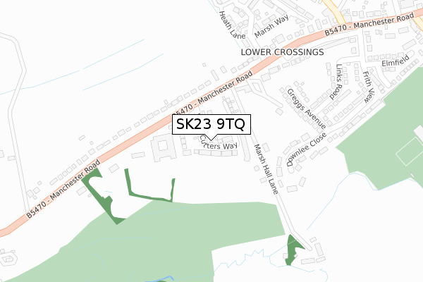
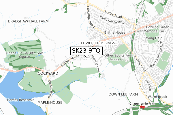
SK23 9TQ is located in the Blackbrook electoral ward, within the local authority district of High Peak and the English Parliamentary constituency of High Peak. The Sub Integrated Care Board (ICB) Location is NHS Derby and Derbyshire ICB - 15M and the police force is Derbyshire. This postcode has been in use since January 2018.


GetTheData
Source: OS Open Zoomstack (Ordnance Survey)
Licence: Open Government Licence (requires attribution)
Attribution: Contains OS data © Crown copyright and database right 2024
Source: Open Postcode Geo
Licence: Open Government Licence (requires attribution)
Attribution: Contains OS data © Crown copyright and database right 2024; Contains Royal Mail data © Royal Mail copyright and database right 2024; Source: Office for National Statistics licensed under the Open Government Licence v.3.0
| Easting | 404697 |
| Northing | 380186 |
| Latitude | 53.318599 |
| Longitude | -1.930953 |
GetTheData
Source: Open Postcode Geo
Licence: Open Government Licence
| Country | England |
| Postcode District | SK23 |
| ➜ SK23 open data dashboard ➜ See where SK23 is on a map ➜ Where is Chapel-en-le-Frith? | |
GetTheData
Source: Land Registry Price Paid Data
Licence: Open Government Licence
| Ward | Blackbrook |
| Constituency | High Peak |
GetTheData
Source: ONS Postcode Database
Licence: Open Government Licence
| June 2022 | Violence and sexual offences | On or near Chapel Police Station | 219m |
| June 2022 | Anti-social behaviour | On or near Frith View | 335m |
| June 2022 | Violence and sexual offences | On or near Elmfield | 456m |
| ➜ Get more crime data in our Crime section | |||
GetTheData
Source: data.police.uk
Licence: Open Government Licence
| Whitestones (Manchester Road) | Chapel En Le Frith | 141m |
| Whitestones (Manchester Road) | Chapel En Le Frith | 174m |
| Crossings Road (Manchester Road) | Chapel En Le Frith | 356m |
| Lower Crossings (Crossings Road) | Chapel En Le Frith | 435m |
| Crossings Road (Manchester Road) | Chapel En Le Frith | 446m |
| Chapel-en-le-Frith Station | 1.1km |
| Chinley Station | 2.6km |
| Dove Holes Station | 3.4km |
GetTheData
Source: NaPTAN
Licence: Open Government Licence
| Percentage of properties with Next Generation Access | 100.0% |
| Percentage of properties with Superfast Broadband | 100.0% |
| Percentage of properties with Ultrafast Broadband | 100.0% |
| Percentage of properties with Full Fibre Broadband | 100.0% |
Superfast Broadband is between 30Mbps and 300Mbps
Ultrafast Broadband is > 300Mbps
| Percentage of properties unable to receive 2Mbps | 0.0% |
| Percentage of properties unable to receive 5Mbps | 0.0% |
| Percentage of properties unable to receive 10Mbps | 0.0% |
| Percentage of properties unable to receive 30Mbps | 0.0% |
GetTheData
Source: Ofcom
Licence: Ofcom Terms of Use (requires attribution)
GetTheData
Source: ONS Postcode Database
Licence: Open Government Licence


➜ Get more ratings from the Food Standards Agency
GetTheData
Source: Food Standards Agency
Licence: FSA terms & conditions
| Last Collection | |||
|---|---|---|---|
| Location | Mon-Fri | Sat | Distance |
| Manchester Road | 17:15 | 10:15 | 567m |
| Spencer Road | 17:15 | 08:00 | 620m |
| Eccles Road | 17:15 | 09:30 | 791m |
GetTheData
Source: Dracos
Licence: Creative Commons Attribution-ShareAlike
| Facility | Distance |
|---|---|
| Chapel Leisure Centre Long Lane, Chapel-en-le-frith Sports Hall, Health and Fitness Gym, Artificial Grass Pitch, Studio, Grass Pitches | 496m |
| Chapel-en-le-frith High School Long Lane, Chapel-en-le-frith, High Peak Grass Pitches | 577m |
| Chapel-en-le-frith Golf Club Ltd Manchester Road, Chapel-en-le-frith, High Peak Golf | 683m |
GetTheData
Source: Active Places
Licence: Open Government Licence
| School | Phase of Education | Distance |
|---|---|---|
| Chapel-en-le-Frith High School Long Lane, Chapel-en-le-Frith, High Peak, SK23 0TQ | Secondary | 579m |
| Chapel-en-le-Frith CofE VC Primary School Warmbrook Road, Chapel-en-le-Frith, High Peak, SK23 0NL | Primary | 1.6km |
| Combs Infant School Lesser Lane, Chapel-en-le-Frith, Combs High Peak, SK23 9UZ | Primary | 1.9km |
GetTheData
Source: Edubase
Licence: Open Government Licence
The below table lists the International Territorial Level (ITL) codes (formerly Nomenclature of Territorial Units for Statistics (NUTS) codes) and Local Administrative Units (LAU) codes for SK23 9TQ:
| ITL 1 Code | Name |
|---|---|
| TLF | East Midlands (England) |
| ITL 2 Code | Name |
| TLF1 | Derbyshire and Nottinghamshire |
| ITL 3 Code | Name |
| TLF13 | South and West Derbyshire |
| LAU 1 Code | Name |
| E07000037 | High Peak |
GetTheData
Source: ONS Postcode Directory
Licence: Open Government Licence
The below table lists the Census Output Area (OA), Lower Layer Super Output Area (LSOA), and Middle Layer Super Output Area (MSOA) for SK23 9TQ:
| Code | Name | |
|---|---|---|
| OA | E00099729 | |
| LSOA | E01019713 | High Peak 008B |
| MSOA | E02004100 | High Peak 008 |
GetTheData
Source: ONS Postcode Directory
Licence: Open Government Licence
| SK23 9TP | Manchester Road | 128m |
| SK23 9TN | Manchester Road | 194m |
| SK23 9TR | Downlee Close | 216m |
| SK23 9TU | Greggs Avenue | 217m |
| SK23 9AB | Heath Lane | 282m |
| SK23 9TX | Links Road | 304m |
| SK23 9AA | Orchid Drive | 311m |
| SK23 9UQ | Marsh Hall Lane | 351m |
| SK23 9TT | Frith View | 351m |
| SK23 9RZ | Crossings Road | 409m |
GetTheData
Source: Open Postcode Geo; Land Registry Price Paid Data
Licence: Open Government Licence