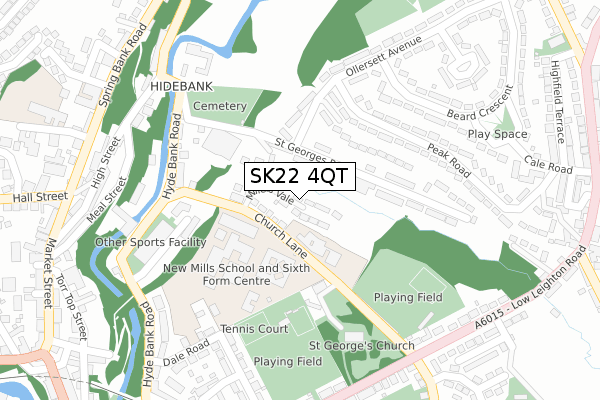
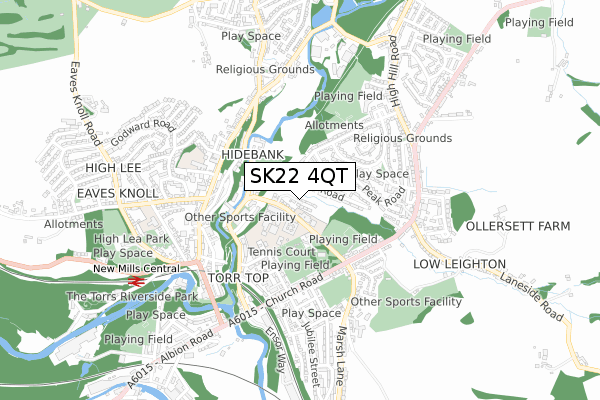
SK22 4QT is located in the New Mills East electoral ward, within the local authority district of High Peak and the English Parliamentary constituency of High Peak. The Sub Integrated Care Board (ICB) Location is NHS Derby and Derbyshire ICB - 15M and the police force is Derbyshire. This postcode has been in use since July 2018.


GetTheData
Source: OS Open Zoomstack (Ordnance Survey)
Licence: Open Government Licence (requires attribution)
Attribution: Contains OS data © Crown copyright and database right 2024
Source: Open Postcode Geo
Licence: Open Government Licence (requires attribution)
Attribution: Contains OS data © Crown copyright and database right 2024; Contains Royal Mail data © Royal Mail copyright and database right 2024; Source: Office for National Statistics licensed under the Open Government Licence v.3.0
| Easting | 400398 |
| Northing | 385670 |
| Latitude | 53.367912 |
| Longitude | -1.995481 |
GetTheData
Source: Open Postcode Geo
Licence: Open Government Licence
| Country | England |
| Postcode District | SK22 |
| ➜ SK22 open data dashboard ➜ See where SK22 is on a map ➜ Where is New Mills? | |
GetTheData
Source: Land Registry Price Paid Data
Licence: Open Government Licence
| Ward | New Mills East |
| Constituency | High Peak |
GetTheData
Source: ONS Postcode Database
Licence: Open Government Licence
19, MILLERS VALE, NEW MILLS, HIGH PEAK, SK22 4QT 2020 10 AUG £455,000 |
2014 8 OCT £138,000 |
GetTheData
Source: HM Land Registry Price Paid Data
Licence: Contains HM Land Registry data © Crown copyright and database right 2024. This data is licensed under the Open Government Licence v3.0.
| January 2024 | Anti-social behaviour | On or near Torr Top Street | 418m |
| November 2023 | Criminal damage and arson | On or near Parking Area | 404m |
| November 2023 | Public order | On or near Torr Top Street | 418m |
| ➜ Get more crime data in our Crime section | |||
GetTheData
Source: data.police.uk
Licence: Open Government Licence
| School (Bus Park) | New Mills | 84m |
| St Georges Road 17 (St Georges Road) | New Mills | 127m |
| Church Lane Clinic (Church Lane) | New Mills | 173m |
| Church Lane | New Mills | 174m |
| Church Lane | New Mills | 177m |
| New Mills Central Station | 0.8km |
| New Mills Newtown Station | 1.3km |
| Furness Vale Station | 2.2km |
GetTheData
Source: NaPTAN
Licence: Open Government Licence
➜ Broadband speed and availability dashboard for SK22 4QT
| Percentage of properties with Next Generation Access | 100.0% |
| Percentage of properties with Superfast Broadband | 100.0% |
| Percentage of properties with Ultrafast Broadband | 0.0% |
| Percentage of properties with Full Fibre Broadband | 0.0% |
Superfast Broadband is between 30Mbps and 300Mbps
Ultrafast Broadband is > 300Mbps
| Median download speed | 22.1Mbps |
| Average download speed | 40.8Mbps |
| Maximum download speed | 79.98Mbps |
| Median upload speed | 1.2Mbps |
| Average upload speed | 8.5Mbps |
| Maximum upload speed | 20.00Mbps |
| Percentage of properties unable to receive 2Mbps | 0.0% |
| Percentage of properties unable to receive 5Mbps | 0.0% |
| Percentage of properties unable to receive 10Mbps | 0.0% |
| Percentage of properties unable to receive 30Mbps | 0.0% |
➜ Broadband speed and availability dashboard for SK22 4QT
GetTheData
Source: Ofcom
Licence: Ofcom Terms of Use (requires attribution)
GetTheData
Source: ONS Postcode Database
Licence: Open Government Licence


➜ Get more ratings from the Food Standards Agency
GetTheData
Source: Food Standards Agency
Licence: FSA terms & conditions
| Last Collection | |||
|---|---|---|---|
| Location | Mon-Fri | Sat | Distance |
| Ollersett Ave | 17:30 | 11:45 | 284m |
| Church Road | 17:30 | 11:30 | 351m |
| Spring Bank | 17:45 | 11:45 | 368m |
GetTheData
Source: Dracos
Licence: Creative Commons Attribution-ShareAlike
| Facility | Distance |
|---|---|
| New Mills School Church Lane, New Mills Sports Hall | 151m |
| New Mills Bowls Cricket & Tennis Club Church Road, New Mills, High Peak Grass Pitches, Outdoor Tennis Courts | 206m |
| New Mills Leisure Centre Hyde Bank Road, New Mills, High Peak Sports Hall, Swimming Pool, Health and Fitness Gym, Squash Courts, Studio | 253m |
GetTheData
Source: Active Places
Licence: Open Government Licence
| School | Phase of Education | Distance |
|---|---|---|
| St George's CofE Primary School Church Lane, New Mills, High Peak, SK22 4NP | Primary | 84m |
| New Mills School Church Lane, New Mills, High Peak, SK22 4NR | Secondary | 120m |
| New Mills Primary School Meadow Street, New Mills, High Peak, SK22 4AY | Primary | 459m |
GetTheData
Source: Edubase
Licence: Open Government Licence
The below table lists the International Territorial Level (ITL) codes (formerly Nomenclature of Territorial Units for Statistics (NUTS) codes) and Local Administrative Units (LAU) codes for SK22 4QT:
| ITL 1 Code | Name |
|---|---|
| TLF | East Midlands (England) |
| ITL 2 Code | Name |
| TLF1 | Derbyshire and Nottinghamshire |
| ITL 3 Code | Name |
| TLF13 | South and West Derbyshire |
| LAU 1 Code | Name |
| E07000037 | High Peak |
GetTheData
Source: ONS Postcode Directory
Licence: Open Government Licence
The below table lists the Census Output Area (OA), Lower Layer Super Output Area (LSOA), and Middle Layer Super Output Area (MSOA) for SK22 4QT:
| Code | Name | |
|---|---|---|
| OA | E00099891 | |
| LSOA | E01019743 | High Peak 006C |
| MSOA | E02004098 | High Peak 006 |
GetTheData
Source: ONS Postcode Directory
Licence: Open Government Licence
| SK22 4NP | Church Lane | 56m |
| SK22 4JT | St Georges Road | 66m |
| SK22 4JY | St Georges Road | 165m |
| SK22 4BP | Hyde Bank Road | 176m |
| SK22 4LD | Peak Road | 193m |
| SK22 4JZ | St Georges Road | 217m |
| SK22 4BW | Hyde Bank Road | 224m |
| SK22 4LE | Ollersett Avenue | 263m |
| SK22 4LJ | Beard Crescent | 282m |
| SK22 4PU | Hyde Bank Road | 287m |
GetTheData
Source: Open Postcode Geo; Land Registry Price Paid Data
Licence: Open Government Licence